 |
|
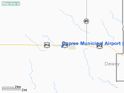
Location & QuickFacts
| FAA Information Effective: | 2008-09-25 |
| Airport Identifier: | 7F2 |
| Airport Status: | Operational |
| Longitude/Latitude: | 101-37-26.5620W/45-02-59.9330N
-101.624045/45.049981 (Estimated) |
| Elevation: | 2341 ft / 713.54 m (Surveyed) |
| Land: | 47 acres |
| From nearest city: | 0 nautical miles SW of Dupree, SD |
| Location: | Ziebach County, SD |
| Magnetic Variation: | 10E (1985) |
Owner & Manager
| Ownership: | Publicly owned |
| Owner: | Town Of Dupree |
| Address: | Po Box 276
Dupree, SD 57623 |
| Phone number: | 605-365-5181 |
| Manager: | Robin Dupree |
| Address: | Town Of Dupree, Po Box 276
Dupree, SD 57623 |
| Phone number: | 605-365-5181 |
Airport Operations and Facilities
| Airport Use: | Open to public |
| Wind indicator: | Yes |
| Segmented Circle: | Yes |
| Control Tower: | No |
| Landing fee charge: | No |
| Sectional chart: | Billings |
| Region: | AGL - Great Lakes |
| Boundary ARTCC: | ZMP - Minneapolis |
| Tie-in FSS: | HON - Huron |
| FSS on Airport: | No |
| FSS Toll Free: | 1-800-WX-BRIEF |
| NOTAMs Facility: | HON (NOTAM-d service avaliable) |
| Federal Agreements: | 1 |
Airport Communications
Airport Services
| Airframe Repair: | NONE |
| Power Plant Repair: | NONE |
| Bottled Oxygen: | NONE |
| Bulk Oxygen: | NONE |
Runway Information
Runway 14/32
| Dimension: | 2400 x 200 ft / 731.5 x 61.0 m |
| Surface: | TURF, Fair Condition |
| |
Runway 14 |
Runway 32 |
| Longitude: | 101-36-29.5600W | 101-36-15.8100W |
| Latitude: | 45-02-53.9300N | 45-02-32.3300N |
| Elevation: | 2328.00 ft | 2341.00 ft |
| Traffic Pattern: | Left | Left |
| Runway End Identifier: | No | No |
| Touchdown Lights: | No | No |
| Obstruction: | 13 ft road, 260.0 ft from runway, 20:1 slope to clear | 18 ft road, 370.0 ft from runway, 20:1 slope to clear |
|
Radio Navigation Aids
| ID |
Type |
Name |
Ch |
Freq |
Var |
Dist |
| DPR | VORTAC | Dupree | 115X | 116.80 | 10E | 4.2 nm |
Remarks
- RY 32 FENCE 125 FT L 226 FT FM THLD & 125 FT R 100 FT FM THLD.
- RY 14 FENCE 125 FT L 185 FT FM THLD & 75 FT L 300 FT FM THLD.
Images and information placed above are from
http://www.airport-data.com/airport/7F2/
We thank them for the data!
| General Info
|
| Country |
United States
|
| State |
SOUTH DAKOTA
|
| FAA ID |
7F2
|
| Latitude |
45-02-59.933N
|
| Longitude |
101-37-26.562W
|
| Elevation |
2341 feet
|
| Near City |
DUPREE
|
We don't guarantee the information is fresh and accurate. The data may
be wrong or outdated.
For more up-to-date information please refer to other sources.
|
|


