 |
|
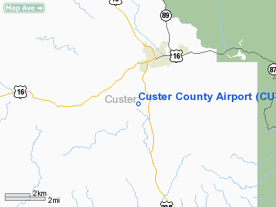
Location & QuickFacts
| FAA Information Effective: | 2008-09-25 |
| Airport Identifier: | CUT |
| Airport Status: | Operational |
| Longitude/Latitude: | 103-37-03.7010W/43-43-59.9380N
-103.617695/43.733316 (Estimated) |
| Elevation: | 5602 ft / 1707.49 m (Estimated) |
| Land: | 86 acres |
| From nearest city: | 2 nautical miles SW of Custer, SD |
| Location: | Custer County, SD |
| Magnetic Variation: | 11E (1985) |
Owner & Manager
| Ownership: | Publicly owned |
| Owner: | Custer County |
| Address: | 420 Mt Rushmore Rd
Custer, SD 57730 |
| Phone number: | 605-673-4824 |
| Manager: | Ralph Bueschel |
| Address: | 12202 Aviation Place
Custer, SD 57730 |
| Phone number: | 605-673-3874 |
Airport Operations and Facilities
| Airport Use: | Open to public |
| Wind indicator: | Yes |
| Segmented Circle: | Yes |
| Control Tower: | No |
| Lighting Schedule: | DUSK-DAWN
MIRL RY 08/26 OPER DUSK-2200, AFT 2200 ACTVT - CTAF. ACTVT PAPI RY 08 & 26 - CTAF. |
| Beacon Color: | Clear-Green (lighted land airport)
AIRPORT BEACON OBSCURED RADIALS 200-260. |
| Landing fee charge: | No |
| Sectional chart: | Cheyenne |
| Region: | AGL - Great Lakes |
| Boundary ARTCC: | ZDV - Denver |
| Tie-in FSS: | HON - Huron |
| FSS on Airport: | No |
| FSS Toll Free: | 1-800-WX-BRIEF |
| NOTAMs Facility: | CUT (NOTAM-d service avaliable) |
| Federal Agreements: | NGY |
Airport Communications
| CTAF: | 122.800 |
| Unicom: | 122.800 |
Airport Services
| Fuel available: | 100LLA
FUEL AVBL 24 HRS WITH CREDIT CARD. |
| Airframe Repair: | MINOR
FOR MINOR REPAIRS CALL 605-673-3874. |
| Bottled Oxygen: | NONE |
| Bulk Oxygen: | NONE |
Runway Information
Runway 08/26
| Dimension: | 5500 x 60 ft / 1676.4 x 18.3 m |
| Surface: | ASPH, Good Condition |
| Weight Limit: | Single wheel: 12500 lbs. |
| Edge Lights: | Medium |
| |
Runway 08 |
Runway 26 |
| Traffic Pattern: | Left | Left |
| Markings: | Basic, Fair Condition | Basic, Good Condition |
| Crossing Height: | 25.00 ft | 48.00 ft |
| VASI: | 4-light PAPI on left side | 4-light PAPI on left side |
| Visual Glide Angle: | 3.00° | 3.65° |
| Runway End Identifier: | No | No |
| Centerline Lights: | No | No |
| Touchdown Lights: | No | No |
| Obstruction: | , 50:1 slope to clear | 60 ft trees, 1500.0 ft from runway, 21:1 slope to clear |
|
Radio Navigation Aids
| ID |
Type |
Name |
Ch |
Freq |
Var |
Dist |
| RA | NDB | Ranch | | 254.00 | 11E | 30.2 nm |
| SPF | NDB | Black Hills | | 300.00 | 11E | 45.7 nm |
| RCA | TACAN | Ellsworth | 025X | | 11E | 33.1 nm |
| ECS | VOR | Newcastle | | 108.20 | 11E | 31.2 nm |
| RAP | VORTAC | Rapid City | 070X | 112.30 | 13E | 30.0 nm |
Remarks
- TREES OBSTRUCT THE TRANSITION OF RWY EDGES.
- STRONG CROSSWINDS & WINDSHEAR MAY EXIST ON FINAL UNDER WINDY CONDS.
- CFM WINTER CONDS WITH AMGR (605) 673-3874.
- BE ALERT: CHECK DENSITY ALT & LEAN MIXTURE FOR BEST OPERATION AT THIS ALT.
- 10 FT WILDLIFE FENCE AROUND PERIMETER OF AIRPORT
Images and information placed above are from
http://www.airport-data.com/airport/CUT/
We thank them for the data!
| General Info
|
| Country |
United States
|
| State |
SOUTH DAKOTA
|
| FAA ID |
CUT
|
| Latitude |
43-43-59.938N
|
| Longitude |
103-37-03.701W
|
| Elevation |
5602 feet
|
| Near City |
CUSTER
|
We don't guarantee the information is fresh and accurate. The data may
be wrong or outdated.
For more up-to-date information please refer to other sources.
|
|


