 |
|
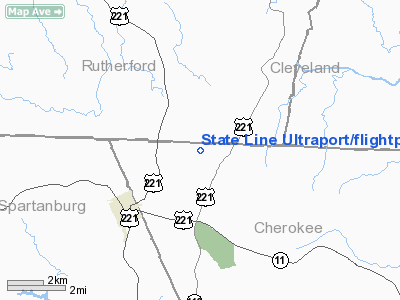
State Line Ultraport/flightpark Ultralight Airport |
Location & QuickFacts
| FAA Information Effective: | 2008-09-25 |
| Airport Identifier: | SC10 |
| Airport Status: | Operational |
| Longitude/Latitude: | 081-49-04.3690W/35-10-42.4400N
-81.817880/35.178456 (Estimated) |
| Elevation: | 870 ft / 265.18 m (Estimated) |
| Land: | 10 acres |
| From nearest city: | 5 nautical miles NE of Chesnee, SC |
| Location: | Cherokee County, SC |
| Magnetic Variation: | 04W (1985) |
Owner & Manager
| Ownership: | Privately owned |
| Owner: | J Clark Summy
OWNER PAUL SCRUGGS - LEASED BY J CLARK SUMMY. |
| Address: | 212 Scruggs Rd
Gaffney, SC 29341 |
| Phone number: | 803-461-3888 |
| Manager: | J Clark Summy |
| Address: | 212 Scruggs Rd
Gaffney, SC 29341 |
| Phone number: | 803-461-3888 |
Airport Operations and Facilities
| Airport Use: | Private |
| Wind indicator: | Yes |
| Segmented Circle: | No |
| Control Tower: | No |
| Sectional chart: | Atlanta |
| Region: | ASO - Southern |
| Boundary ARTCC: | ZTL - Atlanta |
| Tie-in FSS: | AND - Anderson |
| FSS on Airport: | No |
| FSS Toll Free: | 1-800-WX-BRIEF |
Runway Information
Runway 09/27
| Dimension: | 1500 x 50 ft / 457.2 x 15.2 m |
| Surface: | TURF, |
| |
Runway 09 |
Runway 27 |
| Traffic Pattern: | Left | Left |
|
Radio Navigation Aids
| ID |
Type |
Name |
Ch |
Freq |
Var |
Dist |
| MRN | FAN MARKER | Lenoir | | | 03W | 38.3 nm |
| SLP | NDB | First River | | 417.00 | 06W | 11.6 nm |
| RFE | NDB | Rutherford | | 344.00 | 05W | 12.2 nm |
| FRT | NDB | Fairmont | | 248.00 | 05W | 18.5 nm |
| UOT | NDB | Union County | | 326.00 | 04W | 31.0 nm |
| GHJ | NDB | Stonia | | 260.00 | 06W | 32.5 nm |
| BRA | NDB | Broad River | | 379.00 | 04W | 32.6 nm |
| FIQ | NDB | Fiddlers | | 391.00 | 07W | 32.8 nm |
| DCM | NDB | Chester | | 220.00 | 06W | 38.4 nm |
| UZ | NDB | Rally | | 227.00 | 05W | 40.2 nm |
| LUX | NDB | Laurens | | 307.00 | 04W | 40.8 nm |
| IZN | NDB | Lincolnton | | 432.00 | 06W | 41.9 nm |
| GY | NDB | Dyana | | 338.00 | 03W | 42.5 nm |
| HK | NDB | Tawba | | 332.00 | 06W | 44.3 nm |
| LQK | NDB | Lake Keowee | | 408.00 | 04W | 48.9 nm |
| CLT | VOR/DME | Charlotte | 097X | 115.00 | 05W | 42.6 nm |
| SPA | VORTAC | Spartanburg | 104X | 115.70 | 02W | 10.2 nm |
| SUG | VORTAC | Sugarloaf Mountain | 059X | 112.20 | 02W | 26.0 nm |
| FML | VORTAC | Fort Mill | 071X | 112.40 | 02W | 44.0 nm |
| HKY | VOT | Hickory Regional | | 110.00 | | 39.7 nm |
| CLT | VOT | Charlotte | | 112.00 | | 43.3 nm |
Remarks
- PRVDD VFR/PVT USE; AND ALL AERONAUTICAL OPNS ARE CONDUCTED IN ACCORDANCE TO FAR PART 103.
Images and information placed above are from
http://www.airport-data.com/airport/SC10/
We thank them for the data!
| General Info
|
| Country |
United States
|
| State |
SOUTH CAROLINA
|
| FAA ID |
SC10
|
| Latitude |
35-10-42.440N
|
| Longitude |
081-49-04.369W
|
| Elevation |
870 feet
|
| Near City |
CHESNEE
|
We don't guarantee the information is fresh and accurate. The data may
be wrong or outdated.
For more up-to-date information please refer to other sources.
|
|


