 |
|
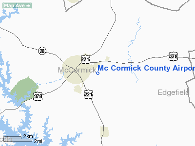
Mc Cormick County Airport |
Location & QuickFacts
| FAA Information Effective: | 2008-09-25 |
| Airport Identifier: | S19 |
| Airport Status: | Operational |
| Longitude/Latitude: | 082-16-00.9480W/33-54-29.1490N
-82.266930/33.908097 (Estimated) |
| Elevation: | 459 ft / 139.90 m (Surveyed) |
| Land: | 84 acres |
| From nearest city: | 1 nautical miles SE of Mc Cormick, SC |
| Location: | Mc Cormick County, SC |
| Magnetic Variation: | 04W (1985) |
Owner & Manager
| Ownership: | Publicly owned |
| Owner: | Mc Cormick County |
| Address: | Rt 2 Box 84aa
Mc Cormick, SC 29835 |
| Phone number: | 864-852-2231 |
| Manager: | Bruce Cooley
COUNTY ADMINISTRATOR. |
| Address: | Rt 2 Box 84aaa
Mc Cormick, SC 29835 |
| Phone number: | 864-852-2231 |
Airport Operations and Facilities
| Airport Use: | Open to public |
| Wind indicator: | Yes |
| Segmented Circle: | Yes |
| Control Tower: | No |
| Lighting Schedule: | RDO-CTL
ACTVT ROTG BCN - CTAF. |
| Beacon Color: | Clear-Green (lighted land airport) |
| Landing fee charge: | No |
| Sectional chart: | Atlanta |
| Region: | ASO - Southern |
| Boundary ARTCC: | ZTL - Atlanta |
| Tie-in FSS: | AND - Anderson |
| FSS on Airport: | No |
| FSS Toll Free: | 1-800-WX-BRIEF |
| NOTAMs Facility: | AND (NOTAM-d service avaliable) |
| Federal Agreements: | Y1 |
Airport Communications
Airport Services
| Airframe Repair: | NONE |
| Power Plant Repair: | NONE |
| Bottled Oxygen: | NONE |
| Bulk Oxygen: | NONE |
Runway Information
Runway 18/36
| Dimension: | 3598 x 75 ft / 1096.7 x 22.9 m |
| Surface: | ASPH, Fair Condition |
| Weight Limit: | Single wheel: 12500 lbs. |
| Edge Lights: | Medium |
| |
Runway 18 |
Runway 36 |
| Longitude: | 082-16-01.9350W | 082-15-59.8720W |
| Latitude: | 33-54-46.8940N | 33-54-11.3420N |
| Elevation: | 451.00 ft | 459.00 ft |
| Alignment: | 127 | 127 |
| Traffic Pattern: | Left | Left |
| Markings: | Basic, Good Condition | Basic, Good Condition
NUMBERS FADED. |
| Runway End Identifier: | No | No |
| Centerline Lights: | No | No |
| Touchdown Lights: | No | No |
| Obstruction: | 45 ft tree, 282.0 ft from runway, 79 ft left of centerline, 1:1 slope to clear | 33 ft tree, 604.0 ft from runway, 75 ft right of centerline, 12:1 slope to clear |
|
Radio Navigation Aids
| ID |
Type |
Name |
Ch |
Freq |
Var |
Dist |
| GIW | NDB | Coronaca | | 239.00 | 04W | 22.6 nm |
| HQU | NDB | Thomson-mcduffie | | 333.00 | 04W | 26.0 nm |
| IIY | NDB | Washington/wilkes County | | 435.00 | 03W | 28.4 nm |
| AA | NDB | Cedar | | 341.00 | 04W | 28.4 nm |
| EMR | NDB | Emory | | 385.00 | 04W | 30.0 nm |
| AIK | NDB | Aiken | | 347.00 | 04W | 33.3 nm |
| LUX | NDB | Laurens | | 307.00 | 04W | 39.4 nm |
| EOE | NDB | Enoree | | 278.00 | 05W | 39.7 nm |
| VV | NDB | Junne | | 353.00 | 05W | 40.8 nm |
| AND | NDB | Anderson County | | 230.00 | 04W | 41.7 nm |
| BJT | NDB | Bulldog | | 221.00 | 03W | 47.6 nm |
| GY | NDB | Dyana | | 338.00 | 03W | 47.9 nm |
| IRQ | VORTAC | Colliers | 086X | 113.90 | 04W | 13.2 nm |
| GRD | VORTAC | Greenwood | 102X | 115.50 | 01W | 21.4 nm |
| ELW | VORTAC | Electric City | 023X | 108.60 | 00E | 40.1 nm |
Remarks
- ALL OPERATIONS ARE CONDUCTED IN VFR WEATHER CONDITIONS.
Images and information placed above are from
http://www.airport-data.com/airport/S19/
We thank them for the data!
| General Info
|
| Country |
United States
|
| State |
SOUTH CAROLINA
|
| FAA ID |
S19
|
| Latitude |
33-54-29.149N
|
| Longitude |
082-16-00.948W
|
| Elevation |
459 feet
|
| Near City |
MC CORMICK
|
We don't guarantee the information is fresh and accurate. The data may
be wrong or outdated.
For more up-to-date information please refer to other sources.
|
|


