|
|
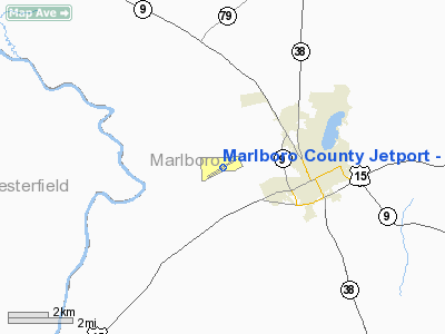
Marlboro County Jetport - H.e. Avent Field Airport |
Marlboro County Jetport
H.E. Avent Field |
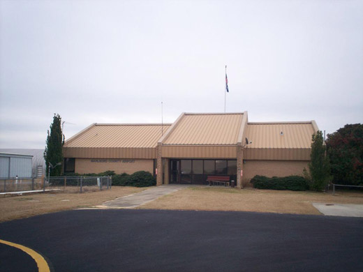 |
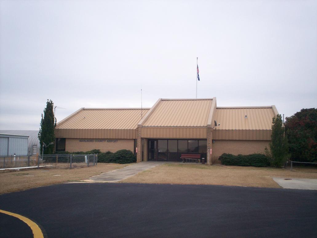
| Terminal at Marlboro County Jetport |
| IATA: BTN – ICAO: KBBP – FAA LID: BBP |
| Summary |
| Airport type |
Public |
| Owner |
Marlboro County |
| Serves |
Bennettsville, South Carolina |
| Location |
Marlboro County, near Bennettsville, South Carolina |
| Elevation AMSL |
147 ft / 45 m |
| Coordinates |
34°37′18″N 079°44′04″W / 34.62167°N 79.73444°W / 34.62167; -79.73444 |
| Runways |
| Direction |
Length |
Surface |
| ft |
m |
| 6/24 |
5,000 |
1,524 |
Asphalt |
| Statistics (2008) |
| Aircraft operations |
3,760 |
| Based aircraft |
13 |
| Source: Federal Aviation Administration |
Marlboro County Jetport (IATA: BTN, ICAO: KBBP, FAA LID: BBP), also known as H.E. Avent Field, is a county-owned public-use airport located three nautical miles (6 km) west of the central business district of Bennettsville, in Marlboro County, South Carolina, United States.
Although most U.S. airports use the same three-letter location identifier for the FAA and IATA, this airport is assigned BBP by the FAA and BTN by the IATA. Facilities and aircraft
Marlboro County Jetport covers an area of 175 acres (71 ha) at an elevation of 147 feet (45 m) above mean sea level. It has one runway designated 6/24 with a 5,000 by 75 ft (1,524 x 23 m) asphalt pavement. For the 12-month period ending May 16, 2008, the airport had 3,760 aircraft operations, an average of 10 per day: 98% general aviation and 2% air taxi. At that time there were 13 aircraft based at this airport, all single-engine.
History
Opened on 8 October 1941. Known as Bennettsville Airport and Palmer Field. Began training United States Army Air Corps flying cadets under contract to Georgia Air Service, Inc & Southeastern Air Service, Inc., under 53d Army Air Forces Flying Training Detachment (later 2152d Army Air Force Base Unit). Assigned to United States Army Air Forces East Coast Training Center (later Eastern Flying Training Command) as a primary (level 1) pilot training airfield. Had a 4,700' irregular all-direction turf field for landings and takeoffs. May have had four auxiliary airfields, although none have been identified. Flying training was performed with Fairchild PT-19s as the primary trainer. Also had several PT-17 Stearmans assigned.
Inactivated on 16 October 1944 with the drawdown of AAFTC's pilot training program. Declared surplus and turned over to the Army Corps of Engineers on 30 September 1945. Eventually discharged to the War Assets Administration (WAA) and became a civil airport.
The above content comes from Wikipedia and is published under free licenses – click here to read more.
Location & QuickFacts
| FAA Information Effective: | 2008-09-25 |
| Airport Identifier: | BBP |
| Airport Status: | Operational |
| Longitude/Latitude: | 079-44-03.6940W/34-37-18.1510N
-79.734359/34.621709 (Estimated) |
| Elevation: | 147 ft / 44.81 m (Surveyed) |
| Land: | 175 acres |
| From nearest city: | 3 nautical miles W of Bennettsville, SC |
| Location: | Marlboro County, SC |
| Magnetic Variation: | 08W (2005) |
Owner & Manager
| Ownership: | Publicly owned |
| Owner: | Marlboro County |
| Address: | Po Box 419
Bennettsville, SC 29512 |
| Phone number: | 803-479-5647 |
| Manager: | Mr. Cecil Kimrey
COUNTY ADMINISTRATOR. |
| Address: | Po Box 419
Bennettsville, SC 29512 |
| Phone number: | 843-479-5600 |
Airport Operations and Facilities
| Airport Use: | Open to public |
| Wind indicator: | Yes |
| Segmented Circle: | Yes |
| Control Tower: | No |
| Lighting Schedule: | DUSK-DAWN |
| Beacon Color: | Clear-Green (lighted land airport) |
| Landing fee charge: | No |
| Sectional chart: | Charlotte |
| Region: | ASO - Southern |
| Boundary ARTCC: | ZJX - Jacksonville |
| Tie-in FSS: | AND - Anderson |
| FSS on Airport: | No |
| FSS Toll Free: | 1-800-WX-BRIEF |
| NOTAMs Facility: | AND (NOTAM-d service avaliable) |
| Federal Agreements: | NGY |
Airport Communications
| CTAF: | 122.800 |
| Unicom: | 122.800 |
Airport Services
| Fuel available: | 100LLA
FOR FUEL AFTER HRS CALL (843)862-4359. |
| Bottled Oxygen: | NONE |
| Bulk Oxygen: | NONE |
Runway Information
Runway 06/24
| Dimension: | 5000 x 75 ft / 1524.0 x 22.9 m |
| Surface: | ASPH, Good Condition |
| Weight Limit: | Single wheel: 28000 lbs.
Dual wheel: 43000 lbs.
Dual tandem wheel: 70000 lbs. |
| Edge Lights: | Medium |
| |
Runway 06 |
Runway 24 |
| Longitude: | 079-44-28.9320W | 079-43-38.4590W |
| Latitude: | 34-37-04.8530N | 34-37-31.4320N |
| Elevation: | 138.00 ft | 147.00 ft |
| Alignment: | 58 | 127 |
| Traffic Pattern: | Left | Left |
| Markings: | Non-precision instrument, Good Condition | Non-precision instrument, Good Condition |
| Crossing Height: | 40.00 ft | 40.00 ft |
| VASI: | 2-light PAPI on left side | 2-light PAPI on left side |
| Visual Glide Angle: | 3.00° | 3.00° |
| Runway End Identifier: | Yes | Yes |
| Obstruction: | 82 ft tree, 2536.0 ft from runway, 329 ft left of centerline, 28:1 slope to clear | 45 ft tree, 809.0 ft from runway, 335 ft right of centerline, 13:1 slope to clear |
|
Radio Navigation Aids
| ID |
Type |
Name |
Ch |
Freq |
Var |
Dist |
| BES | NDB | Bennettsville | | 230.00 | 07W | 0.1 nm |
| CQW | NDB | Cheraw | | 409.00 | 05W | 9.7 nm |
| UDG | NDB | Darlington | | 245.00 | 06W | 13.1 nm |
| RCZ | NDB | Roscoe | | 375.00 | 07W | 14.0 nm |
| ME | NDB | Maxtn | | 257.00 | 08W | 15.8 nm |
| DLC | NDB | Dillon | | 274.00 | 05W | 20.8 nm |
| HVS | NDB | Hartsville | | 341.00 | 07W | 23.1 nm |
| HFF | NDB | Mackall | | 278.00 | 06W | 27.3 nm |
| AFP | NDB | Anson County | | 283.00 | 07W | 29.7 nm |
| JB | NDB | Jigel | | 384.00 | 08W | 29.8 nm |
| PYG | NDB | Pageland | | 270.00 | 06W | 30.7 nm |
| MAO | NDB | Marion | | 388.00 | 06W | 32.9 nm |
| RSY | NDB | Robeson | | 359.00 | 08W | 33.4 nm |
| CDN | NDB | Camden | | 263.00 | 05W | 45.8 nm |
| CFY | NDB | Evans | | 420.00 | 06W | 46.1 nm |
| SMS | NDB | Sumter | | 252.00 | 04W | 49.0 nm |
| POB | TACAN | Pope | 085X | | 07W | 47.8 nm |
| LBT | VOR | Lumberton | | 110.00 | 08W | 33.6 nm |
| CTF | VOR/DME | Chesterfield | 019X | 108.20 | 03W | 26.8 nm |
| FAY | VOR/DME | Fayetteville | 025X | 108.80 | 04W | 47.7 nm |
| FLO | VORTAC | Florence | 099X | 115.20 | 03W | 23.7 nm |
| SDZ | VORTAC | Sandhills | 055X | 111.80 | 03W | 36.4 nm |
Remarks
- FOR FBO MGR BARRY AVENT CALL (843)479-4797.
- RWY 16/34 LIMITED TO OPERATIONS IN VFR WX CONDS.
Images and information placed above are from
http://www.airport-data.com/airport/BBP/
We thank them for the data!
| General Info
|
| Country |
United States
|
| State |
SOUTH CAROLINA
|
| FAA ID |
BBP
|
| Latitude |
34-37-18.151N
|
| Longitude |
079-44-03.694W
|
| Elevation |
146 feet
|
| Near City |
BENNETTSVILLE
|
We don't guarantee the information is fresh and accurate. The data may
be wrong or outdated.
For more up-to-date information please refer to other sources.
|
|