 |
|
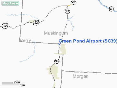
Location & QuickFacts
| FAA Information Effective: | 2008-09-25 |
| Airport Identifier: | SC39 |
| Airport Status: | Operational |
| Longitude/Latitude: | 082-05-00.0000W/39-49-00.0000N
-82.083333/39.816667 (Estimated) |
| Elevation: | 788 ft / 240.18 m (Estimated) |
| Land: | 0 acres |
| From nearest city: | 6 nautical miles NE of Woodruff, SC |
| Location: | Spartanburg County, SC |
| Magnetic Variation: | () |
Owner & Manager
| Ownership: | Privately owned |
| Owner: | Tim E. Brown |
| Address: | 1906 Green Pond Road
Woodruff, SC 29388 |
| Phone number: | 854-542-7253 |
| Manager: | Tim E. Brown |
| Address: | 1906 Green Pond Road
Woodruff, SC 29388 |
| Phone number: | 854-542-7253 |
Airport Operations and Facilities
| Airport Use: | Private |
| Wind indicator: | Yes |
| Control Tower: | No |
| Sectional chart: | Cincinnati |
| Region: | ASO - Southern |
| Boundary ARTCC: | ZTL - Atlanta |
| Tie-in FSS: | AND - Anderson |
| FSS Toll Free: | 1-800-WX-BRIEF |
Runway Information
Runway 12/30
| Dimension: | 2850 x 85 ft / 868.7 x 25.9 m |
| Surface: | TURF, |
| |
Runway 12 |
Runway 30 |
| Traffic Pattern: | Left | Left |
|
Radio Navigation Aids
| ID |
Type |
Name |
Ch |
Freq |
Var |
Dist |
| PKB | FAN MARKER | Marietta Ohio | | | 03W | 40.4 nm |
| HRA | NDB | Zanesville | | 204.00 | 06W | 9.3 nm |
| HEH | NDB | Newark | | 524.00 | 06W | 21.6 nm |
| CM | NDB | Sumie | | 391.00 | 05W | 32.6 nm |
| UGS | NDB | University | | 250.00 | 06W | 33.7 nm |
| MLR | NDB | Millersburg/dcmsnd | | 382.00 | 06W | 44.6 nm |
| CYO | NDB | Circleville | | 366.00 | 05W | 45.1 nm |
| CHC | NDB | Grens | | 272.00 | 04W | 45.1 nm |
| DKG | NDB | Don Scott | | 348.00 | 05W | 48.5 nm |
| RZT | NDB | Ross County | | 236.00 | 05W | 49.3 nm |
| LCK | TACAN | Rickenbacker | 069X | | 05W | 39.0 nm |
| XUB | VOR | Yellow Bud | | 112.50 | 05W | 44.9 nm |
| ZZV | VOR/DME | Zanesville | 051X | 111.40 | 06W | 11.5 nm |
| CTW | VOR/DME | Newcomerstown | 055X | 111.80 | 07W | 37.4 nm |
| TVT | VOR/DME | Tiverton | 112X | 116.50 | 03W | 38.6 nm |
| APE | VORTAC | Appleton | 114X | 116.70 | 06W | 30.7 nm |
| JPU | VORTAC | Parkersburg | 023X | 108.60 | 03W | 39.8 nm |
| CMH | VOT | Port Columbus | | 111.00 | | 38.5 nm |
Remarks
- PRVDD VFR OPNS AND PVT USE.
Images and information placed above are from
http://www.airport-data.com/airport/SC39/
We thank them for the data!
| General Info
|
| Country |
United States
|
| State |
SOUTH CAROLINA
|
| FAA ID |
SC39
|
| Latitude |
34-05-00.486N
|
| Longitude |
081-45-11.389W
|
| Elevation |
460 feet
|
| Near City |
SALUDA
|
We don't guarantee the information is fresh and accurate. The data may
be wrong or outdated.
For more up-to-date information please refer to other sources.
|
|


