 |
|
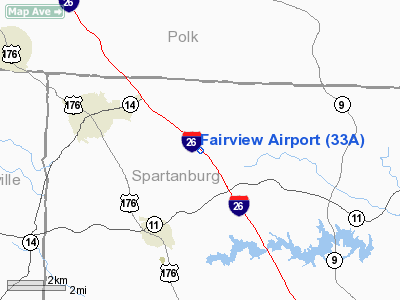
Location & QuickFacts
| FAA Information Effective: | 2008-09-25 |
| Airport Identifier: | 33A |
| Airport Status: | Operational |
| Longitude/Latitude: | 082-07-20.3990W/35-09-26.4170N
-82.122333/35.157338 (Estimated) |
| Elevation: | 1046 ft / 318.82 m (Surveyed) |
| Land: | 25 acres |
| From nearest city: | 3 nautical miles SE of Landrum, SC |
| Location: | Spartanburg County, SC |
| Magnetic Variation: | 04W (1985) |
Owner & Manager
| Ownership: | Privately owned |
| Owner: | Greg Hall |
| Address: | One Century Place
Greer, SC 29651 |
| Phone number: | 864-420-1400 |
| Manager: | Greg Hall |
| Address: | One Century Place
Greer, SC 29651 |
| Phone number: | 864-420-1400 |
Airport Operations and Facilities
| Airport Use: | Open to public |
| Wind indicator: | Yes |
| Segmented Circle: | No |
| Control Tower: | No |
| Lighting Schedule: | DUSK-DAWN
ACTVT LIRL RY 14/32 - CTAF. |
| Beacon Color: | Clear-Green (lighted land airport) |
| Landing fee charge: | No |
| Sectional chart: | Atlanta |
| Region: | ASO - Southern |
| Boundary ARTCC: | ZTL - Atlanta |
| Tie-in FSS: | AND - Anderson |
| FSS on Airport: | No |
| FSS Toll Free: | 1-800-WX-BRIEF |
| NOTAMs Facility: | AND (NOTAM-d service avaliable) |
Airport Communications
Airport Services
| Airframe Repair: | NONE |
| Power Plant Repair: | NONE |
| Bottled Oxygen: | NONE |
| Bulk Oxygen: | NONE |
Runway Information
Runway 14/32
| Dimension: | 2770 x 30 ft / 844.3 x 9.1 m |
| Surface: | ASPH, Poor Condition
HAS SEVERE BUMPS ON ENTIRE RY. |
| Weight Limit: | Single wheel: 6500 lbs. |
| Edge Lights: | Low |
| |
Runway 14 |
Runway 32 |
| Traffic Pattern: | Right | Left |
| Markings: | Nonstandard, Poor Condition
RY 14/32 CNTRLN MARKINGS NONSTANDARD SIZE AND SEPN. | Nonstandard, Poor Condition
RWY 14/32 MARKINGS,SEPERATION AND NUMBERS ARE NOT TO STABDARD. |
| Obstruction: | 25 ft tree, 400.0 ft from runway, 30 ft left of centerline, 8:1 slope to clear
ROAD 100 FT FM THLD. | 73 ft tree, 776.0 ft from runway, 181 ft right of centerline, 7:1 slope to clear
RY 32 HAS PAVED ROAD 50 FT FM THLD. |
|
Radio Navigation Aids
| ID |
Type |
Name |
Ch |
Freq |
Var |
Dist |
| MRN | FAN MARKER | Lenoir | | | 03W | 45.5 nm |
| RFE | NDB | Rutherford | | 344.00 | 05W | 14.2 nm |
| FRT | NDB | Fairmont | | 248.00 | 05W | 16.8 nm |
| BRA | NDB | Broad River | | 379.00 | 04W | 18.5 nm |
| SLP | NDB | First River | | 417.00 | 06W | 26.3 nm |
| GY | NDB | Dyana | | 338.00 | 03W | 32.2 nm |
| LQK | NDB | Lake Keowee | | 408.00 | 04W | 35.4 nm |
| UOT | NDB | Union County | | 326.00 | 04W | 37.0 nm |
| FIQ | NDB | Fiddlers | | 391.00 | 07W | 39.9 nm |
| LUX | NDB | Laurens | | 307.00 | 04W | 39.9 nm |
| GHJ | NDB | Stonia | | 260.00 | 06W | 47.5 nm |
| CEU | NDB | Clemson | | 257.00 | 05W | 47.6 nm |
| AND | NDB | Anderson County | | 230.00 | 04W | 49.1 nm |
| SPA | VORTAC | Spartanburg | 104X | 115.70 | 02W | 12.1 nm |
| SUG | VORTAC | Sugarloaf Mountain | 059X | 112.20 | 02W | 16.6 nm |
Remarks
Images and information placed above are from
http://www.airport-data.com/airport/33A/
We thank them for the data!
| General Info
|
| Country |
United States
|
| State |
SOUTH CAROLINA
|
| FAA ID |
33A
|
| Latitude |
35-09-26.417N
|
| Longitude |
082-07-20.399W
|
| Elevation |
1046 feet
|
| Near City |
LANDRUM
|
We don't guarantee the information is fresh and accurate. The data may
be wrong or outdated.
For more up-to-date information please refer to other sources.
|
|


