 |
|
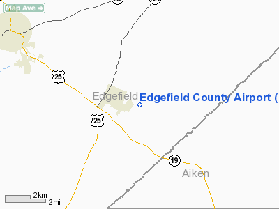
Location & QuickFacts
| FAA Information Effective: | 2008-09-25 |
| Airport Identifier: | 6J6 |
| Airport Status: | Operational |
| Longitude/Latitude: | 081-49-10.3950W/33-44-12.4900N
-81.819554/33.736803 (Estimated) |
| Elevation: | 610 ft / 185.93 m (Estimated) |
| Land: | 90 acres |
| From nearest city: | 1 nautical miles SE of Trenton, SC |
| Location: | Edgefield County, SC |
| Magnetic Variation: | 04W (1985) |
Owner & Manager
| Ownership: | Publicly owned |
| Owner: | Edgefield County |
| Address: | 215 Jeter St
Edgefield, SC 29824 |
| Phone number: | 803-637-4000 |
| Manager: | Johnny Anderson |
| Address: | Po Box 237, 215 Jeter St
Trenton, SC 29847 |
| Phone number: | 803-279-4138 |
Airport Operations and Facilities
| Airport Use: | Open to public |
| Wind indicator: | Yes |
| Segmented Circle: | Yes |
| Control Tower: | No |
| Landing fee charge: | No |
| Sectional chart: | Atlanta |
| Region: | ASO - Southern |
| Traffic Pattern Alt: | 800 ft |
| Boundary ARTCC: | ZJX - Jacksonville |
| Responsible ARTCC: | ZTL - Atlanta |
| Tie-in FSS: | AND - Anderson |
| FSS on Airport: | No |
| FSS Toll Free: | 1-800-WX-BRIEF |
| NOTAMs Facility: | AND (NOTAM-d service avaliable) |
Airport Communications
Airport Services
| Bottled Oxygen: | NONE |
| Bulk Oxygen: | NONE |
Runway Information
Runway 11/29
| Dimension: | 2640 x 85 ft / 804.7 x 25.9 m |
| Surface: | TURF, Good Condition |
| |
Runway 11 |
Runway 29 |
| Traffic Pattern: | Left | Left |
| Obstruction: | 30 ft tree, 100.0 ft from runway, 89 ft left of centerline, 3:1 slope to clear | 52 ft tree, 500.0 ft from runway, 111 ft right of centerline, 9:1 slope to clear |
|
Runway 15/33
| Dimension: | 1584 x 56 ft / 482.8 x 17.1 m |
| Surface: | TURF, Good Condition |
| |
Runway 15 |
Runway 33 |
| Traffic Pattern: | Left | Left |
| Obstruction: | 36 ft pole, 822.0 ft from runway, 180 ft right of centerline, 22:1 slope to clear | 75 ft tree, 496.0 ft from runway, 169 ft left of centerline, 6:1 slope to clear |
|
Radio Navigation Aids
| ID |
Type |
Name |
Ch |
Freq |
Var |
Dist |
| AIK | NDB | Aiken | | 347.00 | 04W | 8.8 nm |
| EMR | NDB | Emory | | 385.00 | 04W | 18.7 nm |
| BKO | NDB | Barnwell | | 392.00 | 06W | 30.7 nm |
| GIW | NDB | Coronaca | | 239.00 | 04W | 33.8 nm |
| EOE | NDB | Enoree | | 278.00 | 05W | 35.7 nm |
| HQU | NDB | Thomson-mcduffie | | 333.00 | 04W | 37.0 nm |
| AA | NDB | Cedar | | 341.00 | 04W | 41.6 nm |
| BXG | NDB | Burke County | | 356.00 | 04W | 42.8 nm |
| LUX | NDB | Laurens | | 307.00 | 04W | 46.8 nm |
| FDW | NDB | Winnsboro | | 414.00 | 05W | 49.5 nm |
| OYI | NDB | Orangeburg | | 226.00 | 05W | 49.6 nm |
| IIY | NDB | Washington/wilkes County | | 435.00 | 03W | 49.7 nm |
| IRQ | VORTAC | Colliers | 086X | 113.90 | 04W | 17.2 nm |
| GRD | VORTAC | Greenwood | 102X | 115.50 | 01W | 35.1 nm |
| CAE | VORTAC | Columbia | 094X | 114.70 | 02W | 38.9 nm |
Remarks
- RADIO CTLD ACFT ON & INVOF ARPT.
- DEER ON & INVICINITY OF ARPT.
- ARPT EXISTED PRIOR TO 1958
Images and information placed above are from
http://www.airport-data.com/airport/6J6/
We thank them for the data!
| General Info
|
| Country |
United States
|
| State |
SOUTH CAROLINA
|
| FAA ID |
6J6
|
| Latitude |
33-44-12.490N
|
| Longitude |
081-49-10.395W
|
| Elevation |
610 feet
|
| Near City |
TRENTON
|
We don't guarantee the information is fresh and accurate. The data may
be wrong or outdated.
For more up-to-date information please refer to other sources.
|
|


