 |
|
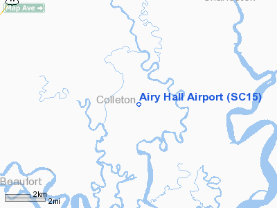
Location & QuickFacts
| FAA Information Effective: | 2008-09-25 |
| Airport Identifier: | SC15 |
| Airport Status: | Operational |
| Longitude/Latitude: | 080-30-14.3750W/32-37-55.6590N
-80.503993/32.632128 (Estimated) |
| Elevation: | 20 ft / 6.10 m (Estimated) |
| Land: | 69 acres |
| From nearest city: | 9 nautical miles SE of Green Pond, SC |
| Location: | Colleton County, SC |
| Magnetic Variation: | 05W (1985) |
Owner & Manager
| Ownership: | Privately owned |
| Owner: | Gaylord Donnelley |
| Address: | Ashepoo Plantation
Green Pond, SC 29446 |
| Manager: | Harold R. Rhoades |
| Address: |
Green Pond, SC 29446 |
| Phone number: | 803-844-2967 |
Airport Operations and Facilities
| Airport Use: | Private |
| Wind indicator: | No |
| Segmented Circle: | No |
| Control Tower: | No |
| Landing fee charge: | No |
| Sectional chart: | Charlotte |
| Region: | ASO - Southern |
| Boundary ARTCC: | ZJX - Jacksonville |
| Tie-in FSS: | AND - Anderson |
| FSS on Airport: | No |
| FSS Toll Free: | 1-800-WX-BRIEF |
Airport Services
| Airframe Repair: | NONE |
| Power Plant Repair: | NONE |
Runway Information
Runway 04/22
| Dimension: | 3100 x 150 ft / 944.9 x 45.7 m |
| Surface: | TURF, |
| |
Runway 04 |
Runway 22 |
| Traffic Pattern: | Left | Left |
|
Radio Navigation Aids
| ID |
Type |
Name |
Ch |
Freq |
Var |
Dist |
| RBW | NDB | Walterboro | | 221.00 | 05W | 18.9 nm |
| JZI | NDB | Johns Island | | 283.00 | 05W | 25.6 nm |
| DYB | NDB | Dorchester County | | 365.00 | 05W | 28.2 nm |
| CH | NDB | Ashly | | 329.00 | 05W | 29.2 nm |
| MKS | NDB | Moncks Corner | | 354.00 | 05W | 41.1 nm |
| NBC | TACAN | Beaufort | 042X | | 05W | 14.2 nm |
| ALD | VOR | Allendale | | 116.70 | 01W | 45.9 nm |
| SVN | VOR/DME | Hunter | 53X | 111.60 | 02W | 49.4 nm |
| CHS | VORTAC | Charleston | 082X | 113.50 | 05W | 28.3 nm |
| SAV | VORTAC | Savannah | 106Y | 115.95 | 06W | 45.8 nm |
| CHS | VOT | Charleston | | 111.00 | | 28.6 nm |
| SAV | VOT | Savannah Travis Fld | | 111.00 | | 46.7 nm |
Remarks
- ARPT IS USED TO GROW HAY EXCP DURG HUNTING SEASON. NOT AVBL FOR PUBLIC USE.
- EXISTED BEFORE 1959
Images and information placed above are from
http://www.airport-data.com/airport/SC15/
We thank them for the data!
| General Info
|
| Country |
United States
|
| State |
SOUTH CAROLINA
|
| FAA ID |
SC15
|
| Latitude |
32-37-55.659N
|
| Longitude |
080-30-14.375W
|
| Elevation |
20 feet
|
| Near City |
GREEN POND
|
We don't guarantee the information is fresh and accurate. The data may
be wrong or outdated.
For more up-to-date information please refer to other sources.
|
|


