 |
|
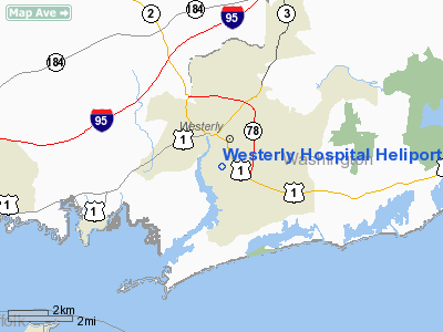
Westerly Hospital Heliport |
Location & QuickFacts
| FAA Information Effective: | 2008-09-25 |
| Airport Identifier: | RI23 |
| Airport Status: | Operational |
| Longitude/Latitude: | 071-49-25.2460W/41-21-45.3580N
-71.823679/41.362599 (Estimated) |
| Elevation: | 120 ft / 36.58 m (Estimated) |
| Land: | 0 acres |
| From nearest city: | 0 nautical miles N of Westerly, RI |
| Location: | Washington County, RI |
| Magnetic Variation: | 15W (1980) |
Owner & Manager
| Ownership: | Privately owned |
| Owner: | The Westerly Hospital |
| Address: | Wells Street
Westerly, RI 02891 |
| Phone number: | 401-596-6000
EXT 271. |
| Manager: | R.j.munson |
| Address: | Wells Street
Westerly, RI 02891 |
| Phone number: | 401-596-6000 |
Airport Operations and Facilities
| Airport Use: | Private
MEDICAL USE. |
| Segmented Circle: | No |
| Control Tower: | No |
| Landing fee charge: | No |
| Sectional chart: | New York |
| Region: | ANE - New England |
| Boundary ARTCC: | ZBW - Boston |
| Tie-in FSS: | BDR - Bridgeport |
| FSS on Airport: | No |
| FSS Toll Free: | 1-800-WX-BRIEF |
Runway Information
Helipad H1
| Dimension: | 50 x 50 ft / 15.2 x 15.2 m |
| Surface: | CONC, |
| |
Runway H1 |
Runway |
| Traffic Pattern: | Left | Left |
|
Radio Navigation Aids
| ID |
Type |
Name |
Ch |
Freq |
Var |
Dist |
| SFZ | NDB | Central | | 241.00 | 15W | 36.7 nm |
| HF | NDB | Lomis | | 244.00 | 15W | 39.7 nm |
| MMK | NDB | Meriden | | 238.00 | 14W | 46.1 nm |
| TAN | NDB | Taunton | | 227.00 | 16W | 47.6 nm |
| IHM | NDB | Mansfield | | 220.00 | 16W | 47.7 nm |
| FOK | TACAN | Suffolk Co | 047X | | 13W | 48.3 nm |
| GON | VOR/DME | Groton | 45Y | 110.85 | 14W | 10.5 nm |
| ORW | VOR/DME | Norwich | 037X | 110.00 | 14W | 14.1 nm |
| SEY | VOR/DME | Sandy Point | 125X | 117.80 | 15W | 16.2 nm |
| PUT | VOR/DME | Putnam | 121X | 117.40 | 14W | 35.6 nm |
| HFD | VOR/DME | Hartford | 096X | 114.90 | 13W | 36.6 nm |
| MAD | VOR/DME | Madison | 041X | 110.40 | 13W | 39.3 nm |
| HVN | VOR/DME | New Haven | 035X | 109.80 | 13W | 48.3 nm |
| PVD | VORTAC | Providence | 103X | 115.60 | 14W | 28.1 nm |
| HTO | VORTAC | Hampton | 083X | 113.60 | 13W | 34.8 nm |
| GON | VOT | Groton | | 110.25 | | 10.5 nm |
| PVD | VOT | Providence | | 108.20 | | 28.1 nm |
| HFD | VOT | Hartford | | 108.20 | | 43.4 nm |
Remarks
Images and information placed above are from
http://www.airport-data.com/airport/RI23/
We thank them for the data!
| General Info
|
| Country |
United States
|
| State |
RHODE ISLAND
|
| FAA ID |
RI23
|
| Latitude |
41-21-45.358N
|
| Longitude |
071-49-25.246W
|
| Elevation |
120 feet
|
| Near City |
WESTERLY
|
We don't guarantee the information is fresh and accurate. The data may
be wrong or outdated.
For more up-to-date information please refer to other sources.
|
|


