|
 |
|
||||
|
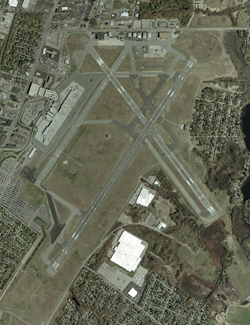
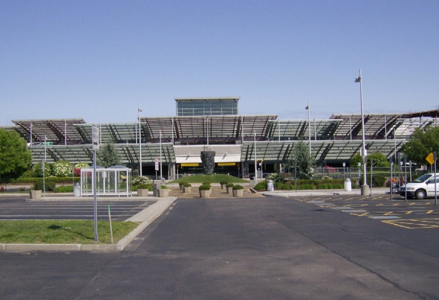
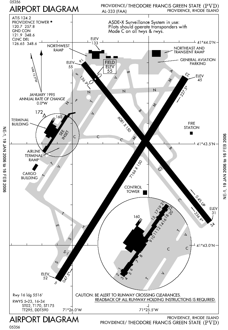
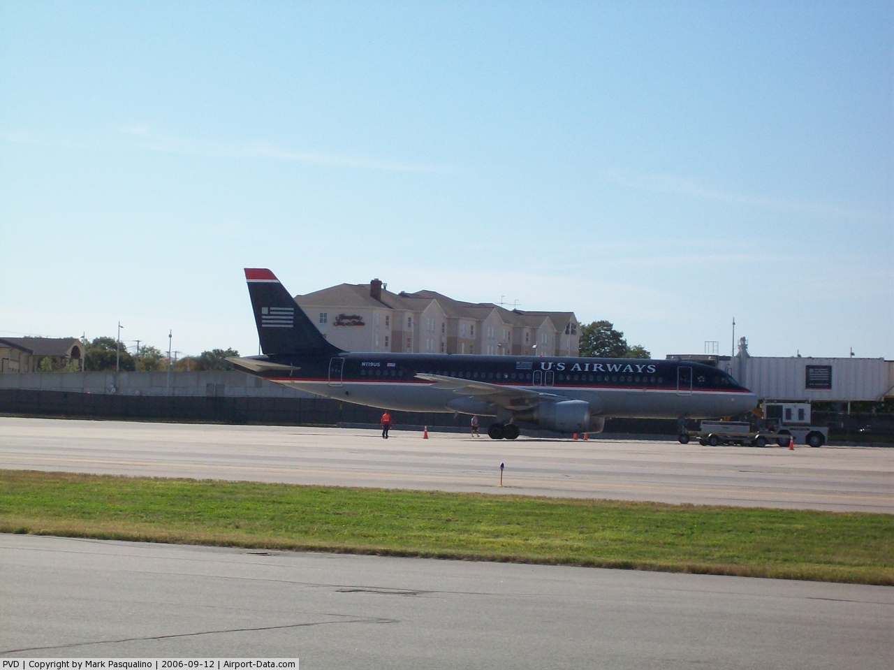
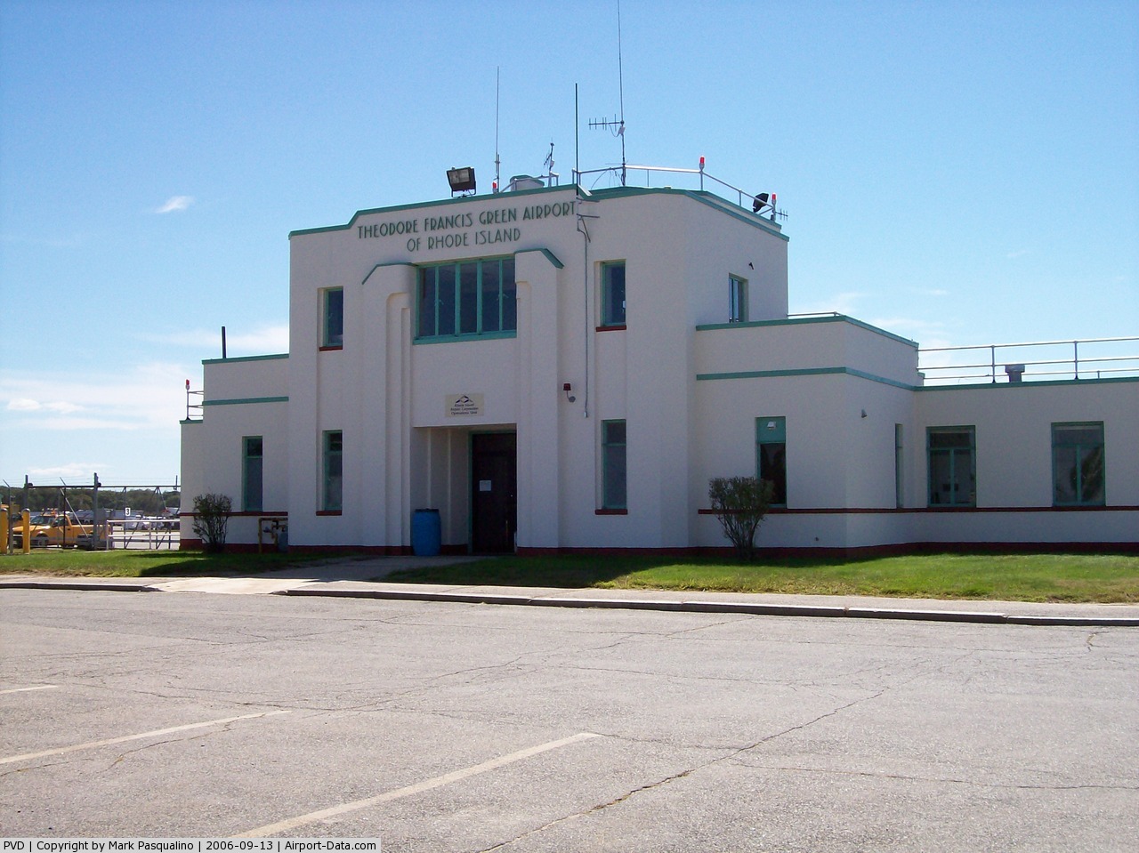
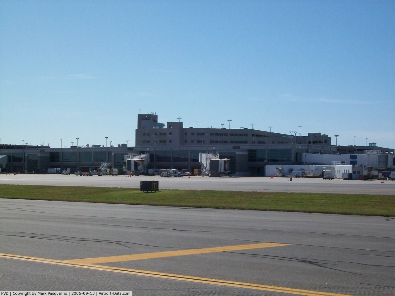
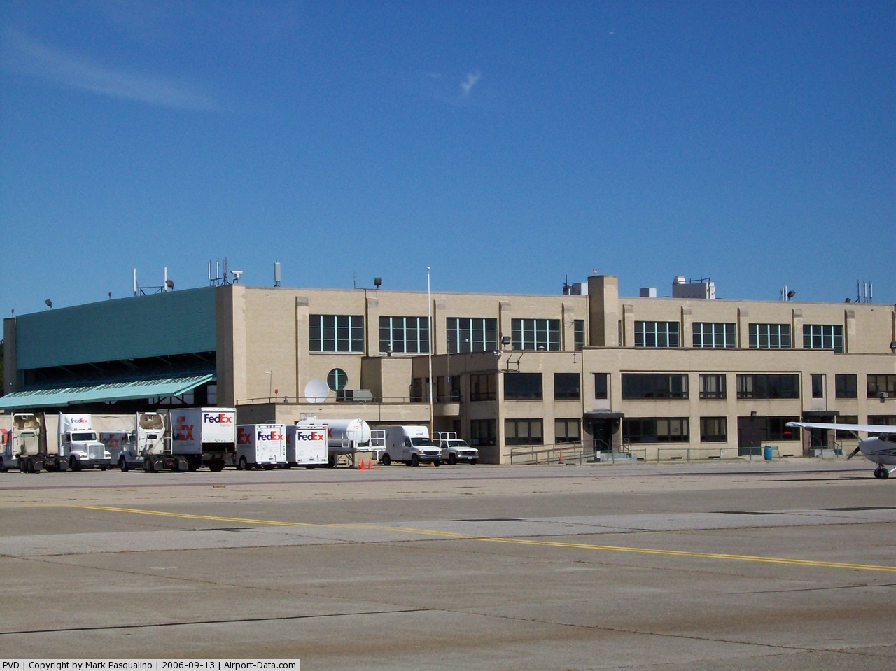
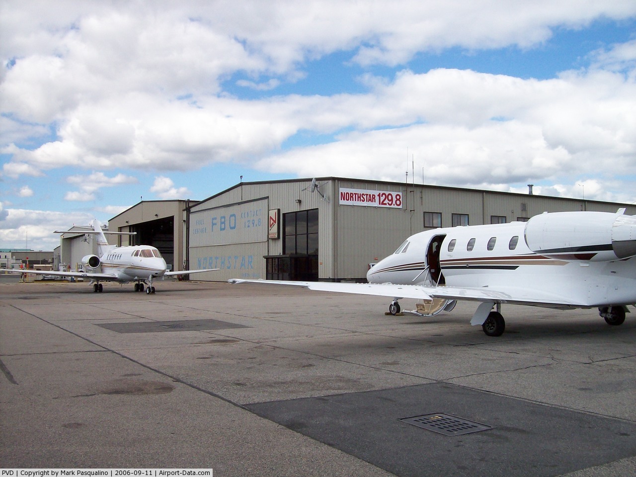
T. F. Green Airport (IATA: PVD, ICAO: KPVD, FAA LID: PVD), also known as Theodore Francis Green State Airport, is a public airport located in Warwick, six miles (10 km) south of Providence, in Kent County, Rhode Island, USA. Dedicated in 1931, the airport was named for former Rhode Island governor and longtime senator Theodore F. Green. Completely rebuilt in 1996, the renovated main terminal was named for former Rhode Island governor Bruce Sundlun. It was the first state-owned airport in the United States. Massport promotes T.F. Green as an alternative to Boston's Logan International Airport, as delays and wait time in the Rhode Island airport are minimal. PVD is the largest and most active airport among the six operated by the Rhode Island Airport Corporation (RIAC). HistoryT.F. Green was dedicated on September 27, 1931 as Hillsgrove State Airport, drawing the largest crowd that had attended a public function in the country at the time. In 1933, the historic terminal building was built, located on Airport Road. It wasn't until 1938 that the airport assumed its current name. During World War II, the Army Air Force took control of the airport from 1942 to 1945, using it for flight training for new air force cadets. In the 1960s, the airport grew rapidly, as commercial aviation sought interest in the Providence market. The runways were expanded to accommodate jet airliners and a new terminal opened on Post Road. In the 1970s, most of the legacy carriers served T.F. Green. In the 1990s, T.F. Green's terminal was once again rebuilt, expanding to 18 gates and modernizing the infrastructure. In 1997, 4 gates were added, totaling the number of gates to 22. Airlines added service to T.F. Green, including Air Canada, Southwest, SATA International, and Spirit Airlines. Following the September 11th attacks, T.F. Green, like most airports in the United States, faced a decrease in passengers, which resulted in fewer flights and loss of service, specifically from SATA, American Airlines, and Spirit. Facilities and aircraftTheodore Francis Green State Airport covers an area of 1,111 acres (450 ha) at an elevation of 55 feet (17 m) above mean sea level. It has two asphalt paved runways: 5/23 is 7,166 by 150 feet (2,184 x 46 m) and 16/34 is 6,081 by 150 feet (1,853 x 46 m). Taxiway Victor served as Runway 5L/23R until 2003. T.F. Green has a terminal with two concourses, North and South. The South Concourse has eight gates, and the North Concourse has 14 gates. Gate 7A is designed for international arrivals for use by Air Canada flights; it is directly connected to customs, which is on the lower level of the concourse. The terminal contains a number of stores and restaurants, and a central food court. For the 12-month period ending April 1, 2008, the airport had 108,392 aircraft operations, an average of 296 per day: 45% scheduled commercial, 30% air taxi, 25% general aviation and <1% military. At that time there were 72 aircraft based at this airport: 76% single-engine, 6% multi-engine, 17% jet and 1% helicopter. Providence is not considered a primary airport. Boston-Logan is New England's primary airport. However, some larger aircraft come into Providence's airport. US Airways uses the A321-200 for flights to Charlotte. Airlines and destinations
Ground transportationT.F. Green Airport has direct access to I-95 via the T. F. Green Airport Connector Road, a 1.1-mile (1.8 km) freeway. The airport is served by major car rental companies as well as by local taxi and limousine services. The Rhode Island Public Transit Authority (RIPTA) offers public bus transportation to and from the cities of Providence (Kennedy Plaza in downtown Providence) and Newport. In particular:
New rail connectionConstruction has started on an intermodal station adjacent to the airport, which includes an elevated walkway to the terminal, a rental car garage, and commuter rail parking. The station is expected to be completed in September 2010, possibly with some MBTA service. Full MBTA Commuter Rail service - 8 trains every weekday - between Boston, Massachusetts and Wickford Junction is expected in 2011. These statements are forward looking and may not actually occur. A look at prior press releases indicates the station was to have been completed years ago. Amtrak has formally stated they will not stop at the station for the foreseeable future citing lack of being economically feasible. Renovation/expansion plansTerminal renovation project
Since the Bruce Sundlun terminal was opened in 1996, T.F. Green has become more congested due to increased traffic and post-9/11 security changes. As a result, terminal renovations have recently begun. According to the RIAC website, these improvements include:
Runway expansion
The Rhode Island Airport Corporation writes (in 2001) that the master plan completed in 1997 failed to envision the "tremendous growth" that had been experience in the years hitherto. The report identifies lack of runway length as a hindrance to "range and diversity of service", in particular emphasizing ability to service non-hub locations, the west coast, and international locations. A challenge particular to T.F. Green in this regard is its being surrounded by dense residential and commercial development. Many local residents also oppose expansion for the impact it will have on quality of life in the area. While some expansion proponents claim extending the main runway would bring in an estimated $138 million over the course of 13 years, doing so could consume 204 houses, at least ten businesses, and large areas of wetlands. More recent studies indicate substantially decreased enplanements due in-part to soaring fuel costs, and easier access to Logan International Airport since completion of improvements to the Southeast Expressway, Third Harbor Tunnel, bus services between TF Green and Logan, as well as the introduction of low cost carriers at Logan such as Jet Blue. The FAA plans to hold public meetings in upcoming May before making its recommendation concerning runway expansion to the Rhode Island Airport Corporation. The Rhode Island Airport Corporation (RIAC) owns some residential property on the eastern side of the airport near the Aircraft Rescue and Firefighting building. Most homes on Cedar Swamp Road and Pembroke Avenue have since been demolished, likely to make way for future expansion. Incidents1999 runway incursionOn December 6, 1999 at approximately 20:35 Eastern Daylight Time, a runway incursion involving United Airlines flight 1448 (a Boeing 757) and FedEx Express flight 1662 (a Boeing 727) on Runway 5R/23L occurred. Shortly after landing on Runway 5R/23L, Flight 1448 was instructed to taxi to the gate. Due to the low-visibility conditions that night, the pilots became disoriented and turned down the wrong taxiway, which led them back towards the same runway. Flight 1448 then confirmed with the air traffic controller that they should cross the runway in front of them, and continued moving towards Runway 5R/23L. The controller, not realizing their mistake, confirmed this crossing, then cleared another plane for takeoff. Flight 1448 then reported that they were near taxiway Kilo, and as they re-entered Runway 5R/23L, reported that "somebody just took-off" overhead, referring to FedEx flight 1662 that had indeed just taken off, clearing the United aircraft. However, the controller appeared not to take their sighting of Kilo seriously, saying, "you shouldn't be anywhere near Kilo", and advised the 1448 crew to hold position. The Flight 1448 crew then informed air traffic control they were now on an active runway, which they mistakenly believed to be 23R (inactive at the time). A moment later the pilot corrected himself, stating that they were on 5R/23L. Flight 1448's crew were told again to stand by, so the plane remained idle at the intersection, while the controller cleared MetroJet flight 2998 for takeoff on the same runway. The 1448 pilot interjected to insist that the plane was on the active runway, which the controller denied, telling them it was not an active runway. The controller again told Flight 2998 to take off, but its crew, having listened to the exchange, realized there was confusion over the whereabouts of the United plane. They refused to take-off until Flight 1448 had made it safely to the gate. The US Airways crew operating Flight 2998 were praised by a US Air spokesperson for their actions of avoiding a near-disaster. An investigation by the National Transportation Safety Board followed and while no fault was assigned to the controller, she was required to undergo retraining before returning to service. The pilots were debriefed by United, received additional training and were returned to service. The NTSB generated a recreation of the events of that night. 2007 CRJ accidentOn December 17, 2007, Air Wisconsin (US Airways Express) flight 3758 arriving from Philadelphia departed the left side of runway 5 after a hard landing by an unstabilized approach. Although the aircraft sustained substantial damage, none of the 31 passengers and crew aboard were injured. Trivia
The above content comes from Wikipedia and is published under free licenses – click here to read more.
Location & QuickFacts
Owner & Manager
Airport Operations and Facilities
Airport Communications
Airport Services
Runway InformationRunway 05/23
Runway 16/34
Radio Navigation Aids
Remarks
Images and information placed above are from We thank them for the data!
We don't guarantee the information is fresh and accurate. The data may
be wrong or outdated.
|
|||||||||||||||||||||||||||||||||||||||||||||||||||||||||||||||||||||||||||||||||||||||||||||||||||||||||||||||||||||||||||||||||||||||||||||||||||||||||||||||||||||||||||||||||||||||||||||||||||||||||||||||||||||||||||||||||||||||||||||||||||||||||||||||||||||||||||||||||||||||||||||||||||||||||||||||||||||||||||||||||||||||||||||||||||||||||||||||||||||||||||||||||||||||||||||||||||||||||||||||||||||||||||||||||||||||||||||||||||||||||||||||||||||||||||||||||||||||||||||||||||||||||||||||||||||||||||||||||||||||||||||||||||||||||

 |
|
Copyright 2004-2024 © by Airports-Worldwide.com, Vyshenskoho st. 36, Lviv 79010, Ukraine Legal Disclaimer |