 |
|
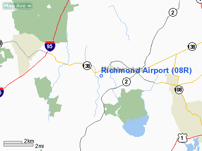
| Richmond Airport |
 |
| CAP aerial image, western view |
| IATA: none – ICAO: none – FAA LID: 08R |
| Summary |
| Airport type |
Public |
| Owner |
Gordon Realty, Inc. |
| Serves |
West Kingston, Rhode Island |
| Elevation AMSL |
130 ft / 40 m |
| Coordinates |
41°29′22″N 071°37′14″W / 41.48944°N 71.62056°W / 41.48944; -71.62056 |
| Runways |
| Direction |
Length |
Surface |
| ft |
m |
| 11/29 |
2,129 |
649 |
Asphalt |
| Statistics (2007) |
| Aircraft operations |
9,500 |
| Based aircraft |
24 |
| Source: Federal Aviation Administration |
Richmond Airport (FAA LID: 08R) is a public use airport in Washington County, Rhode Island, United States. It is located three nautical miles (6 km) west of the central business district of West Kingston, Rhode Island. The airport is privately owned by Gordon Realty, Inc.
Facilities and aircraft
Richmond Airport covers an area of 67 acres (27 ha) at an elevation of 130 feet (40 m) above mean sea level. It has one runway designated 11/29 with an asphalt surface measuring 2,129 by 30 feet (649 x 9 m).
For the 12-month period ending August 30, 2007, the airport had 9,500 general aviation aircraft operations, an average of 26 per day. At that time there were 24 aircraft based at this airport: 71% single-engine and 29% ultralight.
The above content comes from Wikipedia and is published under free licenses – click here to read more.
Location & QuickFacts
| FAA Information Effective: | 2008-09-25 |
| Airport Identifier: | 08R |
| Airport Status: | Operational |
| Longitude/Latitude: | 071-37-14.3000W/41-29-22.2000N
-71.620639/41.489500 (Estimated) |
| Elevation: | 130 ft / 39.62 m (Estimated) |
| Land: | 67 acres |
| From nearest city: | 3 nautical miles W of West Kingston, RI |
| Location: | Washington County, RI |
| Magnetic Variation: | 15W (1985) |
Owner & Manager
| Ownership: | Privately owned |
| Owner: | Gordon Realty, Inc |
| Address: | 23 Heaton Orchard Rd
West Kingston, RI 02892 |
| Phone number: | 401-783-1498 |
| Manager: | Jack Gordon |
| Address: | 23 Heaton Orchard Rd
West Kingston, RI 02892 |
| Phone number: | 401-783-1498 |
Airport Operations and Facilities
| Airport Use: | Open to public |
| Wind indicator: | Yes |
| Segmented Circle: | No |
| Control Tower: | No |
| Lighting Schedule: | DUSK-DAWN
ACTVT LIRL RY 11/29 & WINDSOCK LGTS - CTAF. |
| Beacon Color: | Clear-Green (lighted land airport)
ROTG BEACON OTS INDEFLY. |
| Landing fee charge: | No |
| Sectional chart: | New York |
| Region: | ANE - New England |
| Traffic Pattern Alt: | 1000 ft |
| Boundary ARTCC: | ZBW - Boston |
| Tie-in FSS: | BDR - Bridgeport |
| FSS on Airport: | No |
| FSS Toll Free: | 1-800-WX-BRIEF |
| NOTAMs Facility: | BDR (NOTAM-d service avaliable) |
Airport Communications
| CTAF: | 122.800 |
| Unicom: | 122.800 |
Airport Services
| Fuel available: | 100LL |
| Airframe Repair: | MAJOR |
| Power Plant Repair: | MAJOR |
Runway Information
Runway 11/29
| Dimension: | 2129 x 30 ft / 648.9 x 9.1 m |
| Surface: | ASPH, Fair Condition |
| Edge Lights: | Non-standard lighting system
NSTD LIRL LCTD 30 FT FROM EDGE OF PAVEMENT. |
| |
Runway 11 |
Runway 29 |
| Longitude: | 071-37-28.1457W | 071-37-00.4473W |
| Latitude: | 41-29-23.6949N | 41-29-20.7366N |
| Elevation: | 130.00 ft | 127.00 ft |
| Traffic Pattern: | Left | Left |
| Markings: | Numbers only, Fair Condition | Numbers only, Fair Condition |
| Displaced threshold: | 0.00 ft | 130.00 ft
DSPLCD THLD LGTD & MKD WITH WHITE BAR & NUMBER. |
| VASI: | | tri-color on left side |
| Visual Glide Angle: | 0.00° | 5.50° |
| Obstruction: | 45 ft trees, 600.0 ft from runway, 45 ft right of centerline, 8:1 slope to clear
+23 FT TREES 150 FT FROM THLD 50 FT L; +27 FT TREES 160 FT FROM THLD 110 FT R; +5 FT DIRT PILE 45 FT FROM THLD 50 FT L. | 65 ft tree, 200.0 ft from runway, 45 ft right of centerline
APCH RATIO 5:1 TO DSPLCD THLD.
+ 5 FT TREES 70 FT FROM THR ON CNTRLN; -11 FT ROAD 90 FT FROM THR ON CTNRLN; +40 FT TREES 125 FT FROM THR 110 FT L; +65 FT TREES 200 FT FROM THR 45 FT R. |
|
Radio Navigation Aids
| ID |
Type |
Name |
Ch |
Freq |
Var |
Dist |
| ORW | FAN MARKER | Canton | | | 15W | 45.4 nm |
| SFZ | NDB | Central | | 241.00 | 15W | 26.5 nm |
| TAN | NDB | Taunton | | 227.00 | 16W | 35.7 nm |
| IHM | NDB | Mansfield | | 220.00 | 16W | 36.2 nm |
| FFF | NDB | Plymouth | | 257.00 | 16W | 42.6 nm |
| HF | NDB | Lomis | | 244.00 | 15W | 46.0 nm |
| ORW | VOR/DME | Norwich | 037X | 110.00 | 14W | 17.5 nm |
| SEY | VOR/DME | Sandy Point | 125X | 117.80 | 15W | 19.5 nm |
| GON | VOR/DME | Groton | 45Y | 110.85 | 14W | 21.7 nm |
| PUT | VOR/DME | Putnam | 121X | 117.40 | 14W | 29.7 nm |
| HFD | VOR/DME | Hartford | 096X | 114.90 | 13W | 42.7 nm |
| MVY | VOR/DME | Marthas Vineyard | 092X | 114.50 | 15W | 45.8 nm |
| MAD | VOR/DME | Madison | 041X | 110.40 | 13W | 49.5 nm |
| PVD | VORTAC | Providence | 103X | 115.60 | 14W | 16.5 nm |
| HTO | VORTAC | Hampton | 083X | 113.60 | 13W | 46.5 nm |
| PVD | VOT | Providence | | 108.20 | | 16.6 nm |
| GON | VOT | Groton | | 110.25 | | 21.8 nm |
| ORH | VOT | Worcester | | 108.20 | | 48.0 nm |
| HFD | VOT | Hartford | | 108.20 | | 48.6 nm |
Remarks
- ULTRALIGHTS ON & INVOF ARPT.
- DEER & BIRDS ON & INVOF ARPT.
- RY 11/29 +15 FT TREES 45 FT N SIDE OF CNTRLN.
- RY 11 CLSD NGTS.
- VFR USEONLY. HEL ASP: FILED FOR RECORD PURPOSES ONLY.
Images and information placed above are from
http://www.airport-data.com/airport/08R/
We thank them for the data!
| General Info
|
| Country |
United States
|
| State |
RHODE ISLAND
|
| FAA ID |
08R
|
| Latitude |
41-29-22.200N
|
| Longitude |
071-37-14.300W
|
| Elevation |
130 feet
|
| Near City |
WEST KINGSTON
|
We don't guarantee the information is fresh and accurate. The data may
be wrong or outdated.
For more up-to-date information please refer to other sources.
|
|


