 |
|
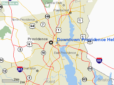
Downtown Providence Helistop Heliport |
Location & QuickFacts
| FAA Information Effective: | 2008-09-25 |
| Airport Identifier: | RI9 |
| Airport Status: | Operational |
| Longitude/Latitude: | 071-24-31.0000W/41-49-27.0000N
-71.408611/41.824167 (Estimated) |
| Elevation: | 7 ft / 2.13 m (Estimated) |
| Land: | 0 acres |
| From nearest city: | 0 nautical miles N of Providence, RI |
| Location: | Providence County, RI |
| Magnetic Variation: | 15W (1985) |
Owner & Manager
| Ownership: | Publicly owned |
| Owner: | State Of Rhode Island |
| Address: | Rhode Island Airport Corporation, T.f. Green Airport
Warwick, RI 02886 |
| Phone number: | 401-737-4000X227
401-737-4000X228 |
| Manager: | Jim Warcup |
| Address: | 2000 Post Rd
Warwick, RI 02886 |
| Phone number: | 401-737-4000X227
EXT 227/228./229 |
Airport Operations and Facilities
| Airport Use: | Open to public |
| Wind indicator: | No |
| Segmented Circle: | No |
| Control Tower: | No |
| Lighting Schedule: | NONE |
| Landing fee charge: | No |
| Sectional chart: | New York |
| Region: | ANE - New England |
| Boundary ARTCC: | ZBW - Boston |
| Tie-in FSS: | BDR - Bridgeport |
| FSS on Airport: | No |
| FSS Toll Free: | 1-800-WX-BRIEF |
| NOTAMs Facility: | BDR (NOTAM-d service avaliable) |
Airport Communications
Airport Services
| Airframe Repair: | NONE |
| Power Plant Repair: | NONE |
| Bottled Oxygen: | NONE |
| Bulk Oxygen: | NONE |
Runway Information
Helipad H1
| Dimension: | 25 x 25 ft / 7.6 x 7.6 m
LNDG AREA 25 FT DIAM CONC TDZ AREA. |
| Surface: | CONC, Good Condition |
| |
Runway H1 |
Runway |
| Traffic Pattern: | Left | Left |
|
Radio Navigation Aids
| ID |
Type |
Name |
Ch |
Freq |
Var |
Dist |
| ORW | FAN MARKER | Canton | | | 15W | 23.1 nm |
| SFZ | NDB | Central | | 241.00 | 15W | 6.7 nm |
| IHM | NDB | Mansfield | | 220.00 | 16W | 14.3 nm |
| TAN | NDB | Taunton | | 227.00 | 16W | 17.8 nm |
| FFF | NDB | Plymouth | | 257.00 | 16W | 27.2 nm |
| IMR | NDB | Marshfield | | 368.00 | 16W | 36.7 nm |
| SKR | NDB | Shaker Hill | | 251.00 | 16W | 39.3 nm |
| LQ | NDB | Lyndy | | 382.00 | 16W | 42.6 nm |
| FIT | NDB | Fitchburg | | 365.00 | 15W | 46.4 nm |
| NZW | TACAN | South Weymouth | 061X | | 15W | 28.7 nm |
| FMH | TACAN | Otis | 105X | | 15W | 41.3 nm |
| PUT | VOR/DME | Putnam | 121X | 117.40 | 14W | 21.0 nm |
| ORW | VOR/DME | Norwich | 037X | 110.00 | 14W | 31.0 nm |
| SEY | VOR/DME | Sandy Point | 125X | 117.80 | 15W | 40.2 nm |
| GON | VOR/DME | Groton | 45Y | 110.85 | 14W | 41.4 nm |
| MVY | VOR/DME | Marthas Vineyard | 092X | 114.50 | 15W | 44.1 nm |
| PVD | VORTAC | Providence | 103X | 115.60 | 14W | 6.1 nm |
| BOS | VORTAC | Boston | 074X | 112.70 | 16W | 37.1 nm |
| PVD | VOT | Providence | | 108.20 | | 6.1 nm |
| ORH | VOT | Worcester | | 108.20 | | 33.6 nm |
| BOS | VOT | Boston Logan Intl | | 111.00 | | 37.4 nm |
| BED | VOT | Laurence G Hanscom Fld | | 110.00 | | 39.1 nm |
| GON | VOT | Groton | | 110.25 | | 41.6 nm |
Remarks
- CTN: HIGH RISE OBSTRUCTIONS 600' N & S & E OF HELISTOP.
- BIRDS ON & INVOF HELISTOP.
- VFR USE ONLY.
Images and information placed above are from
http://www.airport-data.com/airport/RI9/
We thank them for the data!
| General Info
|
| Country |
United States
|
| State |
RHODE ISLAND
|
| FAA ID |
RI9
|
| Latitude |
41-49-27.000N
|
| Longitude |
071-24-31.000W
|
| Elevation |
7 feet
|
| Near City |
PROVIDENCE
|
We don't guarantee the information is fresh and accurate. The data may
be wrong or outdated.
For more up-to-date information please refer to other sources.
|
|


