 |
|
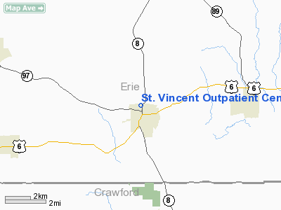
St. Vincent Outpatient Center Heliport |
Location & QuickFacts
| FAA Information Effective: | 2008-09-25 |
| Airport Identifier: | 7PS1 |
| Airport Status: | Operational |
| Longitude/Latitude: | 079-50-48.1860W/41-54-22.2000N
-79.846718/41.906167 (Estimated) |
| Elevation: | 1400 ft / 426.72 m (Estimated) |
| Land: | 0 acres |
| From nearest city: | 0 nautical miles N of Union City, PA |
| Location: | Erie County, PA |
| Magnetic Variation: | 08W (1985) |
Owner & Manager
| Ownership: | Privately owned |
| Owner: | Union City Memorial Hospital |
| Address: | 232 W. 25th Street
Erie, PA 16544 |
| Phone number: | 814-452-5000 |
| Manager: | Duane Weber |
| Address: | 232 W. 25th Street
Erie, PA 16544 |
| Phone number: | 814-438-1000 |
Airport Operations and Facilities
| Airport Use: | Private
MEDICAL USE. |
| Wind indicator: | Yes |
| Segmented Circle: | No |
| Control Tower: | No |
| Sectional chart: | Detroit |
| Region: | AEA - Eastern |
| Boundary ARTCC: | ZOB - Cleveland |
| Tie-in FSS: | AOO - Altoona |
| FSS Toll Free: | 1-800-WX-BRIEF |
Runway Information
Helipad H1
| Dimension: | 40 x 40 ft / 12.2 x 12.2 m |
| Surface: | CONC, |
| |
Runway H1 |
Runway |
| Traffic Pattern: | Left | Left |
|
Radio Navigation Aids
| ID |
Type |
Name |
Ch |
Freq |
Var |
Dist |
| ORJ | NDB | Corry | | 258.00 | 09W | 8.9 nm |
| CQD | NDB | Cascade | | 372.00 | 08W | 17.2 nm |
| FKL | VOR | Franklin | | 109.60 | 06W | 28.1 nm |
| JHW | VOR/DME | Jamestown | 094X | 114.70 | 07W | 36.6 nm |
| JFN | VOR/DME | Jefferson | 099X | 115.20 | 05W | 41.3 nm |
| CIP | VOR/DME | Clarion | 076X | 112.90 | 06W | 48.9 nm |
| ERI | VORTAC | Erie | 031X | 109.40 | 06W | 21.0 nm |
| TDT | VORTAC | Tidioute | 123X | 117.60 | 09W | 22.5 nm |
| DKK | VORTAC | Dunkirk | 109X | 116.20 | 07W | 43.4 nm |
Remarks
- SOUTHEAST - APCH 325DEGREES; DEP 145 DEGREES. NORTHWEST - APCH 120 DEGREES; DEP 300 DEGREES.
Images and information placed above are from
http://www.airport-data.com/airport/7PS1/
We thank them for the data!
| General Info
|
| Country |
United States
|
| State |
PENNSYLVANIA
|
| FAA ID |
7PS1
|
| Latitude |
41-54-22.200N
|
| Longitude |
079-50-48.186W
|
| Elevation |
1400 feet
|
| Near City |
UNION CITY
|
We don't guarantee the information is fresh and accurate. The data may
be wrong or outdated.
For more up-to-date information please refer to other sources.
|
|


