 |
|
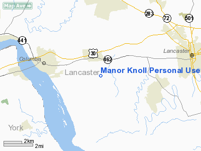
Manor Knoll Personal Use Airport |
Location & QuickFacts
| FAA Information Effective: | 2008-09-25 |
| Airport Identifier: | 7PA0 |
| Airport Status: | Operational |
| Longitude/Latitude: | 076-25-25.8660W/40-01-15.3520N
-76.423852/40.020931 (Estimated) |
| Elevation: | 440 ft / 134.11 m (Estimated) |
| Land: | 0 acres |
| From nearest city: | 1 nautical miles S of Mountville, PA |
| Location: | Lancaster County, PA |
| Magnetic Variation: | 10W (1985) |
Owner & Manager
| Ownership: | Privately owned |
| Owner: | C. Robert Noll |
| Address: | 651 Forry Road
Lancaster, PA 17603 |
| Phone number: | 717-285-5229 |
| Manager: | Robert B. Noll |
| Address: | 684 Steinman Court
Lancaster, PA 17603 |
| Phone number: | 717-392-6896 |
Airport Operations and Facilities
| Airport Use: | Private |
| Wind indicator: | Yes |
| Segmented Circle: | No |
| Control Tower: | No |
| Landing fee charge: | No |
| Sectional chart: | New York |
| Region: | AEA - Eastern |
| Boundary ARTCC: | ZNY - New York |
| Tie-in FSS: | IPT - Williamsport |
| FSS on Airport: | No |
| FSS Toll Free: | 1-800-WX-BRIEF |
Airport Services
| Airframe Repair: | NONE |
| Power Plant Repair: | NONE |
Runway Information
Runway 09/27
| Dimension: | 2000 x 100 ft / 609.6 x 30.5 m |
| Surface: | TURF, |
| |
Runway 09 |
Runway 27 |
| Traffic Pattern: | Left | Left |
|
Radio Navigation Aids
| ID |
Type |
Name |
Ch |
Freq |
Var |
Dist |
| EUD | NDB | York | | 254.00 | 11W | 21.8 nm |
| BZJ | NDB | Bellgrove | | 328.00 | 10W | 25.6 nm |
| APG | NDB | Aberdeen | | 349.00 | 11W | 32.7 nm |
| MTN | NDB | Martin | | 342.00 | 11W | 43.4 nm |
| IUB | NDB | Institute | | 404.00 | 08W | 45.1 nm |
| FND | NDB | Ellicott | | 371.00 | 11W | 47.0 nm |
| MTN | TACAN | Martin | 068X | | 11W | 41.5 nm |
| PPM | VOR/DME | Phillips | 021X | 108.40 | 09W | 35.3 nm |
| ETX | VOR/DME | East Texas | 039X | 110.20 | 09W | 47.8 nm |
| LRP | VORTAC | Lancaster | 120X | 117.30 | 09W | 8.5 nm |
| RAV | VORTAC | Ravine | 093X | 114.60 | 11W | 33.0 nm |
| HAR | VORTAC | Harrisburg | 072X | 112.50 | 10W | 34.1 nm |
| MXE | VORTAC | Modena | 079X | 113.20 | 09W | 35.2 nm |
| EMI | VORTAC | Westminster | 126X | 117.90 | 08W | 40.7 nm |
| PTW | VORTAC | Pottstown | 112X | 116.50 | 09W | 41.5 nm |
| DQO | VORTAC | Dupont | 087X | 114.00 | 10W | 43.0 nm |
| MDT | VOT | Harrisburg International | | 110.00 | | 18.9 nm |
Images and information placed above are from
http://www.airport-data.com/airport/7PA0/
We thank them for the data!
| General Info
|
| Country |
United States
|
| State |
PENNSYLVANIA
|
| FAA ID |
7PA0
|
| Latitude |
40-01-15.352N
|
| Longitude |
076-25-25.866W
|
| Elevation |
440 feet
|
| Near City |
MOUNTVILLE
|
We don't guarantee the information is fresh and accurate. The data may
be wrong or outdated.
For more up-to-date information please refer to other sources.
|
|


