 |
|
Location & QuickFacts
| FAA Information Effective: | 2008-09-25 |
| Airport Identifier: | PS82 |
| Airport Status: | Operational |
| Longitude/Latitude: | 075-35-51.6770W/41-17-45.2960N
-75.597688/41.295916 (Estimated) |
| Elevation: | 1650 ft / 502.92 m (Estimated) |
| Land: | 0 acres |
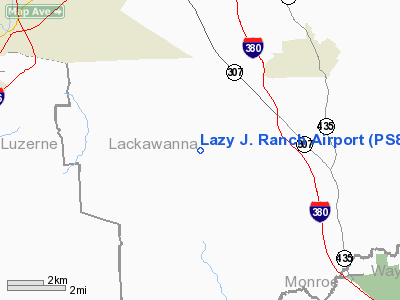
| From nearest city: | 6 nautical miles NW of Springbrook, PA |
| Location: | Lackawanna County, PA |
| Magnetic Variation: | 12W (1986) |
Owner & Manager
| Ownership: | Privately owned |
| Owner: | Robert Schreckengaust |
| Address: | Rr 3, Box 3223a
Moscow, PA 18444 |
| Phone number: | 717-961-0851 |
| Manager: | Robert Schreckengaust |
| Address: | Rr 3 Box 3223a
Moscow, PA 18444 |
| Phone number: | 717-961-0851 |
Airport Operations and Facilities
| Airport Use: | Private |
| Wind indicator: | Yes |
| Segmented Circle: | No |
| Control Tower: | No |
| Landing fee charge: | No |
| Sectional chart: | New York |
| Region: | AEA - Eastern |
| Boundary ARTCC: | ZNY - New York |
| Tie-in FSS: | IPT - Williamsport |
| FSS on Airport: | No |
| FSS Toll Free: | 1-800-WX-BRIEF |
Runway Information
Runway 02/20
| Dimension: | 1480 x 100 ft / 451.1 x 30.5 m |
| Surface: | TURF, |
| |
Runway 02 |
Runway 20 |
| Traffic Pattern: | Left | Left |
| Displaced threshold: | 200.00 ft | 200.00 ft |
| Obstruction: | 15 ft trees, 100.0 ft from runway | 50 ft trees, 300.0 ft from runway |
|
Radio Navigation Aids
| ID |
Type |
Name |
Ch |
Freq |
Var |
Dist |
| CYE | NDB | Crystal Lake | | 410.00 | 11W | 11.8 nm |
| HXM | NDB | Humbolt | | 366.00 | 10W | 25.8 nm |
| LQX | NDB | Carbon | | 339.00 | 12W | 30.0 nm |
| MS | NDB | Monga | | 359.00 | 12W | 43.6 nm |
| HZL | VOR | Hazleton | | 109.40 | 09W | 30.7 nm |
| STW | VOR/DME | Stillwater | 033X | 109.60 | 11W | 37.6 nm |
| ETX | VOR/DME | East Texas | 039X | 110.20 | 09W | 43.2 nm |
| HUO | VOR/DME | Huguenot | 108X | 116.10 | 11W | 45.9 nm |
| BWZ | VOR/DME | Broadway | 089X | 114.20 | 11W | 46.2 nm |
| HNK | VOR/DME | Hancock | 115X | 116.80 | 11W | 47.8 nm |
| LVZ | VORTAC | Wilkes-barre | 053X | 111.60 | 10W | 4.4 nm |
| LHY | VORTAC | Lake Henry | 045X | 110.80 | 10W | 12.0 nm |
| FJC | VORTAC | Allentown | 122X | 117.50 | 10W | 34.8 nm |
| SAX | VORTAC | Sparta | 104X | 115.70 | 11W | 49.9 nm |
Images and information placed above are from
http://www.airport-data.com/airport/PS82/
We thank them for the data!
| General Info
|
| Country |
United States
|
| State |
PENNSYLVANIA
|
| FAA ID |
PS82
|
| Latitude |
41-17-45.296N
|
| Longitude |
075-35-51.677W
|
| Elevation |
1650 feet
|
| Near City |
SPRINGBROOK
|
We don't guarantee the information is fresh and accurate. The data may
be wrong or outdated.
For more up-to-date information please refer to other sources.
|
|


