 |
|
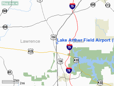
Lake Arthur Field Airport |
Location & QuickFacts
| FAA Information Effective: | 2008-09-25 |
| Airport Identifier: | PN84 |
| Airport Status: | Operational |
| Longitude/Latitude: | 080-09-43.2160W/40-59-04.2230N
-80.162004/40.984506 (Estimated) |
| Elevation: | 1240 ft / 377.95 m (Estimated) |
| Land: | 50 acres |
| From nearest city: | 3 nautical miles N of Portersville, PA |
| Location: | Butler County, PA |
| Magnetic Variation: | 08W (1985) |
Owner & Manager
| Ownership: | Privately owned |
| Owner: | Dale E. Kottraba |
| Address: | 120 Kottraba Lane
Portersville, PA 16051 |
| Phone number: | 412-368-3495 |
| Manager: | Dale E. Kottraba |
| Address: | 120 Kottraba Lane
Portersville, PA 16051 |
| Phone number: | 412-368-3495 |
Airport Operations and Facilities
| Airport Use: | Private |
| Wind indicator: | Yes |
| Segmented Circle: | No |
| Control Tower: | No |
| Landing fee charge: | No |
| Sectional chart: | Detroit |
| Region: | AEA - Eastern |
| Boundary ARTCC: | ZOB - Cleveland |
| Tie-in FSS: | AOO - Altoona |
| FSS on Airport: | No |
| FSS Toll Free: | 1-800-WX-BRIEF |
Airport Services
| Airframe Repair: | NONE |
| Power Plant Repair: | NONE |
Runway Information
Runway 18/36
| Dimension: | 1400 x 100 ft / 426.7 x 30.5 m
400' OVERRUN SOUTH END OF RWY; 300' OVERRUN NORTH END OF RWY. |
| Surface: | TURF, |
| |
Runway 18 |
Runway 36 |
| Traffic Pattern: | Left | Left |
| Obstruction: | 150 ft trees, 1000.0 ft from runway | |
|
Radio Navigation Aids
| ID |
Type |
Name |
Ch |
Freq |
Var |
Dist |
| UCP | NDB | Castle | | 272.00 | 09W | 11.7 nm |
| HBD | NDB | Hubbard | | 408.00 | 08W | 19.6 nm |
| MKP | NDB | Mc Keesport | | 287.00 | 07W | 41.6 nm |
| TSO | NDB | Tolson | | 395.00 | 07W | 48.8 nm |
| FKL | VOR | Franklin | | 109.60 | 06W | 30.6 nm |
| CIP | VOR/DME | Clarion | 076X | 112.90 | 06W | 33.4 nm |
| AGC | VOR/DME | Allegheny | 037X | 110.00 | 09W | 42.8 nm |
| HLG | VOR/DME | Wheeling | 059X | 112.20 | 07W | 47.3 nm |
| ACO | VOR/DME | Akron | 091X | 114.40 | 04W | 47.7 nm |
| EWC | VORTAC | Ellwood City | 105X | 115.80 | 08W | 9.8 nm |
| MMJ | VORTAC | Montour | 057X | 112.00 | 08W | 29.9 nm |
| YNG | VORTAC | Youngstown | 027X | 109.00 | 05W | 31.2 nm |
Remarks
Images and information placed above are from
http://www.airport-data.com/airport/PN84/
We thank them for the data!
| General Info
|
| Country |
United States
|
| State |
PENNSYLVANIA
|
| FAA ID |
PN84
|
| Latitude |
40-59-04.223N
|
| Longitude |
080-09-43.216W
|
| Elevation |
1240 feet
|
| Near City |
PORTERSVILLE
|
We don't guarantee the information is fresh and accurate. The data may
be wrong or outdated.
For more up-to-date information please refer to other sources.
|
|


