|
|
 |
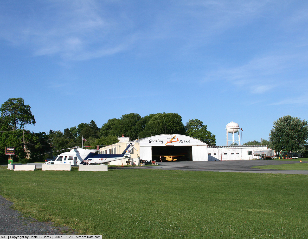
(Click on the photo to enlarge) |
 |
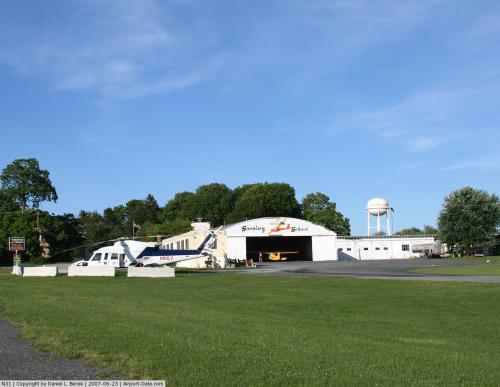
(Click on the photo to enlarge) |
Location & QuickFacts
| FAA Information Effective: | 2008-09-25 |
| Airport Identifier: | N31 |
| Airport Status: | Operational |
| Longitude/Latitude: | 075-47-13.1860W/40-30-12.1460N
-75.786996/40.503374 (Estimated) |
| Elevation: | 512 ft / 156.06 m (Estimated) |
| Land: | 90 acres |
| From nearest city: | 1 nautical miles S of Kutztown, PA |
| Location: | Berks County, PA |
| Magnetic Variation: | 12W (2000) |
Owner & Manager
| Ownership: | Privately owned |
| Owner: | Kutztown Enterprises |
| Address: | 112 Lindbergh
Blandon, PA 19510 |
| Phone number: | 610-683-8077 |
| Manager: | Earl Binder |
| Address: | 15130 Kutztown Rd
Kutztown, PA 19530 |
| Phone number: | 610-683-5666 |
Airport Operations and Facilities
| Airport Use: | Open to public |
| Wind indicator: | Yes |
| Segmented Circle: | Yes |
| Control Tower: | No |
| Lighting Schedule: | PHONE REQ
LIRL RY 17/35 OPERS DUSK-DAWN; FOR ROTG BCN CALL 215-683-5666. ROTG BCN OTS INDEFLY. |
| Beacon Color: | Clear-Green (lighted land airport)
ROTG BCN OTS INDEFLY. |
| Sectional chart: | New York |
| Region: | AEA - Eastern |
| Boundary ARTCC: | ZNY - New York |
| Tie-in FSS: | IPT - Williamsport |
| FSS on Airport: | No |
| FSS Toll Free: | 1-800-WX-BRIEF |
| NOTAMs Facility: | IPT (NOTAM-d service avaliable) |
Airport Communications
| CTAF: | 123.000 |
| Unicom: | 123.000 |
Airport Services
| Fuel available: | 100LL |
| Airframe Repair: | MAJOR |
| Power Plant Repair: | MAJOR |
| Bottled Oxygen: | NONE |
| Bulk Oxygen: | NONE |
Runway Information
Runway 10/28
| Dimension: | 2221 x 150 ft / 677.0 x 45.7 m
50 FT WIDE CONC ALIGNED IN CENTER OF 240 FT TURF STRIP. |
| Surface: | TURF, Good Condition |
| |
Runway 10 |
Runway 28 |
| Longitude: | 075-47-13.4000W | 075-46-44.6400W |
| Latitude: | 40-30-11.8000N | 40-30-11.6500N |
| Elevation: | 475.00 ft | 504.00 ft |
| Alignment: | 90 | 127 |
| Traffic Pattern: | Left | Left |
| Displaced threshold: | 0.00 ft | 295.00 ft |
| Obstruction: | 52 ft trees, 1040.0 ft from runway, 83 ft right of centerline, 20:1 slope to clear | 46 ft tree, 591.0 ft from runway, 49 ft left of centerline, 13:1 slope to clear
RY 28 APCH SLOPE 25:1 TO DSPLCD THLD. |
|
Runway 17/35
| Dimension: | 2460 x 240 ft / 749.8 x 73.2 m
50 FT WIDE CONC ALIGNED IN CENTER OF 240 FT TURF STRIP. |
| Surface: | ASPH-TURF, Fair Condition |
| Weight Limit: | Single wheel: 12500 lbs. |
| Edge Lights: | Low |
| |
Runway 17 |
Runway 35 |
| Longitude: | 075-47-15.5900W | 075-47-02.1100W |
| Latitude: | 40-30-23.5400N | 40-30-01.5100N |
| Elevation: | 485.00 ft | 493.00 ft |
| Alignment: | 127 | 127 |
| Traffic Pattern: | Left | Left |
| Markings: | Basic, Fair Condition | Basic, Fair Condition |
| Displaced threshold: | 420.00 ft | 0.00 ft |
| Obstruction: | 35 ft tree, 257.0 ft from runway, 19 ft left of centerline, 1:1 slope to clear
RY 17 APCH SLOPE 19:1 TO DSPLCD THLD. | 44 ft gnd, 918.0 ft from runway, 16:1 slope to clear |
|
Radio Navigation Aids
| ID |
Type |
Name |
Ch |
Freq |
Var |
Dist |
| LQX | NDB | Carbon | | 339.00 | 12W | 18.6 nm |
| UKT | NDB | Quakertown | | 208.00 | 12W | 22.9 nm |
| HXM | NDB | Humbolt | | 366.00 | 10W | 30.7 nm |
| DYL | NDB | Doylestown | | 237.00 | 10W | 32.1 nm |
| ING | NDB | Ambler | | 275.00 | 11W | 32.3 nm |
| NXX | NDB | Willow Grove | | 388.00 | 12W | 34.9 nm |
| BZJ | NDB | Bellgrove | | 328.00 | 10W | 35.3 nm |
| CYE | NDB | Crystal Lake | | 410.00 | 11W | 42.5 nm |
| NXX | TACAN | Willow Grove | 061X | | 10W | 34.7 nm |
| HZL | VOR | Hazleton | | 109.40 | 09W | 32.3 nm |
| PNE | VOR | North Philadelphia | | 112.00 | 10W | 43.7 nm |
| ETX | VOR/DME | East Texas | 039X | 110.20 | 09W | 6.6 nm |
| CKZ | VOR/DME | Pennridge | 025Y | 108.85 | 12W | 23.8 nm |
| ARD | VOR/DME | Yardley | 019X | 108.20 | 10W | 43.0 nm |
| BWZ | VOR/DME | Broadway | 089X | 114.20 | 11W | 47.5 nm |
| SBJ | VOR/DME | Solberg | 076X | 112.90 | 10W | 48.0 nm |
| PTW | VORTAC | Pottstown | 112X | 116.50 | 09W | 19.8 nm |
| FJC | VORTAC | Allentown | 122X | 117.50 | 10W | 20.2 nm |
| LRP | VORTAC | Lancaster | 120X | 117.30 | 09W | 32.6 nm |
| MXE | VORTAC | Modena | 079X | 113.20 | 09W | 35.6 nm |
| RAV | VORTAC | Ravine | 093X | 114.60 | 11W | 37.2 nm |
| LVZ | VORTAC | Wilkes-barre | 053X | 111.60 | 10W | 46.5 nm |
| PHL | VOT | Philadelphia Intl | | 109.80 | | 45.5 nm |
| MDT | VOT | Harrisburg International | | 110.00 | | 48.4 nm |
Remarks
- HEAVY GLIDER TFC ON & INVOF RY 17/35 & ON GRASS E SIDE OF RY 17/35; CTC UNICOM PRIOR TO LNDG OR TKOF.
- TWY OPNS FOR RY 17/35 & 10/28 MUST BE CONFINED TO GRASS W OF 17/35 & N OF 10/28.
- BANNER PICKUP & TOWING OPNS SR-SS.
- GLIDER STAGING AREA WEST SIDE RY 17/35.
- EST PRIOR 1959.
Images and information placed above are from
http://www.airport-data.com/airport/N31/
We thank them for the data!
| General Info
|
| Country |
United States
|
| State |
PENNSYLVANIA
|
| FAA ID |
N31
|
| Latitude |
40-30-12.339N
|
| Longitude |
075-47-13.707W
|
| Elevation |
512 feet
|
| Near City |
KUTZTOWN
|
We don't guarantee the information is fresh and accurate. The data may
be wrong or outdated.
For more up-to-date information please refer to other sources.
|
|