 |
|
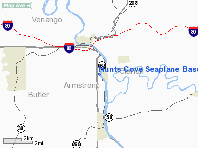
Hunts Cove Seaplane Base Airport |
Location & QuickFacts
| FAA Information Effective: | 2008-09-25 |
| Airport Identifier: | PN19 |
| Airport Status: | Operational |
| Longitude/Latitude: | 079-41-14.1770W/41-08-45.2220N
-79.687271/41.145895 (Estimated) |
| Elevation: | 840 ft / 256.03 m (Estimated) |
| Land: | 0 acres |
| From nearest city: | 0 nautical miles W of Foxburg, PA |
| Location: | Armstrong County, PA |
| Magnetic Variation: | 08W (1985) |
Owner & Manager
| Ownership: | Privately owned |
| Owner: | Raymond J. Hunt |
| Address: | 734 Wible Run Rd
Pittsburgh, PA 15209 |
| Phone number: | 412-659-4946 |
| Address: |
|
Airport Operations and Facilities
| Airport Use: | Private |
| Wind indicator: | Yes |
| Segmented Circle: | No |
| Control Tower: | No |
| Landing fee charge: | No |
| Sectional chart: | Detroit |
| Region: | AEA - Eastern |
| Boundary ARTCC: | ZOB - Cleveland |
| Tie-in FSS: | AOO - Altoona |
| FSS on Airport: | No |
| FSS Toll Free: | 1-800-WX-BRIEF |
Airport Services
| Fuel available: | 80 |
| Airframe Repair: | NONE |
| Power Plant Repair: | NONE |
Runway Information
Runway 02/20
| Dimension: | 7500 x 500 ft / 2286.0 x 152.4 m |
| Surface: | WATER, |
| |
Runway 02 |
Runway 20 |
| Traffic Pattern: | Left | Left |
|
Runway 16/34
| Dimension: | 6500 x 500 ft / 1981.2 x 152.4 m |
| Surface: | WATER, |
| |
Runway 16 |
Runway 34 |
| Traffic Pattern: | Left | Left |
|
Radio Navigation Aids
| ID |
Type |
Name |
Ch |
Freq |
Var |
Dist |
| UCP | NDB | Castle | | 272.00 | 09W | 33.8 nm |
| HBD | NDB | Hubbard | | 408.00 | 08W | 38.2 nm |
| INP | NDB | Indiana | | 242.00 | 08W | 41.9 nm |
| ORJ | NDB | Corry | | 258.00 | 09W | 46.1 nm |
| MKP | NDB | Mc Keesport | | 287.00 | 07W | 47.7 nm |
| FKL | VOR | Franklin | | 109.60 | 06W | 19.2 nm |
| CIP | VOR/DME | Clarion | 076X | 112.90 | 06W | 10.4 nm |
| EWC | VORTAC | Ellwood City | 105X | 115.80 | 08W | 30.6 nm |
| TDT | VORTAC | Tidioute | 123X | 117.60 | 09W | 36.2 nm |
| MMJ | VORTAC | Montour | 057X | 112.00 | 08W | 45.8 nm |
| YNG | VORTAC | Youngstown | 027X | 109.00 | 05W | 46.0 nm |
Remarks
- USE IN VFR CONDITIONS ONLY.
Images and information placed above are from
http://www.airport-data.com/airport/PN19/
We thank them for the data!
| General Info
|
| Country |
United States
|
| State |
PENNSYLVANIA
|
| FAA ID |
PN19
|
| Latitude |
41-08-45.222N
|
| Longitude |
079-41-14.177W
|
| Elevation |
840 feet
|
| Near City |
FOXBURG
|
We don't guarantee the information is fresh and accurate. The data may
be wrong or outdated.
For more up-to-date information please refer to other sources.
|
|


