 |
|
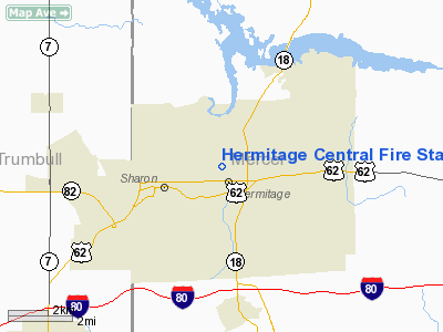
Hermitage Central Fire Station Heliport |
Location & QuickFacts
| FAA Information Effective: | 2008-09-25 |
| Airport Identifier: | 1PS1 |
| Airport Status: | Operational |
| Longitude/Latitude: | 080-27-53.2490W/41-14-24.2020N
-80.464791/41.240056 (Estimated) |
| Elevation: | 1165 ft / 355.09 m (Estimated) |
| Land: | 0 acres |
| From nearest city: | 0 nautical miles N of Hermitage, PA |
| Location: | Mercer County, PA |
| Magnetic Variation: | 07W (1980) |
Owner & Manager
| Ownership: | Publicly owned |
| Owner: | City Of Hermitage |
| Address: | 2511 Highland Road
Hermitage, PA 16148 |
| Phone number: | 412-342-0669 |
| Manager: | R.s. Goeliz, Fire Marshal |
| Address: | 2511 Highland Rd.
Hermitage, PA 16148 |
| Phone number: | 412-342-0669 |
Airport Operations and Facilities
| Airport Use: | Private |
| Wind indicator: | Yes |
| Segmented Circle: | No |
| Control Tower: | No |
| Landing fee charge: | No |
| Sectional chart: | Detroit |
| Region: | AEA - Eastern |
| Boundary ARTCC: | ZOB - Cleveland |
| Tie-in FSS: | AOO - Altoona |
| FSS Toll Free: | 1-800-WX-BRIEF |
Runway Information
Helipad H1
| Dimension: | 60 x 60 ft / 18.3 x 18.3 m |
| Surface: | ASPH, |
| |
Runway H1 |
Runway |
| Traffic Pattern: | Left | Left |
|
Radio Navigation Aids
| ID |
Type |
Name |
Ch |
Freq |
Var |
Dist |
| HBD | NDB | Hubbard | | 408.00 | 08W | 6.0 nm |
| UCP | NDB | Castle | | 272.00 | 09W | 13.2 nm |
| AK | NDB | Akron | | 362.00 | 07W | 43.0 nm |
| LQL | NDB | Lakeland | | 263.00 | 08W | 49.0 nm |
| TSO | NDB | Tolson | | 395.00 | 07W | 49.3 nm |
| FKL | VOR | Franklin | | 109.60 | 06W | 29.9 nm |
| JFN | VOR/DME | Jefferson | 099X | 115.20 | 05W | 33.8 nm |
| ACO | VOR/DME | Akron | 091X | 114.40 | 04W | 34.3 nm |
| CXR | VOR/DME | Chardon | 074X | 112.70 | 05W | 35.6 nm |
| CIP | VOR/DME | Clarion | 076X | 112.90 | 06W | 45.9 nm |
| LNN | VOR/DME | Lost Nation | 039X | 110.20 | 08W | 49.5 nm |
| YNG | VORTAC | Youngstown | 027X | 109.00 | 05W | 10.9 nm |
| EWC | VORTAC | Ellwood City | 105X | 115.80 | 08W | 27.5 nm |
| MMJ | VORTAC | Montour | 057X | 112.00 | 08W | 46.8 nm |
| ERI | VORTAC | Erie | 031X | 109.40 | 06W | 47.4 nm |
| CAK | VOT | Akron/canton Regional | | 110.60 | | 48.4 nm |
Remarks
- PROVIDED PLINE E IS MARKED; TREES N & W ARE REMOVED/LOWERED TO PROVIDE 8:1 APCH SURFACE.
Images and information placed above are from
http://www.airport-data.com/airport/1PS1/
We thank them for the data!
| General Info
|
| Country |
United States
|
| State |
PENNSYLVANIA
|
| FAA ID |
1PS1
|
| Latitude |
41-14-24.202N
|
| Longitude |
080-27-53.249W
|
| Elevation |
1165 feet
|
| Near City |
HERMITAGE
|
We don't guarantee the information is fresh and accurate. The data may
be wrong or outdated.
For more up-to-date information please refer to other sources.
|
|


