 |
|
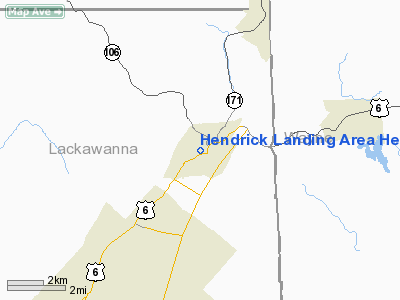
Hendrick Landing Area Heliport |
Location & QuickFacts
| FAA Information Effective: | 2008-09-25 |
| Airport Identifier: | PA09 |
| Airport Status: | Operational |
| Longitude/Latitude: | 075-30-26.6600W/41-34-17.3000N
-75.507406/41.571472 (Estimated) |
| Elevation: | 1100 ft / 335.28 m (Estimated) |
| Land: | 0 acres |
| From nearest city: | 0 nautical miles N of Carbondale, PA |
| Location: | Lackawanna County, PA |
| Magnetic Variation: | 12W (1995) |
Owner & Manager
| Ownership: | Privately owned |
| Owner: | Hendrick Mfg |
| Address: | 7th Ave & Clidco Dr
Carbondale, PA 18407 |
| Phone number: | 717-282-1010 |
| Manager: | Jim Roche |
| Address: | 7th Ave & Clidco Dr
Carbondale, PA 18407 |
| Phone number: | 717-282-1010 |
Airport Operations and Facilities
| Airport Use: | Private
HELIPAD FOR MEDICAL USE. |
| Wind indicator: | Yes |
| Segmented Circle: | No |
| Control Tower: | No |
| Lighting Schedule: | DUSK-DAWN |
| Sectional chart: | New York |
| Region: | AEA - Eastern |
| Boundary ARTCC: | ZNY - New York |
| Tie-in FSS: | IPT - Williamsport |
| FSS on Airport: | No |
| FSS Toll Free: | 1-800-WX-BRIEF |
Runway Information
Helipad H1
| Dimension: | 100 x 100 ft / 30.5 x 30.5 m |
| Surface: | ASPH, |
| |
Runway H1 |
Runway |
| Traffic Pattern: | Left | Left |
|
Radio Navigation Aids
| ID |
Type |
Name |
Ch |
Freq |
Var |
Dist |
| CYE | NDB | Crystal Lake | | 410.00 | 11W | 26.2 nm |
| MS | NDB | Monga | | 359.00 | 12W | 31.3 nm |
| HXM | NDB | Humbolt | | 366.00 | 10W | 41.4 nm |
| LQX | NDB | Carbon | | 339.00 | 12W | 47.0 nm |
| HZL | VOR | Hazleton | | 109.40 | 09W | 45.4 nm |
| HNK | VOR/DME | Hancock | 115X | 116.80 | 11W | 30.8 nm |
| HUO | VOR/DME | Huguenot | 108X | 116.10 | 11W | 42.4 nm |
| DNY | VOR/DME | De Lancey | 058X | 112.10 | 11W | 44.0 nm |
| STW | VOR/DME | Stillwater | 033X | 109.60 | 11W | 45.0 nm |
| LHY | VORTAC | Lake Henry | 045X | 110.80 | 10W | 5.9 nm |
| LVZ | VORTAC | Wilkes-barre | 053X | 111.60 | 10W | 19.7 nm |
| CFB | VORTAC | Binghamton | 059X | 112.20 | 10W | 45.1 nm |
Remarks
- PRVDD DALGT OPNS; NO IFR OPNS; THERE IS A CLEAR 8:1 INGRESS/EGRESS; & APPROPRIATE INGRESS/EGRESS MARKINGS.
Images and information placed above are from
http://www.airport-data.com/airport/PA09/
We thank them for the data!
| General Info
|
| Country |
United States
|
| State |
PENNSYLVANIA
|
| FAA ID |
PA09
|
| Latitude |
41-34-17.300N
|
| Longitude |
075-30-26.660W
|
| Elevation |
1100 feet
|
| Near City |
CARBONDALE
|
We don't guarantee the information is fresh and accurate. The data may
be wrong or outdated.
For more up-to-date information please refer to other sources.
|
|


