|
|
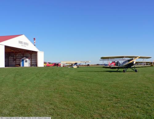 |
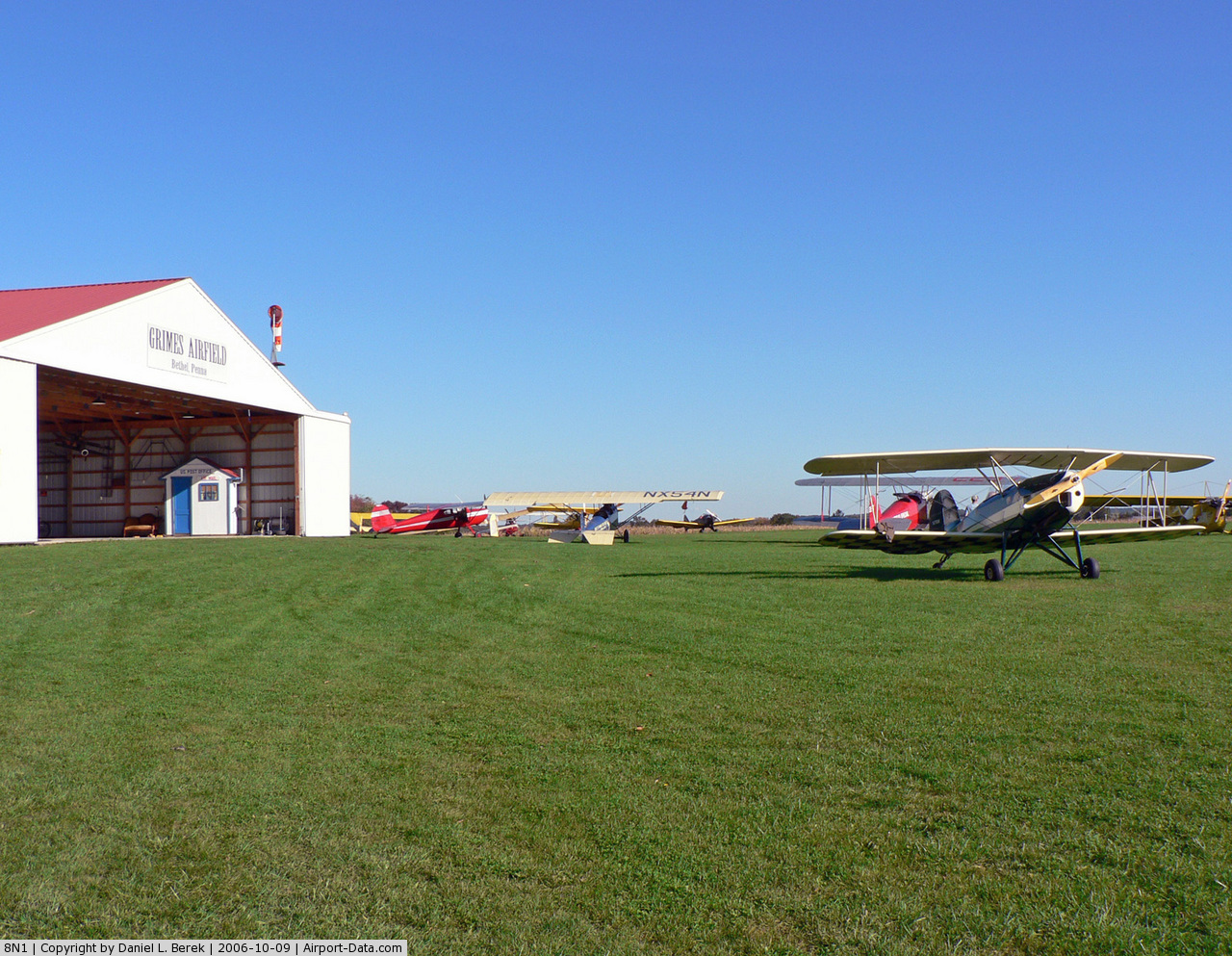
(Click on the photo to enlarge) |
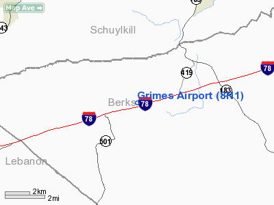
Location & QuickFacts
| FAA Information Effective: | 2008-09-25 |
| Airport Identifier: | 8N1 |
| Airport Status: | Operational |
| Longitude/Latitude: | 076-15-48.8230W/40-29-05.3310N
-76.263562/40.484814 (Estimated) |
| Elevation: | 582 ft / 177.39 m (Estimated) |
| Land: | 50 acres |
| From nearest city: | 2 nautical miles E of Bethel, PA |
| Location: | Berks County, PA |
| Magnetic Variation: | 11W (1985) |
Owner & Manager
| Ownership: | Privately owned |
| Owner: | Paul D Dougherty Jr |
| Address: | 371 Airport Rd
Bethel, PA 19507 |
| Phone number: | 717-933-9566 |
| Manager: | Paul D Dougherty Jr |
| Address: | 371 Airport Rd
Bethel, PA 19507 |
| Phone number: | 717-933-9566 |
Airport Operations and Facilities
| Airport Use: | Open to public |
| Wind indicator: | Yes |
| Segmented Circle: | No |
| Control Tower: | No |
| Landing fee charge: | No |
| Sectional chart: | New York |
| Region: | AEA - Eastern |
| Boundary ARTCC: | ZNY - New York |
| Tie-in FSS: | IPT - Williamsport |
| FSS on Airport: | No |
| FSS Toll Free: | 1-800-WX-BRIEF |
| NOTAMs Facility: | IPT (NOTAM-d service avaliable) |
Airport Communications
| CTAF: | 122.800 |
| Unicom: | 122.800 |
Airport Services
| Bottled Oxygen: | NONE |
| Bulk Oxygen: | NONE |
Runway Information
Runway 11/29
| Dimension: | 2720 x 100 ft / 829.1 x 30.5 m |
| Surface: | TURF, Good Condition
FIRST 700 FT OF RY ON W END UNUSBL IN EARLY SPRING DUE TO WET CONDS. |
| |
Runway 11 |
Runway 29 |
| Traffic Pattern: | Left | Left |
| Displaced threshold: | 250.00 ft
& 29 DSPLCD THRS MARKED WITH 3 RED ELEVATED PLASTIC CONTAINERS. | 270.00 ft |
| Obstruction: | 14 ft road, 41.0 ft from runway, 80 ft right of centerline, 2:1 slope to clear
RY 11 APCH SLOPE 20:1 TO DSPLCD THR. | 13 ft road, 78.0 ft from runway, 6:1 slope to clear
RY 29 APCH SLOPE 26:1 TO DSPLCD THR. |
|
Radio Navigation Aids
| ID |
Type |
Name |
Ch |
Freq |
Var |
Dist |
| BZJ | NDB | Bellgrove | | 328.00 | 10W | 13.6 nm |
| LQX | NDB | Carbon | | 339.00 | 12W | 30.3 nm |
| HXM | NDB | Humbolt | | 366.00 | 10W | 32.6 nm |
| EUD | NDB | York | | 254.00 | 11W | 44.1 nm |
| UKT | NDB | Quakertown | | 208.00 | 12W | 44.3 nm |
| CYE | NDB | Crystal Lake | | 410.00 | 11W | 47.8 nm |
| ING | NDB | Ambler | | 275.00 | 11W | 49.8 nm |
| HZL | VOR | Hazleton | | 109.40 | 09W | 30.1 nm |
| ETX | VOR/DME | East Texas | 039X | 110.20 | 09W | 27.1 nm |
| CKZ | VOR/DME | Pennridge | 025Y | 108.85 | 12W | 45.0 nm |
| RAV | VORTAC | Ravine | 093X | 114.60 | 11W | 15.9 nm |
| LRP | VORTAC | Lancaster | 120X | 117.30 | 09W | 22.0 nm |
| SEG | VORTAC | Selinsgrove | 041X | 110.40 | 08W | 33.8 nm |
| PTW | VORTAC | Pottstown | 112X | 116.50 | 09W | 35.9 nm |
| MIP | VORTAC | Milton | 029X | 109.20 | 09W | 37.2 nm |
| HAR | VORTAC | Harrisburg | 072X | 112.50 | 10W | 38.5 nm |
| FJC | VORTAC | Allentown | 122X | 117.50 | 10W | 39.7 nm |
| MXE | VORTAC | Modena | 079X | 113.20 | 09W | 43.6 nm |
| MDT | VOT | Harrisburg International | | 110.00 | | 28.7 nm |
Images and information placed above are from
http://www.airport-data.com/airport/8N1/
We thank them for the data!
| General Info
|
| Country |
United States
|
| State |
PENNSYLVANIA
|
| FAA ID |
8N1
|
| Latitude |
40-29-05.331N
|
| Longitude |
076-15-48.823W
|
| Elevation |
582 feet
|
| Near City |
BETHEL
|
We don't guarantee the information is fresh and accurate. The data may
be wrong or outdated.
For more up-to-date information please refer to other sources.
|
|