 |
|
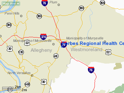
Forbes Rgnl Health Center Heliport |
Location & QuickFacts
| FAA Information Effective: | 2008-09-25 |
| Airport Identifier: | 54PN |
| Airport Status: | Operational |
| Longitude/Latitude: | 079-44-51.1650W/40-25-38.2460N
-79.747546/40.427291 (Estimated) |
| Elevation: | 1199 ft / 365.46 m (Estimated) |
| Land: | 0 acres |
| From nearest city: | 0 nautical miles N of Monroeville, PA |
| Location: | Allegheny County, PA |
| Magnetic Variation: | 08W (1985) |
Owner & Manager
| Ownership: | Privately owned |
| Owner: | Forbes Health System |
| Address: | 500 Finley Street
Pittsburgh, PA 15206 |
| Phone number: | 412-665-3569 |
| Manager: | J.d. Harkins
DIR. FACILITY SVCS. |
| Address: | 2570 Haymaker Road
Monroeville, PA 15146 |
| Phone number: | 412-858-2526 |
Airport Operations and Facilities
| Airport Use: | Private
MEDICAL USE. |
| Wind indicator: | Yes |
| Segmented Circle: | No |
| Control Tower: | No |
| Lighting Schedule: | PHONE REQ
FOR ROTG BCN PHONE 412-665-3569. |
| Beacon Color: | Clear-Green (lighted land airport) |
| Sectional chart: | Detroit |
| Region: | AEA - Eastern |
| Boundary ARTCC: | ZOB - Cleveland |
| Tie-in FSS: | AOO - Altoona |
| FSS on Airport: | No |
| FSS Toll Free: | 1-800-WX-BRIEF |
Runway Information
Helipad H1
| Dimension: | 100 x 100 ft / 30.5 x 30.5 m
CIRCULAR LNDG AREA. |
| Surface: | ASPH, |
| |
Runway H1 |
Runway |
| Traffic Pattern: | Left | Left |
|
Radio Navigation Aids
| ID |
Type |
Name |
Ch |
Freq |
Var |
Dist |
| MKP | NDB | Mc Keesport | | 287.00 | 07W | 4.6 nm |
| BHU | NDB | Benje | | 382.00 | 07W | 22.0 nm |
| PNU | NDB | Washington County | | 255.00 | 08W | 25.5 nm |
| VV | NDB | Camor | | 299.00 | 08W | 32.7 nm |
| INP | NDB | Indiana | | 242.00 | 08W | 33.5 nm |
| SYS | NDB | Stoystown | | 209.00 | 08W | 43.3 nm |
| UCP | NDB | Castle | | 272.00 | 09W | 47.0 nm |
| AGC | VOR/DME | Allegheny | 037X | 110.00 | 09W | 16.1 nm |
| HLG | VOR/DME | Wheeling | 059X | 112.20 | 07W | 38.9 nm |
| CIP | VOR/DME | Clarion | 076X | 112.90 | 06W | 45.2 nm |
| REC | VOR/DME | Revloc | 043X | 110.60 | 09W | 46.3 nm |
| MMJ | VORTAC | Montour | 057X | 112.00 | 08W | 20.7 nm |
| EWC | VORTAC | Ellwood City | 105X | 115.80 | 08W | 31.9 nm |
| IHD | VORTAC | Indian Head | 019X | 108.20 | 06W | 32.6 nm |
| JST | VORTAC | Johnstown | 077X | 113.00 | 06W | 42.4 nm |
Images and information placed above are from
http://www.airport-data.com/airport/54PN/
We thank them for the data!
| General Info
|
| Country |
United States
|
| State |
PENNSYLVANIA
|
| FAA ID |
54PN
|
| Latitude |
40-25-38.246N
|
| Longitude |
079-44-51.165W
|
| Elevation |
1199 feet
|
| Near City |
MONROEVILLE
|
We don't guarantee the information is fresh and accurate. The data may
be wrong or outdated.
For more up-to-date information please refer to other sources.
|
|


