 |
|
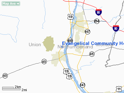
Evangelical Community Hospital East Heliport |
Location & QuickFacts
| FAA Information Effective: | 2008-09-25 |
| Airport Identifier: | 5PS7 |
| Airport Status: | Operational |
| Longitude/Latitude: | 076-53-08.8740W/40-58-45.3050N
-76.885798/40.979251 (Estimated) |
| Elevation: | 495 ft / 150.88 m (Estimated) |
| Land: | 0 acres |
| From nearest city: | 2 nautical miles S of Lewisburg, PA |
| Location: | Union County, PA |
| Magnetic Variation: | 10W (1985) |
Owner & Manager
| Ownership: | Privately owned |
| Owner: | Evangelical Community Hosp |
| Address: | 1 Hospital Drive
Lewisburg, PA 17837 |
| Phone number: | 717-522-2000 |
| Manager: | Sidney Westmoreland |
| Address: | 1 Hospital Drive
Lewisburg, PA 17837 |
| Phone number: | 717-523-2500 |
Airport Operations and Facilities
| Airport Use: | Private
MEDICAL USE. |
| Wind indicator: | Yes |
| Segmented Circle: | No |
| Control Tower: | No |
| Sectional chart: | New York |
| Region: | AEA - Eastern |
| Boundary ARTCC: | ZNY - New York |
| Tie-in FSS: | IPT - Williamsport |
| FSS Toll Free: | 1-800-WX-BRIEF |
Runway Information
Helipad H1
| Dimension: | 65 x 65 ft / 19.8 x 19.8 m |
| Surface: | TURF, |
| |
Runway H1 |
Runway |
| Traffic Pattern: | Left | Left |
|
Radio Navigation Aids
| ID |
Type |
Name |
Ch |
Freq |
Var |
Dist |
| PIX | NDB | Picture Rocks | | 344.00 | 09W | 19.6 nm |
| BZJ | NDB | Bellgrove | | 328.00 | 10W | 36.0 nm |
| HXM | NDB | Humbolt | | 366.00 | 10W | 40.3 nm |
| RV | NDB | Stroh | | 407.00 | 10W | 43.7 nm |
| CYE | NDB | Crystal Lake | | 410.00 | 11W | 49.7 nm |
| HZL | VOR | Hazleton | | 109.40 | 09W | 34.5 nm |
| FQM | VOR/DME | Williamsport | 091X | 114.40 | 09W | 22.2 nm |
| SFK | VOR/DME | Stonyfork | 023X | 108.60 | 08W | 49.3 nm |
| MIP | VORTAC | Milton | 029X | 109.20 | 09W | 10.3 nm |
| SEG | VORTAC | Selinsgrove | 041X | 110.40 | 08W | 11.3 nm |
| RAV | VORTAC | Ravine | 093X | 114.60 | 11W | 28.7 nm |
| HAR | VORTAC | Harrisburg | 072X | 112.50 | 10W | 41.5 nm |
| MDT | VOT | Harrisburg International | | 110.00 | | 47.3 nm |
Remarks
Images and information placed above are from
http://www.airport-data.com/airport/5PS7/
We thank them for the data!
| General Info
|
| Country |
United States
|
| State |
PENNSYLVANIA
|
| FAA ID |
5PS7
|
| Latitude |
40-58-45.305N
|
| Longitude |
076-53-08.874W
|
| Elevation |
495 feet
|
| Near City |
LEWISBURG
|
We don't guarantee the information is fresh and accurate. The data may
be wrong or outdated.
For more up-to-date information please refer to other sources.
|
|


