 |
|
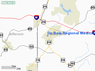
Du Bois Rgnl Medical Center Heliport |
Location & QuickFacts
| FAA Information Effective: | 2008-09-25 |
| Airport Identifier: | PA10 |
| Airport Status: | Operational |
| Longitude/Latitude: | 078-46-31.1080W/41-06-53.2210N
-78.775308/41.114784 (Estimated) |
| Elevation: | 1467 ft / 447.14 m (Estimated) |
| Land: | 0 acres |
| From nearest city: | 0 nautical miles N of Du Bois, PA |
| Location: | Clearfield County, PA |
| Magnetic Variation: | 09W (1985) |
Owner & Manager
| Ownership: | Privately owned |
| Owner: | Drmc
AND A16 -- DU BOIS REGIONAL MEDICAL CENTER. |
| Address: | 100 Hospital Avenue
Du Bois, PA 15801 |
| Phone number: | 814-371-2200 |
| Manager: | Drmc |
| Address: | 100 Hospital Avenue
Du Bois, PA 15801 |
| Phone number: | 814-371-2200 |
Airport Operations and Facilities
| Airport Use: | Private
MEDICAL USE. |
| Wind indicator: | Yes |
| Segmented Circle: | No |
| Control Tower: | No |
| Sectional chart: | Detroit |
| Region: | AEA - Eastern |
| Boundary ARTCC: | ZOB - Cleveland |
| Tie-in FSS: | AOO - Altoona |
| FSS Toll Free: | 1-800-WX-BRIEF |
Runway Information
Helipad H1
| Dimension: | 32 x 32 ft / 9.8 x 9.8 m |
| Surface: | ASPH, |
| |
Runway H1 |
Runway |
| Traffic Pattern: | Left | Left |
|
Radio Navigation Aids
| ID |
Type |
Name |
Ch |
Freq |
Var |
Dist |
| INP | NDB | Indiana | | 242.00 | 08W | 31.9 nm |
| BHU | NDB | Benje | | 382.00 | 07W | 49.9 nm |
| CIP | VOR/DME | Clarion | 076X | 112.90 | 06W | 31.0 nm |
| REC | VOR/DME | Revloc | 043X | 110.60 | 09W | 34.2 nm |
| BFD | VOR/DME | Bradford | 113X | 116.60 | 07W | 41.0 nm |
| ETG | VORTAC | Keating | 107X | 116.00 | 10W | 29.2 nm |
| TON | VORTAC | Tyrone | 096X | 114.90 | 07W | 30.5 nm |
| PSB | VORTAC | Philipsburg | 102X | 115.50 | 10W | 37.4 nm |
| SLT | VORTAC | Slate Run | 086X | 113.90 | 08W | 43.5 nm |
| TDT | VORTAC | Tidioute | 123X | 117.60 | 09W | 46.2 nm |
| JST | VORTAC | Johnstown | 077X | 113.00 | 06W | 48.0 nm |
Remarks
- PROVIDED LGT POLE TO THE N IS MKD/LGTD FOR NIGHT OPERATIONS.
Images and information placed above are from
http://www.airport-data.com/airport/PA10/
We thank them for the data!
| General Info
|
| Country |
United States
|
| State |
PENNSYLVANIA
|
| FAA ID |
PA10
|
| Latitude |
41-06-53.221N
|
| Longitude |
078-46-31.108W
|
| Elevation |
1467 feet
|
| Near City |
DU BOIS
|
We don't guarantee the information is fresh and accurate. The data may
be wrong or outdated.
For more up-to-date information please refer to other sources.
|
|


