 |
|
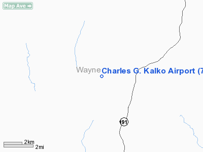
Location & QuickFacts
| FAA Information Effective: | 2008-09-25 |
| Airport Identifier: | 7PA3 |
| Airport Status: | Operational |
| Longitude/Latitude: | 075-17-16.6340W/41-42-20.3150N
-75.287954/41.705643 (Estimated) |
| Elevation: | 1400 ft / 426.72 m (Estimated) |
| Land: | 400 acres |
| From nearest city: | 10 nautical miles N of Honesdale, PA |
| Location: | Wayne County, PA |
| Magnetic Variation: | 12W (1985) |
Owner & Manager
| Ownership: | Privately owned |
| Owner: | Mrs. Marti Kalko |
| Address: | 1126 Upper Woods Road
Honesdale, PA 18431 |
| Phone number: | 908-385-7948 |
| Manager: | Mrs. Marti Kalko |
| Address: | 1126 Upper Woods Road
Honesdale, PA 18431 |
| Phone number: | 908-385-7948 |
Airport Operations and Facilities
| Airport Use: | Private |
| Wind indicator: | Yes |
| Segmented Circle: | No |
| Control Tower: | No |
| Lighting Schedule: | RDO-CTL
ACTVT LIRL RY 18/36 - 129.900. |
| Sectional chart: | New York |
| Region: | AEA - Eastern |
| Boundary ARTCC: | ZNY - New York |
| Tie-in FSS: | IPT - Williamsport |
| FSS on Airport: | No |
| FSS Toll Free: | 1-800-WX-BRIEF |
Airport Services
Runway Information
Runway 18/36
| Dimension: | 4000 x 50 ft / 1219.2 x 15.2 m |
| Surface: | ASPH, |
| Edge Lights: | Low |
| |
Runway 18 |
Runway 36 |
| Traffic Pattern: | Left | Left |
|
Radio Navigation Aids
| ID |
Type |
Name |
Ch |
Freq |
Var |
Dist |
| MS | NDB | Monga | | 359.00 | 12W | 19.5 nm |
| CYE | NDB | Crystal Lake | | 410.00 | 11W | 38.6 nm |
| SW | NDB | Neely | | 335.00 | 14W | 49.4 nm |
| HNK | VOR/DME | Hancock | 115X | 116.80 | 11W | 21.5 nm |
| DNY | VOR/DME | De Lancey | 058X | 112.10 | 11W | 32.0 nm |
| HUO | VOR/DME | Huguenot | 108X | 116.10 | 11W | 36.0 nm |
| RKA | VOR/DME | Rockdale | 073X | 112.60 | 11W | 45.8 nm |
| STW | VOR/DME | Stillwater | 033X | 109.60 | 11W | 46.7 nm |
| LHY | VORTAC | Lake Henry | 045X | 110.80 | 10W | 16.4 nm |
| LVZ | VORTAC | Wilkes-barre | 053X | 111.60 | 10W | 31.7 nm |
| CFB | VORTAC | Binghamton | 059X | 112.20 | 10W | 46.7 nm |
Remarks
- PRVDD LARGEST CLASS OF ACFT RECOMMENDED FOR OPNS IS 12500 LBS OR LESS & THE ARPT IS CONSISTENT WITH FAA DESIGN STANDARDS.
Images and information placed above are from
http://www.airport-data.com/airport/7PA3/
We thank them for the data!
| General Info
|
| Country |
United States
|
| State |
PENNSYLVANIA
|
| FAA ID |
7PA3
|
| Latitude |
41-42-20.315N
|
| Longitude |
075-17-16.634W
|
| Elevation |
1400 feet
|
| Near City |
HONESDALE
|
We don't guarantee the information is fresh and accurate. The data may
be wrong or outdated.
For more up-to-date information please refer to other sources.
|
|


