 |
|
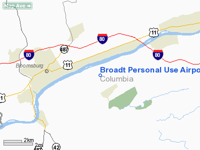
Broadt Personal Use Airport |
Location & QuickFacts
| FAA Information Effective: | 2008-09-25 |
| Airport Identifier: | 5PA1 |
| Airport Status: | Operational |
| Longitude/Latitude: | 076-23-01.7920W/40-59-50.3110N
-76.383831/40.997309 (Estimated) |
| Elevation: | 920 ft / 280.42 m (Estimated) |
| Land: | 0 acres |
| From nearest city: | 1 nautical miles N of Mainville, PA |
| Location: | Columbia County, PA |
| Magnetic Variation: | 11W (1985) |
Owner & Manager
| Ownership: | Privately owned |
| Owner: | Roger C. Broadt |
| Address: | Rd 3
Bloomsburg, PA 17815 |
| Phone number: | 717-784-0911 |
| Manager: | Roger C. Broadt |
| Address: | Rd 3
Bloomsburg, PA 17815 |
| Phone number: | 717-784-0911 |
Airport Operations and Facilities
| Airport Use: | Private |
| Wind indicator: | Yes |
| Segmented Circle: | No |
| Control Tower: | No |
| Landing fee charge: | No |
| Sectional chart: | New York |
| Region: | AEA - Eastern |
| Boundary ARTCC: | ZNY - New York |
| Tie-in FSS: | IPT - Williamsport |
| FSS on Airport: | No |
| FSS Toll Free: | 1-800-WX-BRIEF |
Runway Information
Runway 06/24
| Dimension: | 1600 x 100 ft / 487.7 x 30.5 m |
| Surface: | TURF, |
| |
Runway 06 |
Runway 24 |
| Traffic Pattern: | Left | Left |
|
Radio Navigation Aids
| ID |
Type |
Name |
Ch |
Freq |
Var |
Dist |
| HXM | NDB | Humbolt | | 366.00 | 10W | 17.6 nm |
| PIX | NDB | Picture Rocks | | 344.00 | 09W | 22.4 nm |
| CYE | NDB | Crystal Lake | | 410.00 | 11W | 28.1 nm |
| LQX | NDB | Carbon | | 339.00 | 12W | 30.5 nm |
| BZJ | NDB | Bellgrove | | 328.00 | 10W | 34.6 nm |
| HZL | VOR | Hazleton | | 109.40 | 09W | 11.8 nm |
| FQM | VOR/DME | Williamsport | 091X | 114.40 | 09W | 27.1 nm |
| ETX | VOR/DME | East Texas | 039X | 110.20 | 09W | 40.5 nm |
| MIP | VORTAC | Milton | 029X | 109.20 | 09W | 12.9 nm |
| SEG | VORTAC | Selinsgrove | 041X | 110.40 | 08W | 25.9 nm |
| RAV | VORTAC | Ravine | 093X | 114.60 | 11W | 28.4 nm |
| LVZ | VORTAC | Wilkes-barre | 053X | 111.60 | 10W | 35.5 nm |
| FJC | VORTAC | Allentown | 122X | 117.50 | 10W | 45.3 nm |
| LHY | VORTAC | Lake Henry | 045X | 110.80 | 10W | 49.9 nm |
Images and information placed above are from
http://www.airport-data.com/airport/5PA1/
We thank them for the data!
| General Info
|
| Country |
United States
|
| State |
PENNSYLVANIA
|
| FAA ID |
5PA1
|
| Latitude |
40-59-50.311N
|
| Longitude |
076-23-01.792W
|
| Elevation |
920 feet
|
| Near City |
MAINVILLE
|
We don't guarantee the information is fresh and accurate. The data may
be wrong or outdated.
For more up-to-date information please refer to other sources.
|
|


