 |
|
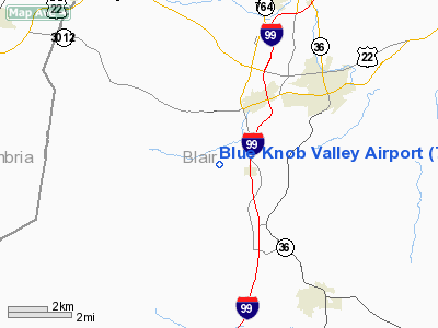
Location & QuickFacts
| FAA Information Effective: | 2008-09-25 |
| Airport Identifier: | 7G4 |
| Airport Status: | Operational |
| Longitude/Latitude: | 078-27-14.0520W/40-23-45.2630N
-78.453903/40.395906 (Estimated) |
| Elevation: | 1270 ft / 387.10 m (Surveyed) |
| Land: | 20 acres |
| From nearest city: | 1 nautical miles W of Newry, PA |
| Location: | Blair County, PA |
| Magnetic Variation: | 09W (1985) |
Owner & Manager
| Ownership: | Privately owned |
| Owner: | Blue Knob Valley Airport Inc |
| Address: | 200 Airport Road
Duncansville, PA 16635 |
| Phone number: | 814-695-7705 |
| Manager: | Alan Montgomery |
| Address: | 200 Airport Road
Duncansville, PA 16635 |
| Phone number: | 814-695-7705 |
Airport Operations and Facilities
| Airport Use: | Open to public |
| Wind indicator: | Yes |
| Segmented Circle: | Yes |
| Control Tower: | No |
| Landing fee charge: | No |
| Sectional chart: | Detroit |
| Region: | AEA - Eastern |
| Boundary ARTCC: | ZOB - Cleveland |
| Tie-in FSS: | AOO - Altoona |
| FSS on Airport: | No |
| FSS Toll Free: | 1-800-WX-BRIEF |
| NOTAMs Facility: | AOO (NOTAM-d service avaliable) |
Airport Communications
| CTAF: | 122.800 |
| Unicom: | 122.800 |
Airport Services
| Fuel available: | 100LL |
| Airframe Repair: | MINOR |
| Power Plant Repair: | MINOR |
Runway Information
Runway 11/29
| Dimension: | 3415 x 89 ft / 1040.9 x 27.1 m |
| Surface: | GRVL, Fair Condition
SFC IS ROLLED SLATE. |
| |
Runway 11 |
Runway 29 |
| Traffic Pattern: | Left | Right |
| Displaced threshold: | 300.00 ft
RY 11 DSPLCD THLD MKD WITH YELLOW L'S EACH SIDE. | 0.00 ft |
| Obstruction: | 14 ft road, 55 ft left of centerline
RWY 11 APCH RATIO 21:1 TO DSPLCD THR. | 3 ft brush, 12.0 ft from runway, 56 ft right of centerline, 3:1 slope to clear |
|
Radio Navigation Aids
| ID |
Type |
Name |
Ch |
Freq |
Var |
Dist |
| SYS | NDB | Stoystown | | 209.00 | 08W | 28.3 nm |
| INP | NDB | Indiana | | 242.00 | 08W | 31.4 nm |
| RV | NDB | Stroh | | 407.00 | 10W | 36.1 nm |
| BHU | NDB | Benje | | 382.00 | 07W | 37.5 nm |
| CBE | NDB | Cumberland | | 317.00 | 07W | 46.9 nm |
| AOO | VOR | Altoona | | 108.80 | 07W | 8.1 nm |
| REC | VOR/DME | Revloc | 043X | 110.60 | 09W | 16.2 nm |
| JST | VORTAC | Johnstown | 077X | 113.00 | 06W | 18.1 nm |
| TON | VORTAC | Tyrone | 096X | 114.90 | 07W | 21.1 nm |
| THS | VORTAC | St Thomas | 097X | 115.00 | 07W | 36.2 nm |
| PSB | VORTAC | Philipsburg | 102X | 115.50 | 10W | 37.7 nm |
| IHD | VORTAC | Indian Head | 019X | 108.20 | 06W | 48.7 nm |
Remarks
- ARPT SURROUNDED BY MOUNTAINS.
- LOOSE STONES ON RY; TWY & RAMP.
- NUMEROUS TREES IN PRIMARY SURFACE ALONG SOUTH SIDE OF RY.
- VFR ONLY.
Images and information placed above are from
http://www.airport-data.com/airport/7G4/
We thank them for the data!
| General Info
|
| Country |
United States
|
| State |
PENNSYLVANIA
|
| FAA ID |
7G4
|
| Latitude |
40-23-45.263N
|
| Longitude |
078-27-14.052W
|
| Elevation |
1270 feet
|
| Near City |
NEWRY
|
We don't guarantee the information is fresh and accurate. The data may
be wrong or outdated.
For more up-to-date information please refer to other sources.
|
|


