 |
|
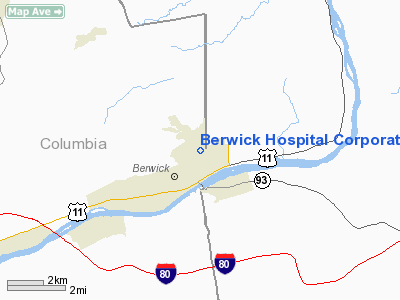
Berwick Hospital Corporation Personal Use Heliport |
Location & QuickFacts
| FAA Information Effective: | 2008-09-25 |
| Airport Identifier: | PA42 |
| Airport Status: | Operational |
| Longitude/Latitude: | 076-13-52.7620W/41-04-13.3040N
-76.231323/41.070362 (Estimated) |
| Elevation: | 581 ft / 177.09 m (Estimated) |
| Land: | 0 acres |
| From nearest city: | 1 nautical miles NE of Berwick, PA |
| Location: | Columbia County, PA |
| Magnetic Variation: | 11W (1985) |
Owner & Manager
| Ownership: | Privately owned |
| Owner: | Berwick Hospital Center |
| Address: | 701 East 16th Street
Berwick, PA 18603 |
| Phone number: | 717-759-5000 |
| Manager: | John Costa |
| Address: | 701 East 16th Street
Berwick, PA 18603 |
| Phone number: | 717-759-5000 |
Airport Operations and Facilities
| Airport Use: | Private
MEDICAL USE. |
| Wind indicator: | Yes |
| Segmented Circle: | No |
| Control Tower: | No |
| Lighting Schedule: | PHONE REQ
FOR HELIPAD LGTS AND ROTG BCN; CALL 717-759-5000. |
| Beacon Color: | Clear-Yellow (lighted seaplan base) |
| Landing fee charge: | No |
| Sectional chart: | New York |
| Region: | AEA - Eastern |
| Boundary ARTCC: | ZNY - New York |
| Tie-in FSS: | IPT - Williamsport |
| FSS on Airport: | No |
| FSS Toll Free: | 1-800-WX-BRIEF |
Runway Information
Helipad H1
| Dimension: | 200 x 200 ft / 61.0 x 61.0 m |
| Surface: | ASPH, |
| Edge Lights: | Low |
| |
Runway H1 |
Runway |
| Traffic Pattern: | Left | Left |
|
Radio Navigation Aids
| ID |
Type |
Name |
Ch |
Freq |
Var |
Dist |
| HXM | NDB | Humbolt | | 366.00 | 10W | 11.7 nm |
| CYE | NDB | Crystal Lake | | 410.00 | 11W | 19.9 nm |
| PIX | NDB | Picture Rocks | | 344.00 | 09W | 25.0 nm |
| LQX | NDB | Carbon | | 339.00 | 12W | 26.5 nm |
| BZJ | NDB | Bellgrove | | 328.00 | 10W | 40.9 nm |
| HZL | VOR | Hazleton | | 109.40 | 09W | 7.5 nm |
| FQM | VOR/DME | Williamsport | 091X | 114.40 | 09W | 29.4 nm |
| ETX | VOR/DME | East Texas | 039X | 110.20 | 09W | 38.5 nm |
| MIP | VORTAC | Milton | 029X | 109.20 | 09W | 19.9 nm |
| LVZ | VORTAC | Wilkes-barre | 053X | 111.60 | 10W | 27.4 nm |
| SEG | VORTAC | Selinsgrove | 041X | 110.40 | 08W | 34.1 nm |
| RAV | VORTAC | Ravine | 093X | 114.60 | 11W | 35.3 nm |
| FJC | VORTAC | Allentown | 122X | 117.50 | 10W | 40.9 nm |
| LHY | VORTAC | Lake Henry | 045X | 110.80 | 10W | 41.7 nm |
Images and information placed above are from
http://www.airport-data.com/airport/PA42/
We thank them for the data!
| General Info
|
| Country |
United States
|
| State |
PENNSYLVANIA
|
| FAA ID |
PA42
|
| Latitude |
41-04-13.304N
|
| Longitude |
076-13-52.762W
|
| Elevation |
581 feet
|
| Near City |
BERWICK
|
We don't guarantee the information is fresh and accurate. The data may
be wrong or outdated.
For more up-to-date information please refer to other sources.
|
|


