 |
|
Altoona-blair County Airport |
Coordinates: 40°17′47″N 078°19′12″W / 40.29639°N 78.32°W / 40.29639; -78.32
| Altoona-Blair County Airport |
 |
| IATA: AOO – ICAO: KAOO – FAA LID: AOO |
| Summary |
| Airport type |
Public |
| Owner |
Blair County Airport Authority |
| Serves |
Altoona, Pennsylvania |
| Location |
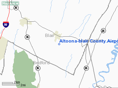
Martinsburg, Pennsylvania |
| Elevation AMSL |
1,504 ft / 458 m |
| Website |
AltoonaBlairCountyAirport.com |
| Runways |
| Direction |
Length |
Surface |
| ft |
m |
| 3/21 |
5,466 |
1,666 |
Asphalt |
| 12/30 |
3,668 |
1,118 |
Asphalt |
| Statistics (2007) |
| Aircraft operations |
24,082 |
| Based aircraft |
55 |
| Source: Federal Aviation Administration |
Altoona-Blair County Airport (IATA: AOO, ICAO: KAOO, FAA LID: AOO) is a county-owned public-use airport located in Martinsburg, 12 miles (19 km) south of the central business district of Altoona, a city in Blair County, Pennsylvania, United States. It offers limited commercial service, subsidized by the Essential Air Service program.
US Airways ceased service to Pittsburgh on July 7, 2007. Facilities and aircraft
Altoona-Blair County Airport covers an area of 320 acres (129 ha) which contains two asphalt paved runways: 3/21 measuring 5,466 x 100 ft. (1,666 x 30 m) and 12/30 measuring 3,668 x 75 ft. (1,118 x 23 m).
For the 12-month period ending January 8, 2007, the airport had 24,082 aircraft operations, an average of 65 per day: 78% general aviation, 21% air taxi and 1% military. At that time there were 55 aircraft based at this airport: 80% single-engine, 9% multi-engine, 5% jet, 2% helicopter and 4% ultralight.
Altoona-Blair County Airport has 46 small aircraft T-Hangar facilities that it rents to aircraft owners, while construction is under way for more. The airport was previously serviced by the FBO Penn-Air, Inc, which provided fuel and repair services. Penn-Air, Inc. has closed its operation at Altoona-Blair County Airport, and fuel services are currently being performed by the Altoona-Blair County Airport Authority on an interim basis.
Altoona-Blair County Airport houses the Kitty Hawk Restaurant, which is accessible either from the flight line or from the terminal building. The airport also offers car rental through Hertz.
Airlines and destinations
| Airlines |
Destinations |
| United Airlines operated by Colgan Air |
Washington-Dulles, Johnstown |
The above content comes from Wikipedia and is published under free licenses – click here to read more.
Location & QuickFacts
| FAA Information Effective: | 2008-09-25 |
| Airport Identifier: | AOO |
| Airport Status: | Operational |
| Longitude/Latitude: | 078-19-12.0830W/40-17-46.9400N
-78.320023/40.296372 (Estimated) |
| Elevation: | 1504 ft / 458.42 m (Surveyed) |
| Land: | 320 acres |
| From nearest city: | 12 nautical miles S of Altoona, PA |
| Location: | Blair County, PA |
| Magnetic Variation: | 10W (2005) |
Owner & Manager
| Ownership: | Publicly owned |
| Owner: | Blair County Airport Auth |
| Address: | 2 Airport Dr
Martinsburg, PA 16662 |
| Phone number: | 814-793-3872 |
| Manager: | Chuck Pillar |
| Address: | 2 Airport Dr
Martinsburg, PA 16662 |
| Phone number: | 814-793-2027 |
Airport Operations and Facilities
| Airport Use: | Open to public |
| Wind indicator: | Yes
SUPPLEMENTAL LIGHTED WINDCONE INVOF AER 03. |
| Segmented Circle: | Yes |
| Control Tower: | No |
| Lighting Schedule: | DUSK-DAWN
HIRL RY 03/21 & MIRL RY 12/30 PRESET LOW INTST, INCR INTST & ACTVT PAPI RYS 12, 30, 03 & 21, MALSR RY 21 & REIL RYS 03, 12, & 30 - CTAF. |
| Beacon Color: | Clear-Green (lighted land airport) |
| Landing fee charge: | No |
| Sectional chart: | Detroit |
| Region: | AEA - Eastern |
| Boundary ARTCC: | ZOB - Cleveland |
| Tie-in FSS: | AOO - Altoona
CTC ALTOONA RADIO FOR REMOTE AIRPORT ADVISORY SERVICE ON 123.6. |
| FSS on Airport: | No |
| FSS Toll Free: | 1-800-WX-BRIEF |
| NOTAMs Facility: | AOO (NOTAM-d service avaliable) |
| Certification type/date: | I A S 07/1990
PPR 24 FOR UNSKED ACR & NON-ACR OPNS WITH MORE THAN 30 PSGR SEATS; CALL AMGR 814-793-3872. |
| Federal Agreements: | NGYH |
Airport Communications
| CTAF: | 123.600 |
| Unicom: | 123.000 |
Airport Services
| Fuel available: | 100LLA |
| Airframe Repair: | MAJOR |
| Power Plant Repair: | MAJOR |
| Bottled Oxygen: | HIGH |
| Bulk Oxygen: | HIGH |
Runway Information
Runway 03/21
| Dimension: | 5466 x 100 ft / 1666.0 x 30.5 m |
| Surface: | ASPH, Good Condition |
| Surface Treatment: | Saw-cut or plastic Grooved |
| Weight Limit: | Single wheel: 16000 lbs.
Dual wheel: 44000 lbs. |
| Edge Lights: | High |
| |
Runway 03 |
Runway 21 |
| Longitude: | 078-19-23.2870W | 078-19-03.8670W |
| Latitude: | 40-17-19.4140N | 40-18-11.3320N |
| Elevation: | 1504.00 ft | 1470.00 ft |
| Alignment: | 16 | 127 |
| ILS Type: | | ILS
|
| Traffic Pattern: | Left | Left |
| Markings: | Non-precision instrument, Good Condition | Precision instrument, Good Condition |
| Crossing Height: | 43.00 ft | 54.00 ft |
| VASI: | 4-light PAPI on left side | 4-light PAPI on left side |
| Visual Glide Angle: | 3.00° | 3.00° |
| Approach lights: | | MALSR |
| Runway End Identifier: | Yes | |
| Obstruction: | 46 ft trees, 1070.0 ft from runway, 500 ft left of centerline, 18:1 slope to clear
HAS +11 FT GND AT RY END 290 FT RIGHT. | 85 ft trees, 3100.0 ft from runway, 600 ft right of centerline, 34:1 slope to clear |
|
Runway 12/30
| Dimension: | 3668 x 75 ft / 1118.0 x 22.9 m |
| Surface: | ASPH, Good Condition |
| Weight Limit: | Single wheel: 11500 lbs.
Dual wheel: 33000 lbs. |
| Edge Lights: | Medium |
| |
Runway 12 |
Runway 30 |
| Longitude: | 078-19-32.3240W | 078-18-47.3900W |
| Latitude: | 40-17-54.9740N | 40-17-43.5760N |
| Elevation: | 1473.00 ft | 1482.00 ft |
| Alignment: | 108 | 127 |
| Traffic Pattern: | Left | Left |
| Markings: | Basic, Fair Condition | Basic, Fair Condition |
| Crossing Height: | 55.00 ft | 54.00 ft |
| VASI: | 4-light PAPI on left side | 4-light PAPI on right side |
| Visual Glide Angle: | 3.00° | 4.00° |
| Runway End Identifier: | Yes | Yes |
| Obstruction: | 27 ft tree, 970.0 ft from runway, 300 ft left of centerline, 28:1 slope to clear
HAS +7 FT TREE 90 FT FM RY END 100 FT RIGHT. | 25 ft tree, 715.0 ft from runway, 80 ft right of centerline, 20:1 slope to clear
HAS + 4 FT GND 20 FT FM RY END 215 FT RIGHT. |
|
Radio Navigation Aids
| ID |
Type |
Name |
Ch |
Freq |
Var |
Dist |
| SYS | NDB | Stoystown | | 209.00 | 08W | 30.2 nm |
| RV | NDB | Stroh | | 407.00 | 10W | 33.5 nm |
| INP | NDB | Indiana | | 242.00 | 08W | 39.6 nm |
| CBE | NDB | Cumberland | | 317.00 | 07W | 43.7 nm |
| BHU | NDB | Benje | | 382.00 | 07W | 43.9 nm |
| AOO | VOR | Altoona | | 108.80 | 07W | 1.9 nm |
| HGR | VOR | Hagerstown | | 109.80 | 07W | 41.9 nm |
| REC | VOR/DME | Revloc | 043X | 110.60 | 09W | 24.7 nm |
| JST | VORTAC | Johnstown | 077X | 113.00 | 06W | 23.6 nm |
| TON | VORTAC | Tyrone | 096X | 114.90 | 07W | 26.4 nm |
| THS | VORTAC | St Thomas | 097X | 115.00 | 07W | 27.6 nm |
| PSB | VORTAC | Philipsburg | 102X | 115.50 | 10W | 40.1 nm |
Remarks
- PREFERRED RY IS RY 21; FOR NOISE ABATEMENT WHEN DEP RY 03 MAINT RY HDG TIL 2 NM N OR ARPT.
- PAEW ADJ ALL RYS & TWYS 0600-2100 (ANNUALLY) 01 MAY THRU 31 OCT EXCEPT SAFETY AREAS WILL REMAIN CLR DURG ACR OPNS.
- SPECIALIZED ACFT (ULTRALGT, HOMEBUILT, ETC) CTC AMGR 814-793-3872 OR UNICOM PRIOR TO LDG.
Images and information placed above are from
http://www.airport-data.com/airport/AOO/
We thank them for the data!
| General Info
|
| Country |
United States
|
| State |
PENNSYLVANIA
|
| FAA ID |
AOO
|
| Latitude |
40-17-46.940N
|
| Longitude |
078-19-12.083W
|
| Elevation |
1504 feet
|
| Near City |
ALTOONA
|
We don't guarantee the information is fresh and accurate. The data may
be wrong or outdated.
For more up-to-date information please refer to other sources.
|
|


