 |
|
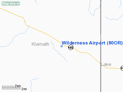
Location & QuickFacts
| FAA Information Effective: | 2008-09-25 |
| Airport Identifier: | 80OR |
| Airport Status: | Operational |
| Longitude/Latitude: | 120-57-56.9370W/42-21-51.5460N
-120.965816/42.364318 (Estimated) |
| Elevation: | 4540 ft / 1383.79 m (Estimated) |
| Land: | 0 acres |
| From nearest city: | 4 nautical miles E of Bly, OR |
| Location: | Klamath County, OR |
| Magnetic Variation: | 18E (1985) |
Owner & Manager
| Ownership: | Privately owned |
| Owner: | Frank R. De Mendoza |
| Address: | 5481 Don Basillo Cr
San Jose, CA 95123-3104 |
| Phone number: | 503-884-8241 |
| Address: |
|
| Phone number: | 503-884-8241 |
Airport Operations and Facilities
| Airport Use: | Private |
| Wind indicator: | Yes |
| Segmented Circle: | No |
| Control Tower: | No |
| Landing fee charge: | No |
| Sectional chart: | Seattle |
| Region: | ANM - Northwest Mountain |
| Boundary ARTCC: | ZSE - Seattle |
| Tie-in FSS: | MMV - Mc Minnville |
| FSS Toll Free: | 1-800-WX-BRIEF |
Runway Information
Runway 08/26
| Dimension: | 2500 x 80 ft / 762.0 x 24.4 m |
| Surface: | GRVL, |
| |
Runway 08 |
Runway 26 |
| Traffic Pattern: | Left | Left |
|
Radio Navigation Aids
| ID |
Type |
Name |
Ch |
Freq |
Var |
Dist |
| LFA | NDB | Merrill | | 347.00 | 17E | 37.8 nm |
| LKV | VORTAC | Lakeview | 57X | 112.00 | 19E | 21.8 nm |
| LMT | VORTAC | Klamath Falls | 106X | 115.90 | 17E | 36.2 nm |
Images and information placed above are from
http://www.airport-data.com/airport/80OR/
We thank them for the data!
| General Info
|
| Country |
United States
|
| State |
OREGON
|
| FAA ID |
80OR
|
| Latitude |
42-21-51.546N
|
| Longitude |
120-57-56.937W
|
| Elevation |
4540 feet
|
| Near City |
BLY
|
We don't guarantee the information is fresh and accurate. The data may
be wrong or outdated.
For more up-to-date information please refer to other sources.
|
|


