 |
|
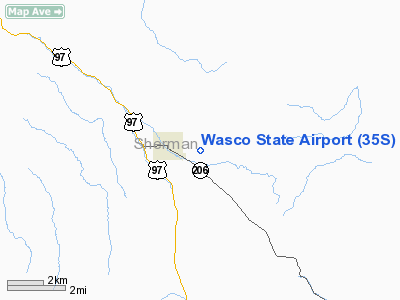
| Wasco State Airport |
 |
| IATA: none – ICAO: FAA: 35S |
| Summary |
| Airport type |
Public |
| Operator |
Oregon Department of Aviation |
| Location |
Wasco, Oregon |
| Elevation AMSL |
1503 ft / 458 m |
| Coordinates |
45°35′22.0000″N 120°40′27.0000″W / 45.58944°N 120.67417°W / 45.58944; -120.67417Coordinates: 45°35′22.0000″N 120°40′27.0000″W / 45.58944°N 120.67417°W / 45.58944; -120.67417 |
| Runways |
| Direction |
Length |
Surface |
| ft |
m |
| 7/25 |
3450 |
1052 |
Asphalt |
Wasco State Airport (FAA LID: 35S), is a public airport located one mile (1.6 km) east of Wasco in Sherman County, Oregon, USA.
The above content comes from Wikipedia and is published under free licenses – click here to read more.
Location & QuickFacts
| FAA Information Effective: | 2008-09-25 |
| Airport Identifier: | 35S |
| Airport Status: | Operational |
| Longitude/Latitude: | 120-40-27.0000W/45-35-22.0000N
-120.674167/45.589444 (Estimated) |
| Elevation: | 1503 ft / 458.11 m (Estimated) |
| Land: | 66 acres |
| From nearest city: | 1 nautical miles E of Wasco, OR |
| Location: | Sherman County, OR |
| Magnetic Variation: | 19E (1985) |
Owner & Manager
| Ownership: | Publicly owned |
| Owner: | Oregon Dept Of Aviation |
| Address: | 3040 25th St Se
Salem, OR 97302-1125 |
| Phone number: | 503-378-4880 |
| Manager: | State Airport Manager |
| Address: | 3040 25th St Se
Salem, OR 97302-1125 |
| Phone number: | 503-378-4880 |
Airport Operations and Facilities
| Airport Use: | Open to public |
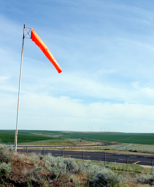
| Wind indicator: | Yes |
| Segmented Circle: | No |
| Control Tower: | No |
| Lighting Schedule: | DUSK-DAWN |
| Beacon Color: | Clear-Green (lighted land airport) |
| Landing fee charge: | No |
| Sectional chart: | Seattle |
| Region: | ANM - Northwest Mountain |
| Traffic Pattern Alt: | 1000 ft |
| Boundary ARTCC: | ZSE - Seattle |
| Tie-in FSS: | MMV - Mc Minnville |
| FSS on Airport: | No |
| FSS Toll Free: | 1-800-WX-BRIEF |
| NOTAMs Facility: | MMV (NOTAM-d service avaliable) |
| Federal Agreements: | NGY |
Airport Communications
Airport Services
| Airframe Repair: | NONE |
| Power Plant Repair: | NONE |
| Bulk Oxygen: | NONE |
Runway Information
Runway 07/25
| Dimension: | 3450 x 60 ft / 1051.6 x 18.3 m |
| Surface: | ASPH, Fair Condition |
| Weight Limit: | Single wheel: 12500 lbs. |
| Edge Lights: | Medium |
| |
Runway 07 |
Runway 25 |
| Traffic Pattern: | Left | Left |
| Markings: | Basic, Fair Condition | Basic, Fair Condition |
|
Radio Navigation Aids
| ID |
Type |
Name |
Ch |
Freq |
Var |
Dist |
| LTJ | VOR/DME | Klickitat | 070X | 112.30 | 21E | 19.4 nm |
Remarks
- EXTENSIVE AG-SPRAYER OPNS DURING SPRING & SUMMER.
- RY SLOPES DOWN TO W AT 1.48 DEGREES.
- EXISTED PRIOR TO 1959.
Images and information placed above are from
http://www.airport-data.com/airport/35S/
We thank them for the data!
| General Info
|
| Country |
United States
|
| State |
OREGON
|
| FAA ID |
35S
|
| Latitude |
45-35-22.000N
|
| Longitude |
120-40-27.000W
|
| Elevation |
1503 feet
|
| Near City |
WASCO
|
We don't guarantee the information is fresh and accurate. The data may
be wrong or outdated.
For more up-to-date information please refer to other sources.
|
|


