 |
|
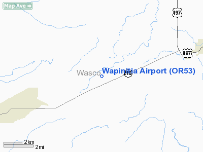
Location & QuickFacts
| FAA Information Effective: | 2008-09-25 |
| Airport Identifier: | OR53 |
| Airport Status: | Operational |
| Longitude/Latitude: | 121-13-44.2270W/45-08-44.4230N
-121.228952/45.145673 (Estimated) |
| Elevation: | 1910 ft / 582.17 m (Estimated) |
| Land: | 10 acres |
| From nearest city: | 2 nautical miles NE of Wapinitia, OR |
| Location: | Wasco County, OR |
| Magnetic Variation: | 19E (1985) |
Owner & Manager
| Ownership: | Privately owned |
| Owner: | Eugene H Walters |
| Address: | Rt 1 Box 86
Maupin, OR 97037 |
| Phone number: | 503-328-6330 |
| Manager: | Eugene H Walters |
| Address: | Rt 1 Box 86
Maupin, OR 97037 |
| Phone number: | 503-328-6333 |
Airport Operations and Facilities
| Airport Use: | Private |
| Wind indicator: | Yes |
| Segmented Circle: | No |
| Control Tower: | No |
| Sectional chart: | Seattle |
| Region: | ANM - Northwest Mountain |
| Boundary ARTCC: | ZSE - Seattle |
| Tie-in FSS: | MMV - Mc Minnville |
| FSS Toll Free: | 1-800-WX-BRIEF |
Runway Information
Runway 03/21
| Dimension: | 2400 x 88 ft / 731.5 x 26.8 m |
| Surface: | TURF, |
| |
Runway 03 |
Runway 21 |
| Traffic Pattern: | Left | Left |
| Obstruction: | | 40 ft poles, 37.0 ft from runway |
|
Radio Navigation Aids
| ID |
Type |
Name |
Ch |
Freq |
Var |
Dist |
| LTJ | VOR/DME | Klickitat | 070X | 112.30 | 21E | 34.6 nm |
Images and information placed above are from
http://www.airport-data.com/airport/OR53/
We thank them for the data!
| General Info
|
| Country |
United States
|
| State |
OREGON
|
| FAA ID |
OR53
|
| Latitude |
45-08-44.423N
|
| Longitude |
121-13-44.227W
|
| Elevation |
1910 feet
|
| Near City |
WAPINITIA
|
We don't guarantee the information is fresh and accurate. The data may
be wrong or outdated.
For more up-to-date information please refer to other sources.
|
|


