|
|
Wakonda Beach State Airport |
| Wakonda Beach State Airport |
 |
| IATA: none – ICAO: FAA: R33 |
| Summary |
| Airport type |
Public |
| Operator |
Oregon Department of Aviation |
| Location |
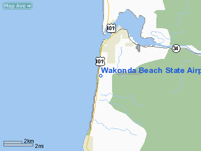
Waldport, Oregon |
| Elevation AMSL |
41 ft / 12 m |
| Coordinates |
44°23′04.4300″N 124°05′06.4300″W / 44.3845639°N 124.0851194°W / 44.3845639; -124.0851194Coordinates: 44°23′04.4300″N 124°05′06.4300″W / 44.3845639°N 124.0851194°W / 44.3845639; -124.0851194 |
| Runways |
| Direction |
Length |
Surface |
| ft |
m |
| 16/34 |
2000 |
610 |
Turf |
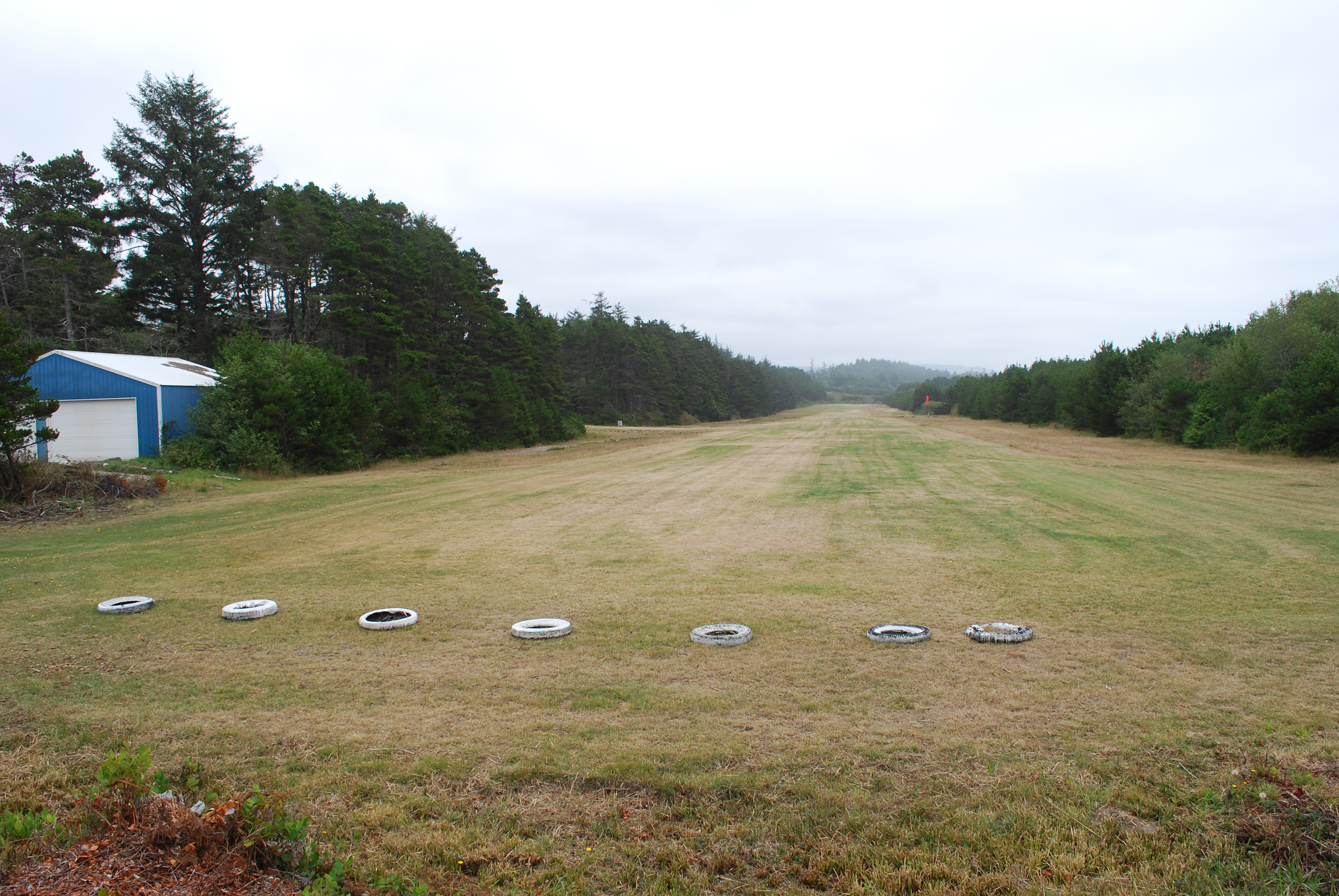
Wakonda Beach State Airport (FAA LID: R33) is a public airport located three miles (4.8 km) southwest of Waldport in Lincoln County, Oregon, USA. The airport is locate a short walk from Beachside State Recreation Site.
The above content comes from Wikipedia and is published under free licenses – click here to read more.
Location & QuickFacts
| FAA Information Effective: | 2008-09-25 |
| Airport Identifier: | R33 |
| Airport Status: | Operational |
| Longitude/Latitude: | 124-05-06.4300W/44-23-04.4300N
-124.085119/44.384564 (Estimated) |
| Elevation: | 41 ft / 12.50 m (Estimated) |
| Land: | 27 acres |
| From nearest city: | 3 nautical miles S of Waldport, OR |
| Location: | Lincoln County, OR |
| Magnetic Variation: | 19E (1985) |
Owner & Manager
| Ownership: | Publicly owned |
| Owner: | Oregon Department Of Aviation |
| Address: | 3040 25th St, Se
Salem, OR 97302 |
| Phone number: | 503-378-4880 |
| Manager: | State Airports Mgr |
| Address: | 3040 25th St, Se
Salem, OR 97302 |
| Phone number: | 503-378-4880 |
Airport Operations and Facilities
| Airport Use: | Open to public |
| Wind indicator: | Yes |
| Segmented Circle: | No |
| Control Tower: | No |
| Landing fee charge: | No |
| Sectional chart: | Klamath Falls |
| Region: | ANM - Northwest Mountain |
| Traffic Pattern Alt: | 1000 ft |
| Boundary ARTCC: | ZSE - Seattle |
| Tie-in FSS: | MMV - Mc Minnville |
| FSS on Airport: | No |
| FSS Toll Free: | 1-800-WX-BRIEF |
| NOTAMs Facility: | MMV (NOTAM-d service avaliable) |
Airport Communications
Airport Services
| Airframe Repair: | NONE |
| Power Plant Repair: | NONE |
| Bottled Oxygen: | NONE |
| Bulk Oxygen: | NONE |
Runway Information
Runway 16/34
| Dimension: | 2000 x 40 ft / 609.6 x 12.2 m
RY 16/34 ONLY CENTER 40 FT USBL. |
| Surface: | TURF, Fair Condition |
| |
Runway 16 |
Runway 34 |
| Traffic Pattern: | Left | Left |
| Obstruction: | 30 ft trees, 108.0 ft from runway, 3:1 slope to clear | 120 ft trees, 695.0 ft from runway, 110 ft right of centerline, 7:1 slope to clear |
|
Radio Navigation Aids
| ID |
Type |
Name |
Ch |
Freq |
Var |
Dist |
| LWG | NDB | Lewisburg | | 225.00 | 18E | 37.5 nm |
| EU | NDB | Frakk | | 260.00 | 19E | 38.6 nm |
| CVO | VOR/DME | Corvallis | 101X | 115.40 | 18E | 34.7 nm |
| ONP | VORTAC | Newport | 118X | 117.10 | 19E | 11.5 nm |
| EUG | VORTAC | Eugene | 076X | 112.90 | 20E | 40.4 nm |
Remarks
- OWNER ADVISES CONTACT OREGON DEPT OF AVIATION (503-378-4880) PRIOR TO USE.
- RWY 34 CURVE APCH FROM SOUTHWEST TO AVOID HIGH TERRAIN & TREES RIGHT AT 800'.
- LNDG TO THE SOUTH & TKOF TO THE NORTH NOT RECOMMENDED.
- RY 34 HAS RISING TERRAIN & DITCH 7 FT WIDE & 2 FT DEEP AT 25 FT FROM THLD.
- RY 16 HAS A ROAD +30 FT TREES & A P-LINE ACROSS THE APCH PATH WITHIN 110 FT OF RY END.
Images and information placed above are from
http://www.airport-data.com/airport/R33/
We thank them for the data!
| General Info
|
| Country |
United States
|
| State |
OREGON
|
| FAA ID |
R33
|
| Latitude |
44-23-04.430N
|
| Longitude |
124-05-06.430W
|
| Elevation |
41 feet
|
| Near City |
WALDPORT
|
We don't guarantee the information is fresh and accurate. The data may
be wrong or outdated.
For more up-to-date information please refer to other sources.
|
|