|
|
| Toledo State Airport |
 |
| IATA: none – ICAO: none – FAA LID: 5S4 |
| Summary |
| Airport type |
Public |
| Operator |
Oregon Department of Aviation |
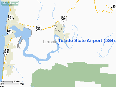
| Location |
Toledo, Oregon |
| Elevation AMSL |
7 ft / 2.1 m |
| Coordinates |
44°36′03.4260″N 123°56′22.4110″W / 44.60095167°N 123.93955861°W / 44.60095167; -123.93955861Coordinates: 44°36′03.4260″N 123°56′22.4110″W / 44.60095167°N 123.93955861°W / 44.60095167; -123.93955861 |
| Runways |
| Direction |
Length |
Surface |
| ft |
m |
| 13/31 |
1750 |
533 |
Asphalt |
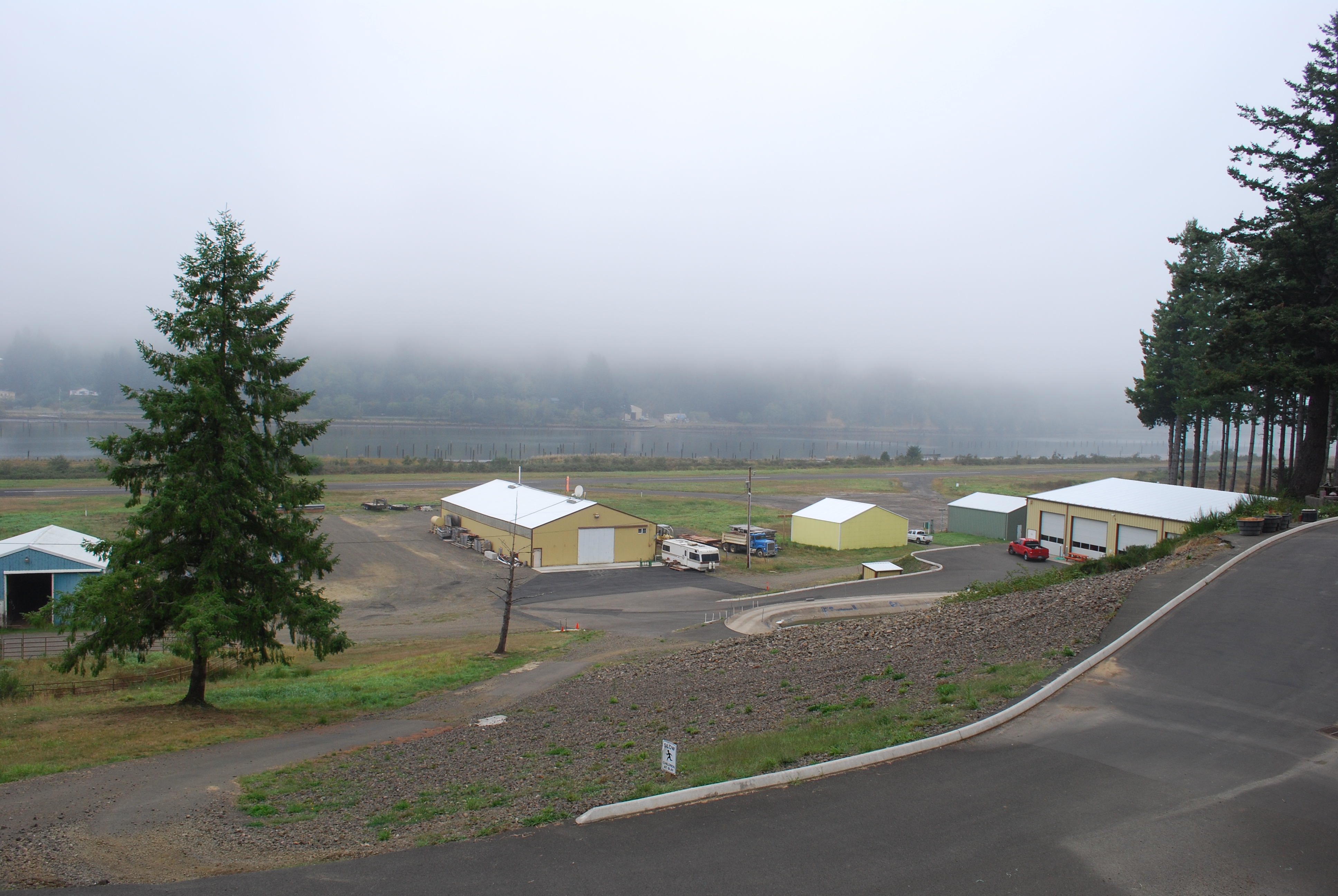
Toledo State Airport (FAA LID: 5S4), is a public airport located one mile (1.6 km) southwest of Toledo in Lincoln County, Oregon, USA.
The above content comes from Wikipedia and is published under free licenses – click here to read more.
Location & QuickFacts
| FAA Information Effective: | 2008-09-25 |
| Airport Identifier: | 5S4 |
| Airport Status: | Operational |
| Longitude/Latitude: | 123-56-22.4110W/44-36-03.4260N
-123.939559/44.600952 (Estimated) |
| Elevation: | 7 ft / 2.13 m (Surveyed) |
| Land: | 14 acres |
| From nearest city: | 1 nautical miles SW of Toledo, OR |
| Location: | Lincoln County, OR |
| Magnetic Variation: | 19E (1985) |
Owner & Manager
| Ownership: | Publicly owned |
| Owner: | Oregon Dept Of Aviation |
| Address: | 3040 25th St Se
Salem, OR 97302 |
| Phone number: | 503-378-4880 |
| Manager: | State Airports Mgr |
| Address: | 3040 25th St Se
Salem, OR 97302 |
| Phone number: | 503-378-4880 |
Airport Operations and Facilities
| Airport Use: | Open to public |
| Wind indicator: | Yes |
| Segmented Circle: | No
NSTD CIRCLE OF WHITE TIRES. |
| Control Tower: | No |
| Landing fee charge: | No |
| Sectional chart: | Seattle |
| Region: | ANM - Northwest Mountain |
| Traffic Pattern Alt: | 1000 ft |
| Boundary ARTCC: | ZSE - Seattle |
| Tie-in FSS: | MMV - Mc Minnville |
| FSS on Airport: | No |
| FSS Toll Free: | 1-800-WX-BRIEF |
| NOTAMs Facility: | MMV (NOTAM-d service avaliable) |
Airport Communications
Airport Services
| Airframe Repair: | NONE |
| Power Plant Repair: | NONE |
| Bottled Oxygen: | NONE |
| Bulk Oxygen: | NONE |
Runway Information
Runway 13/31
| Dimension: | 1750 x 40 ft / 533.4 x 12.2 m |
| Surface: | ASPH, Fair Condition |
| |
Runway 13 |
Runway 31 |
| Traffic Pattern: | Left | Left |
| Markings: | Nonstandard, Poor Condition
RWY 13/31 MARKINGS SMALLER THAN STD | Nonstandard, Poor Condition |
| Obstruction: | 200 ft trees, 1500.0 ft from runway, 150 ft left of centerline, 6:1 slope to clear | 70 ft trees, 450.0 ft from runway, 100 ft right of centerline, 3:1 slope to clear
RWY 31 HAS +16 FT TREES 80 FT FM RY END 85 FT L. |
|
Radio Navigation Aids
| ID |
Type |
Name |
Ch |
Freq |
Var |
Dist |
| LWG | NDB | Lewisburg | | 225.00 | 18E | 28.6 nm |
| EU | NDB | Frakk | | 260.00 | 19E | 38.7 nm |
| CVO | VOR/DME | Corvallis | 101X | 115.40 | 18E | 28.3 nm |
| ONP | VORTAC | Newport | 118X | 117.10 | 19E | 5.4 nm |
| EUG | VORTAC | Eugene | 076X | 112.90 | 20E | 42.2 nm |
Remarks
- OWNER ADVISES CTC WITH DEPT OF AVIATION (503-378-4880) PRIOR TO USE.
- TREES IN TRANSITION AREA.
- NUMEROUS DEER & WATERFOWL INVOF OF AIRPORT.
- UNPAVED RAMP AND TAXIWAY
- ESTABD PRIOR TO 1959.
Images and information placed above are from
http://www.airport-data.com/airport/5S4/
We thank them for the data!
| General Info
|
| Country |
United States
|
| State |
OREGON
|
| FAA ID |
5S4
|
| Latitude |
44-36-03.426N
|
| Longitude |
123-56-22.411W
|
| Elevation |
7 feet
|
| Near City |
TOLEDO
|
We don't guarantee the information is fresh and accurate. The data may
be wrong or outdated.
For more up-to-date information please refer to other sources.
|
|