 |
|
| Toketee State Airport |
| IATA: none – ICAO: none – FAA LID: 3S6 |
| Summary |
| Airport type |
Public |
| Operator |
Oregon Department of Aviation |
| Location |
Clearwater, Oregon |
| Elevation AMSL |
3361 ft / 1024 m |
| Coordinates |
43°13′24.4400″N 122°25′15.1480″W / 43.2234556°N 122.42087444°W / 43.2234556; -122.42087444Coordinates: 43°13′24.4400″N 122°25′15.1480″W / 43.2234556°N 122.42087444°W / 43.2234556; -122.42087444 |
| Runways |
| Direction |
Length |
Surface |
| ft |
m |
| 11/29 |
5350 |
1631 |
dirt |
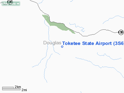
Toketee State Airport (FAA LID: 3S6), is a public airport located two miles (3.2 km) south of Clearwater in Douglas County, Oregon, USA. It is closed between November 1st and May 1st, and pilots are advised that elk and deer can sometimes be found on the runway.
The above content comes from Wikipedia and is published under free licenses – click here to read more.
Location & QuickFacts
| FAA Information Effective: | 2008-09-25 |
| Airport Identifier: | 3S6 |
| Airport Status: | Operational |
| Longitude/Latitude: | 122-25-15.1480W/43-13-24.4400N
-122.420874/43.223456 (Estimated) |
| Elevation: | 3361 ft / 1024.43 m (Estimated) |
| Land: | 72 acres |
| From nearest city: | 2 nautical miles S of Clearwater, OR |
| Location: | Douglas County, OR |
| Magnetic Variation: | 18E (1985) |
Owner & Manager
| Ownership: | Publicly owned |
| Owner: | Us Forest Service |
| Address: | P.o. Box 1008
Roseburg, OR 97470 |
| Phone number: | 541-672-6601 |
| Manager: | Oregon Dept Of Aviation |
| Address: | 3040 25th Street Se
Salem, OR 97302-1125 |
| Phone number: | 503-378-4880 |
Airport Operations and Facilities
| Airport Use: | Open to public |
| Wind indicator: | Yes |
| Segmented Circle: | No |
| Control Tower: | No |
| Landing fee charge: | No |
| Sectional chart: | Klamath Falls |
| Region: | ANM - Northwest Mountain |
| Boundary ARTCC: | ZSE - Seattle |
| Tie-in FSS: | MMV - Mc Minnville |
| FSS on Airport: | No |
| FSS Toll Free: | 1-800-WX-BRIEF |
| NOTAMs Facility: | MMV (NOTAM-d service avaliable) |
Airport Communications
Airport Services
| Airframe Repair: | NONE |
| Power Plant Repair: | NONE |
| Bottled Oxygen: | NONE |
| Bulk Oxygen: | NONE |
Runway Information
Runway 11/29
| Dimension: | 5350 x 60 ft / 1630.7 x 18.3 m
GRADED; 60 FT WIDE; SHOULDERS ROUGH & RUTTED. |
| Surface: | DIRT, Fair Condition |
| |
Runway 11 |
Runway 29 |
| Traffic Pattern: | Left | Left |
| Markings: | Nonstandard,
RY 11/29 THLDS OUTLINED WITH WHITE TIRES. | , |
| Obstruction: | 70 ft trees, 600.0 ft from runway, 9:1 slope to clear | 50 ft trees, 280.0 ft from runway, 40 ft right of centerline, 6:1 slope to clear |
|
Radio Navigation Aids
| ID |
Type |
Name |
Ch |
Freq |
Var |
Dist |
| RBG | NDB | Roseburg | | 400.00 | 20E | 41.0 nm |
| RBG | VOR/DME | Roseburg | 019X | 108.20 | 20E | 40.9 nm |
| OED | VORTAC | Rogue Valley | 083X | 113.60 | 19E | 49.7 nm |
Remarks
- RY 11/29 HAS 120 FT TREES 250 FT EITHER SIDE OF CNTRLN.
- ARPT CLSD FROM 01 NOV UNTIL 01 MAY.
- ELK AND DEER ON AND INVOF ARPT.
Images and information placed above are from
http://www.airport-data.com/airport/3S6/
We thank them for the data!
| General Info
|
| Country |
United States
|
| State |
OREGON
|
| FAA ID |
3S6
|
| Latitude |
43-13-24.440N
|
| Longitude |
122-25-15.148W
|
| Elevation |
3361 feet
|
| Near City |
CLEARWATER
|
We don't guarantee the information is fresh and accurate. The data may
be wrong or outdated.
For more up-to-date information please refer to other sources.
|
|


