|
|
| Tillamook Airport |
| IATA: none – ICAO: KTMK – FAA LID: TMK |
| Summary |
| Airport type |
Public |
| Owner |
Port of Tillamook Bay |
| Serves |
Tillamook, Oregon |
| Elevation AMSL |
36 ft / 11 m |
| Coordinates |
45°25′06″N 123°48′52″W / 45.41833°N 123.81444°W / 45.41833; -123.81444 |
| Website |
www.potb.org/... |
| Runways |
| Direction |
Length |
Surface |
| ft |
m |
| 13/31 |
5,001 |
1,524 |
Asphalt |
| 1/19 |
2,910 |
887 |
Asphalt |
| Statistics (2008) |
| Aircraft operations |
25,600 |
| Based aircraft |
45 |
| Source: Federal Aviation Administration |
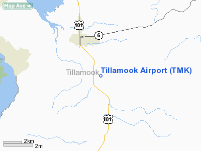
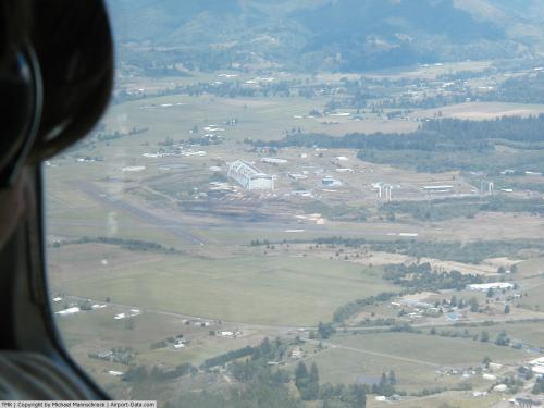
Tillamook Airport (ICAO: KTMK, FAA LID: TMK) is a public use airport located three nautical miles (6 km) south of the central business district of Tillamook, a city in Tillamook County, Oregon, United States. It is owned by the Port of Tillamook Bay. According to the FAA's National Plan of Integrated Airport Systems for 2009–2013, it is categorized as a general aviation facility.
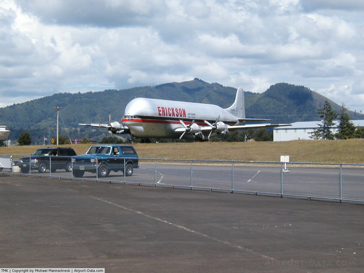
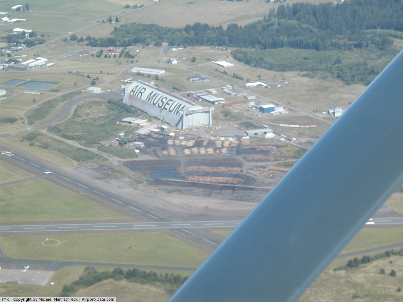
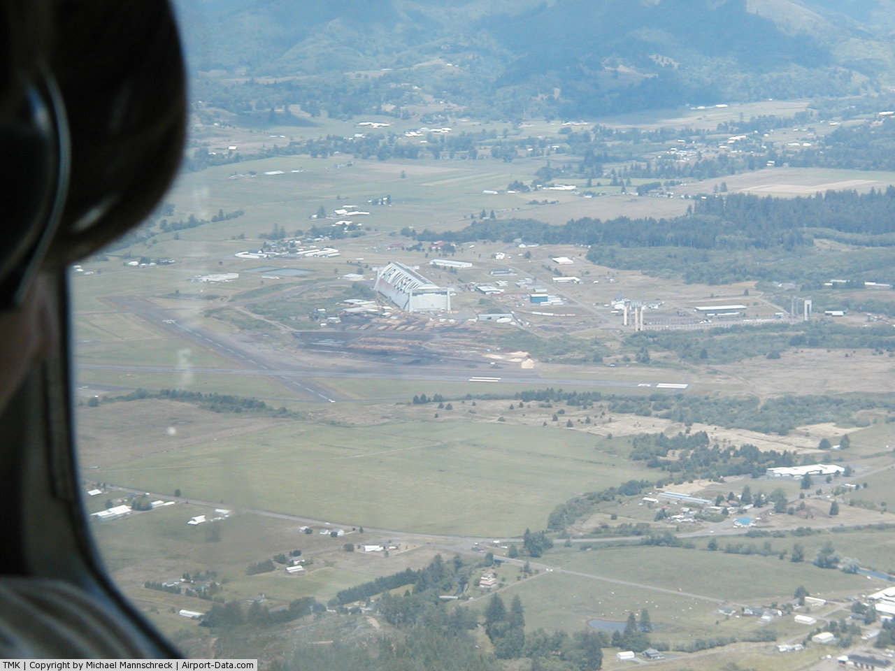
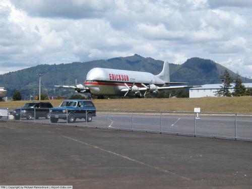
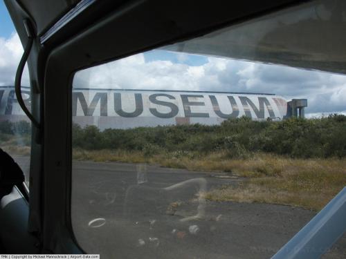
The airfield was developed from the former Naval Air Station Tillamook and serves as the home to the Tillamook Air Museum.
Although many U.S. airports use the same three-letter location identifier for the FAA and IATA, this facility is assigned TMK by the FAA but has no designation from the IATA (which assigned TMK to Tam-Ky, Vietnam).
Facilities and aircraft
Tillamook Airport covers an area of 360 acres (146 ha) at an elevation of 36 feet (11 m) above mean sea level. It has two asphalt paved runways: 13/31 is 5,001 by 100 feet (1,524 x 30 m) and 1/19 is 2,910 by 75 feet (887 x 23 m).
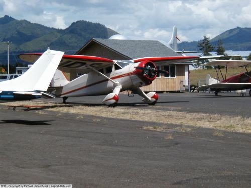
For the 12-month period ending April 2, 2008, the airport had 25,600 aircraft operations, an average of 70 per day: 99.6% general aviation and 0.4% military. At that time there were 45 aircraft based at this airport: 78% single-engine, 16% multi-engine, 2% jet, 2% helicopter and 2% ultralight.
The above content comes from Wikipedia and is published under free licenses – click here to read more.
 |
(Click on the photo to enlarge) |
 |
(Click on the photo to enlarge) |
 |
(Click on the photo to enlarge) |
 |
(Click on the photo to enlarge) |
 |
(Click on the photo to enlarge) |
Location & QuickFacts
| FAA Information Effective: | 2008-09-25 |
| Airport Identifier: | TMK |
| Airport Status: | Operational |
| Longitude/Latitude: | 123-48-51.7820W/45-25-05.6710N
-123.814384/45.418242 (Estimated) |
| Elevation: | 36 ft / 10.97 m (Estimated) |
| Land: | 360 acres |
| From nearest city: | 3 nautical miles S of Tillamook, OR |
| Location: | Tillamook County, OR |
| Magnetic Variation: | 20E (1985) |
Owner & Manager
| Ownership: | Publicly owned |
| Owner: | Port Of Tillamook Bay |
| Address: | 4000 Blimp Blvd
Tillamook, OR 97141 |
| Phone number: | 503-842-2413 |
| Manager: | Robert Miller |
| Address: | 4000 Blimp Blvd
Tillamook, OR 97141 |
| Phone number: | 503-842-2413 |
Airport Operations and Facilities
| Airport Use: | Open to public |
| Wind indicator: | Yes |
| Segmented Circle: | Yes |
| Control Tower: | No |
| Lighting Schedule: | DUSK-DAWN
ACTVT MIRL RYS 01/19 & 13/31 & REIL RY 13 - CTAF. |
| Beacon Color: | Clear-Green (lighted land airport) |
| Landing fee charge: | No |
| Sectional chart: | Seattle |
| Region: | ANM - Northwest Mountain |
| Boundary ARTCC: | ZSE - Seattle |
| Tie-in FSS: | MMV - Mc Minnville |
| FSS on Airport: | No |
| FSS Toll Free: | 1-800-WX-BRIEF |
| NOTAMs Facility: | TMK (NOTAM-d service avaliable) |
| Federal Agreements: | NGPY3 |
Airport Communications
| CTAF: | 122.800 |
| Unicom: | 122.800 |
Airport Services
| Fuel available: | 100LLA |
| Airframe Repair: | NONE |
| Power Plant Repair: | NONE |
| Bottled Oxygen: | NONE |
| Bulk Oxygen: | NONE |
Runway Information
Runway 01/19
| Dimension: | 2910 x 75 ft / 887.0 x 22.9 m |
| Surface: | ASPH, Good Condition |
| Weight Limit: | Single wheel: 40000 lbs.
Dual wheel: 46000 lbs.
Dual tandem wheel: 67000 lbs. |
| Edge Lights: | Medium |
| |
Runway 01 |
Runway 19 |
| Longitude: | 123-48-58.8300W | 123-48-38.0200W |
| Latitude: | 45-24-54.5200N | 45-25-19.2300N |
| Elevation: | 25.00 ft | 32.00 ft |
| Alignment: | 30 | 127 |
| Traffic Pattern: | Left | Right |
| Markings: | Basic, Good Condition | Basic, Good Condition |
| Crossing Height: | 45.00 ft | 40.00 ft |
| VASI: | 2-light PAPI on left side | 2-light PAPI on left side |
| Visual Glide Angle: | 4.00° | 3.00° |
| Obstruction: | 8 ft fence, 400.0 ft from runway, 25:1 slope to clear | , 50:1 slope to clear |
|
Runway 13/31
| Dimension: | 5001 x 100 ft / 1524.3 x 30.5 m |
| Surface: | ASPH, Good Condition |
| Weight Limit: | Single wheel: 60000 lbs.
Dual wheel: 75000 lbs.
Dual tandem wheel: 125000 lbs. |
| Edge Lights: | Medium |
| |
Runway 13 |
Runway 31 |
| Longitude: | 123-49-08.1300W | 123-48-39.3400W |
| Latitude: | 45-25-27.4800N | 45-24-42.4600N |
| Elevation: | 17.00 ft | 36.00 ft |
| Alignment: | 127 | 127 |
| Traffic Pattern: | Left | Left |
| Markings: | Non-precision instrument, Good Condition | Non-precision instrument, Good Condition |
| Crossing Height: | 40.00 ft | 40.00 ft |
| VASI: | 2-light PAPI on left side | 2-light PAPI on left side |
| Visual Glide Angle: | 3.00° | 3.50° |
| Runway End Identifier: | Yes
REIL OTS INDEFLY. | |
| Obstruction: | 8 ft fence, 450.0 ft from runway, 31:1 slope to clear | 20 ft brush, 605.0 ft from runway, 20:1 slope to clear |
|
Radio Navigation Aids
| ID |
Type |
Name |
Ch |
Freq |
Var |
Dist |
| AST | FAN MARKER | Fort Stevens | | | 22E | 47.9 nm |
| PND | NDB | Banks | | 356.00 | 21E | 34.8 nm |
| PEN | NDB | Karpen | | 201.00 | 20E | 44.4 nm |
| UBG | VOR/DME | Newberg | 121X | 117.40 | 21E | 35.5 nm |
| AST | VOR/DME | Astoria | 087X | 114.00 | 19E | 44.8 nm |
| HIO | VOT | Portland-hillsboro | | 115.20 | | 37.2 nm |
Remarks
- OCNL FLOCKS OF BIRDS ON OR NEAR ARPT.
- TWYS MKD WITH YELLOW REFLECTORS.
- ULTRALIGHT ACFT ON AND INVOF ARPT.
- ESTABD PRIOR TO 1959.
Images and information placed above are from
http://www.airport-data.com/airport/TMK/
We thank them for the data!
|
|