 |
|
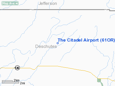
Location & QuickFacts
| FAA Information Effective: | 2008-09-25 |
| Airport Identifier: | 61OR |
| Airport Status: | Operational |
| Longitude/Latitude: | 121-21-19.1470W/44-20-05.4230N
-121.355319/44.334840 (Estimated) |
| Elevation: | 3077 ft / 937.87 m (Estimated) |
| Land: | 5 acres |
| From nearest city: | 9 nautical miles E of Sisters, OR |
| Location: | Deschutes County, OR |
| Magnetic Variation: | 19E (1985) |
Owner & Manager
| Ownership: | Privately owned |
| Owner: | Danny G. Sage |
| Address: | Po Box 67
Terrebonne, OR 97760 |
| Phone number: | 503-548-4229 |
| Manager: | Danny G. Sage |
| Address: | Po Box 67
Terrebonne, OR 97760 |
| Phone number: | 503-548-4229 |
Airport Operations and Facilities
| Airport Use: | Private |
| Wind indicator: | Yes |
| Segmented Circle: | No |
| Control Tower: | No |
| Sectional chart: | Klamath Falls |
| Region: | ANM - Northwest Mountain |
| Boundary ARTCC: | ZSE - Seattle |
| Tie-in FSS: | MMV - Mc Minnville |
| FSS Toll Free: | 1-800-WX-BRIEF |
Runway Information
Runway 07/25
| Dimension: | 1800 x 100 ft / 548.6 x 30.5 m |
| Surface: | DIRT, Fair Condition |
| |
Runway 07 |
Runway 25 |
| Traffic Pattern: | Left | Left |
|
Radio Navigation Aids
| ID |
Type |
Name |
Ch |
Freq |
Var |
Dist |
| RD | NDB | Bodey | | 411.00 | 18E | 14.6 nm |
| DSD | VORTAC | Deschutes | 123X | 117.60 | 18E | 5.4 nm |
Remarks
- OWNER DESIRES ARPT NOT TO BE CHARTED.
- RWY OBSTRUCTED AT TIMES DUE TO ON GOING IMPROVEMENTS.
- TREES & ROCKS ALONG BOTH SIDES OF RWY PROPERTY.
- DEER ON RUNWAY.
- RWY SOFT WHEN GROUND THAWING OR AFTER HEAVY RAIN.
- SOFT SAND AT TOUCHDOWN END OF RWY 25.
- 5 FEET DISPLACEMENT (STEEP SLOPE) 1800 FEET FM TOUCHDOWN END OF RWY 25.
- TREES & ROCKS 2100 FT FROM TOUCHDOWN END OF RWY 25.
- NO OVER RUN AREAS.
- 300 FT DROP OFF AT APCH END OF RWY 25 AND 600 FT FROM TOUCHDOWN OF RWY 07.
Images and information placed above are from
http://www.airport-data.com/airport/61OR/
We thank them for the data!
| General Info
|
| Country |
United States
|
| State |
OREGON
|
| FAA ID |
61OR
|
| Latitude |
44-20-05.423N
|
| Longitude |
121-21-19.147W
|
| Elevation |
3077 feet
|
| Near City |
SISTERS
|
We don't guarantee the information is fresh and accurate. The data may
be wrong or outdated.
For more up-to-date information please refer to other sources.
|
|


