 |
|
| Siletz Bay State Airport |
| IATA: none – ICAO: none – FAA LID: S45 |
| Summary |
| Airport type |
Public |
| Operator |
Oregon Department of Aviation |
| Location |
Gleneden Beach, Oregon |
| Elevation AMSL |
69 ft / 21 m |
| Coordinates |
44°52′36.9200″N 124°01′42.6700″W / 44.8769222°N 124.0285194°W / 44.8769222; -124.0285194Coordinates: 44°52′36.9200″N 124°01′42.6700″W / 44.8769222°N 124.0285194°W / 44.8769222; -124.0285194 |
| Runways |
| Direction |
Length |
Surface |
| ft |
m |
| 17/35 |
3300 |
1006 |
Asphalt |
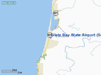
Siletz Bay State Airport (FAA LID: S45), is a public airport located one mile (1.6 km) southeast of Gleneden Beach in Lincoln County, Oregon, USA. The airfield is located to the south of its name sake Siletz Bay.
The above content comes from Wikipedia and is published under free licenses – click here to read more.
Location & QuickFacts
| FAA Information Effective: | 2008-09-25 |
| Airport Identifier: | S45 |
| Airport Status: | Operational |
| Longitude/Latitude: | 124-01-42.6700W/44-52-36.9200N
-124.028519/44.876922 (Estimated) |
| Elevation: | 69 ft / 21.03 m (Surveyed) |
| Land: | 98 acres |
| From nearest city: | 1 nautical miles SE of Gleneden Beach, OR |
| Location: | Lincoln County, OR |
| Magnetic Variation: | 19E (1985) |
Owner & Manager
| Ownership: | Publicly owned |
| Owner: | Oregon Dept. Of Aviation |
| Address: | 3040 25th St Se
Salem, OR 97302-1125 |
| Phone number: | 503-378-4880 |
| Manager: | State Airports Manager |
| Address: | 3040 25th St Se
Salem, OR 97302-1125 |
| Phone number: | 503-378-4880 |
Airport Operations and Facilities
| Airport Use: | Open to public |
| Wind indicator: | Yes |
| Segmented Circle: | Yes |
| Control Tower: | No |
| Lighting Schedule: | DUSK-DAWN
MIRL RY 17/35 PRESET LOW INTST; ACTVT HIGHER INTST - CTAF. |
| Beacon Color: | Clear-Green (lighted land airport) |
| Landing fee charge: | No |
| Sectional chart: | Seattle |
| Region: | ANM - Northwest Mountain |
| Traffic Pattern Alt: | 1000 ft |
| Boundary ARTCC: | ZSE - Seattle |
| Tie-in FSS: | MMV - Mc Minnville |
| FSS on Airport: | No |
| FSS Toll Free: | 1-800-WX-BRIEF |
| NOTAMs Facility: | MMV (NOTAM-d service avaliable) |
| Federal Agreements: | NGY |
Airport Communications
| CTAF: | 122.700 |
| Unicom: | 122.700
UNICOM ATTENDED IRREGULARLY. |
Airport Services
| Airframe Repair: | NONE |
| Power Plant Repair: | NONE |
| Bottled Oxygen: | NONE |
| Bulk Oxygen: | NONE |
Runway Information
Runway 17/35
| Dimension: | 3300 x 60 ft / 1005.8 x 18.3 m |
| Surface: | ASPH, |
| Weight Limit: | Single wheel: 11000 lbs. |
| Edge Lights: | Medium |
| |
Runway 17 |
Runway 35 |
| Longitude: | 124-01-38.4813W | 124-01-47.1230W |
| Latitude: | 44-52-52.4384N | 44-52-20.4385N |
| Elevation: | 59.00 ft | 69.00 ft |
| Alignment: | 127 | 11 |
| Traffic Pattern: | Right | Left |
| Markings: | Basic, Good Condition | Basic, Good Condition |
| Obstruction: | 56 ft trees, 630.0 ft from runway, 100 ft left of centerline, 7:1 slope to clear | 10 ft brush, 300.0 ft from runway, 30 ft right of centerline, 10:1 slope to clear
RWY 35 +7' TERRAIN FROM END TO 150' FROM END, 120'R. |
|
Radio Navigation Aids
| ID |
Type |
Name |
Ch |
Freq |
Var |
Dist |
| LWG | NDB | Lewisburg | | 225.00 | 18E | 36.0 nm |
| CVO | VOR/DME | Corvallis | 101X | 115.40 | 18E | 38.7 nm |
| ONP | VORTAC | Newport | 118X | 117.10 | 19E | 18.2 nm |
Remarks
- WILDLIFE ON AND INVOF OF AIRPORT.
Images and information placed above are from
http://www.airport-data.com/airport/S45/
We thank them for the data!
| General Info
|
| Country |
United States
|
| State |
OREGON
|
| FAA ID |
S45
|
| Latitude |
44-52-39.401N
|
| Longitude |
124-01-42.410W
|
| Elevation |
62 feet
|
| Near City |
GLENEDEN BEACH
|
We don't guarantee the information is fresh and accurate. The data may
be wrong or outdated.
For more up-to-date information please refer to other sources.
|
|


