 |
|
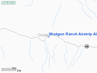
Shotgun Ranch Airstrip Airport |
Location & QuickFacts
| FAA Information Effective: | 2008-09-25 |
| Airport Identifier: | 42OR |
| Airport Status: | Operational |
| Longitude/Latitude: | 120-19-23.0000W/44-08-03.0000N
-120.323056/44.134167 (Estimated) |
| Elevation: | 3430 ft / 1045.46 m (Estimated) |
| Land: | 0 acres |
| From nearest city: | 8 nautical miles E of Post, OR |
| Location: | Crook County, OR |
| Magnetic Variation: | () |
Owner & Manager
| Ownership: | Privately owned |
| Owner: | Cal Cannon |
| Address: | 2730 Nightfall Cir.
Bend, OR 97701 |
| Phone number: | 541-480-6000 |
| Manager: | Cal Cannon |
| Address: | 2730 Nightfall Cir.
Bend, OR 97701 |
| Phone number: | 541-480-6000 |
Airport Operations and Facilities
| Airport Use: | Private |
| Control Tower: | No |
| Sectional chart: | Seattle |
| Region: | ANM - Northwest Mountain |
| Boundary ARTCC: | ZSE - Seattle |
| Tie-in FSS: | MMV - Mc Minnville |
| FSS Toll Free: | 1-800-WX-BRIEF |
Runway Information
Runway 01/19
| Dimension: | 1650 x 50 ft / 502.9 x 15.2 m |
| Surface: | ASPH-CONC, |
| |
Runway 01 |
Runway 19 |
| Traffic Pattern: | Left | Left |
|
Radio Navigation Aids
| ID |
Type |
Name |
Ch |
Freq |
Var |
Dist |
| RD | NDB | Bodey | | 411.00 | 18E | 31.7 nm |
| IMB | VORTAC | Kimberly | 103X | 115.60 | 20E | 40.6 nm |
| DSD | VORTAC | Deschutes | 123X | 117.60 | 18E | 42.9 nm |
Images and information placed above are from
http://www.airport-data.com/airport/42OR/
We thank them for the data!
| General Info
|
| Country |
United States
|
| State |
OREGON
|
| FAA ID |
42OR
|
| Latitude |
45-22-21.437N
|
| Longitude |
122-27-48.318W
|
| Elevation |
380 feet
|
| Near City |
CARVER
|
We don't guarantee the information is fresh and accurate. The data may
be wrong or outdated.
For more up-to-date information please refer to other sources.
|
|


