 |
|
Location & QuickFacts
| FAA Information Effective: | 2008-09-25 |
| Airport Identifier: | OG54 |
| Airport Status: | Operational |
| Longitude/Latitude: | 120-53-04.7700W/44-57-36.3500N
-120.884658/44.960097 (Estimated) |
| Elevation: | 3300 ft / 1005.84 m (Estimated) |
| Land: | 1 acres |
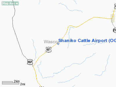
| From nearest city: | 6 nautical miles SW of Shaniko, OR |
| Location: | Wasco County, OR |
| Magnetic Variation: | () |
Owner & Manager
| Ownership: | Privately owned |
| Owner: | Shaniko Cattle Company |
| Address: | 89706 Hwy 97
Moupin, OR 97037 |
| Phone number: | 503-253-6277 |
| Manager: | Shaniko Cattle Company |
| Address: | 89706 Hwy 97
Moupin, OR 97037 |
| Phone number: | 503-253-6277 |
Airport Operations and Facilities
| Airport Use: | Private |
| Wind indicator: | Yes |
| Control Tower: | No |
| Sectional chart: | Seattle |
| Region: | ANM - Northwest Mountain |
| Boundary ARTCC: | ZSE - Seattle |
| Tie-in FSS: | MMV - Mc Minnville |
| FSS Toll Free: | 1-800-WX-BRIEF |
Runway Information
Runway 07/25
| Dimension: | 2000 x 100 ft / 609.6 x 30.5 m |
| Surface: | TURF, |
| |
Runway 07 |
Runway 25 |
| Traffic Pattern: | Left | Left |
| Displaced threshold: | 400.00 ft | 0.00 ft |
|
Radio Navigation Aids
| ID |
Type |
Name |
Ch |
Freq |
Var |
Dist |
| RD | NDB | Bodey | | 411.00 | 18E | 39.6 nm |
| LTJ | VOR/DME | Klickitat | 070X | 112.30 | 21E | 46.2 nm |
| DSD | VORTAC | Deschutes | 123X | 117.60 | 18E | 46.1 nm |
Images and information placed above are from
http://www.airport-data.com/airport/OG54/
We thank them for the data!
|
|


