 |
|
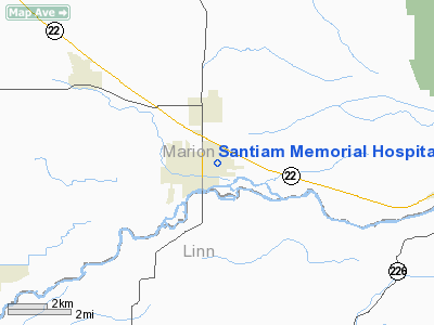
Santiam Memorial Hospital Helistop Heliport |
Location & QuickFacts
| FAA Information Effective: | 2008-09-25 |
| Airport Identifier: | 5OR7 |
| Airport Status: | Operational |
| Longitude/Latitude: | 122-47-04.3170W/44-48-17.4390N
-122.784532/44.804844 (Estimated) |
| Elevation: | 515 ft / 156.97 m (Estimated) |
| Land: | 0 acres |
| From nearest city: | 1 nautical miles NE of Stayton, OR |
| Location: | Marion County, OR |
| Magnetic Variation: | 19E (1985) |
Owner & Manager
| Ownership: | Privately owned |
| Owner: | Santiam Memorial Hospital |
| Address: | 1401 N. 10th Street
Stayton, OR 97383 |
| Phone number: | 503-769-2175 |
| Manager: | Adm Terry Fletchall |
| Address: | 1401 N 10th St
Stayton, OR 97383 |
| Phone number: | 503-769-2175 |
Airport Operations and Facilities
| Airport Use: | Private
MEDICAL USE. |
| Wind indicator: | No |
| Segmented Circle: | No |
| Control Tower: | No |
| Landing fee charge: | No |
| Sectional chart: | Seattle |
| Region: | ANM - Northwest Mountain |
| Boundary ARTCC: | ZSE - Seattle |
| Tie-in FSS: | MMV - Mc Minnville |
| FSS on Airport: | No |
| FSS Toll Free: | 1-800-WX-BRIEF |
Airport Services
| Airframe Repair: | NONE |
| Power Plant Repair: | NONE |
Runway Information
Helipad H1
| Dimension: | 75 x 75 ft / 22.9 x 22.9 m |
| Surface: | TURF, |
| |
Runway H1 |
Runway |
| Traffic Pattern: | Left | Left |
|
Radio Navigation Aids
| ID |
Type |
Name |
Ch |
Freq |
Var |
Dist |
| LWG | NDB | Lewisburg | | 225.00 | 18E | 23.7 nm |
| EU | NDB | Frakk | | 260.00 | 19E | 40.2 nm |
| LBH | NDB | Laker | | 332.00 | 20E | 46.3 nm |
| CBU | TACAN | Columbia | 029X | | 20E | 47.7 nm |
| CVO | VOR/DME | Corvallis | 101X | 115.40 | 18E | 28.5 nm |
| UBG | VOR/DME | Newberg | 121X | 117.40 | 21E | 34.0 nm |
| PDX | VOR/DME | Portland | 055X | 111.80 | 20E | 48.0 nm |
| EUG | VORTAC | Eugene | 076X | 112.90 | 20E | 45.2 nm |
| HIO | VOT | Portland-hillsboro | | 115.20 | | 44.8 nm |
| PDX | VOT | Portland Intl | | 111.00 | | 48.3 nm |
Images and information placed above are from
http://www.airport-data.com/airport/5OR7/
We thank them for the data!
| General Info
|
| Country |
United States
|
| State |
OREGON
|
| FAA ID |
5OR7
|
| Latitude |
44-48-17.439N
|
| Longitude |
122-47-04.317W
|
| Elevation |
515 feet
|
| Near City |
STAYTON
|
We don't guarantee the information is fresh and accurate. The data may
be wrong or outdated.
For more up-to-date information please refer to other sources.
|
|


