 |
|
| Sandy River Airport |
| IATA: none – ICAO: FAA: 03S |
| Summary |
| Airport type |
Public |
| Operator |
Private Owner |
| Location |
Sandy, Oregon |
| Elevation AMSL |
704 ft / 214 m |
| Coordinates |
45°24′06.4330″N 122°13′43.3120″W / 45.40178694°N 122.22869778°W / 45.40178694; -122.22869778Coordinates: 45°24′06.4330″N 122°13′43.3120″W / 45.40178694°N 122.22869778°W / 45.40178694; -122.22869778 |
| Runways |
| Direction |
Length |
Surface |
| ft |
m |
| 8/26 |
2115 |
645 |
Turf |
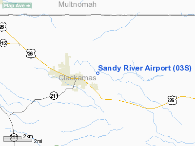
Sandy River Airport (FAA LID: 03S), is a public airport located one mile (1.6 km) northeast of Sandy in Clackamas County, Oregon, USA.
The above content comes from Wikipedia and is published under free licenses – click here to read more.
Location & QuickFacts
| FAA Information Effective: | 2008-09-25 |
| Airport Identifier: | 03S |
| Airport Status: | Operational |
| Longitude/Latitude: | 122-13-43.3120W/45-24-06.4330N
-122.228698/45.401787 (Estimated) |
| Elevation: | 704 ft / 214.58 m (Surveyed) |
| Land: | 35 acres |
| From nearest city: | 1 nautical miles NE of Sandy, OR |
| Location: | Clackamas County, OR |
| Magnetic Variation: | 19E (1985) |
Owner & Manager
| Ownership: | Privately owned |
| Owner: | Jack Hoffman |
| Address: | 42313 Se Oral Hull Rd
Sandy, OR 97055 |
| Phone number: | 503-668-4542 |
| Manager: | Jack Hoffman |
| Address: | 42313 Se Oral Hull Road
Sandy, OR 97055 |
| Phone number: | 503-668-4542 |
Airport Operations and Facilities
| Airport Use: | Open to public |
| Wind indicator: | Yes |
| Segmented Circle: | No |
| Control Tower: | No |
| Landing fee charge: | No |
| Sectional chart: | Seattle |
| Region: | ANM - Northwest Mountain |
| Boundary ARTCC: | ZSE - Seattle |
| Tie-in FSS: | MMV - Mc Minnville |
| FSS on Airport: | No |
| FSS Toll Free: | 1-800-WX-BRIEF |
| NOTAMs Facility: | MMV (NOTAM-d service avaliable) |
Airport Communications
| CTAF: | 122.800 |
| Unicom: | 122.800 |
Airport Services
| Fuel available: | 100LL |
| Airframe Repair: | MAJOR |
| Power Plant Repair: | MINOR |
| Bottled Oxygen: | NONE |
| Bulk Oxygen: | NONE |
Runway Information
Runway 08/26
| Dimension: | 2115 x 100 ft / 644.7 x 30.5 m |
| Surface: | TURF, Good Condition |
| |
Runway 08 |
Runway 26 |
| Traffic Pattern: | Left | Left |
| Obstruction: | 95 ft trees, 612.0 ft from runway, 6:1 slope to clear | 56 ft road, 204.0 ft from runway, 3:1 slope to clear
10' ROAD 10' FROM RUNWAY END ON CENTERLINE |
|
Radio Navigation Aids
| ID |
Type |
Name |
Ch |
Freq |
Var |
Dist |
| LBH | NDB | Laker | | 332.00 | 20E | 12.9 nm |
| PND | NDB | Banks | | 356.00 | 21E | 37.1 nm |
| CBU | TACAN | Columbia | 029X | | 20E | 19.6 nm |
| PDX | VOR/DME | Portland | 055X | 111.80 | 20E | 19.6 nm |
| UBG | VOR/DME | Newberg | 121X | 117.40 | 21E | 31.8 nm |
| BTG | VORTAC | Battle Ground | 113X | 116.60 | 21E | 25.8 nm |
| PDX | VOT | Portland Intl | | 111.00 | | 19.6 nm |
| HIO | VOT | Portland-hillsboro | | 115.20 | | 31.5 nm |
Remarks
- RY 08/26 NOT MARKED.
- EXTSV ULTRALIGHT ACTVT ON AND INVOF ARPT.
- ARPT ESTBD 1947.
Images and information placed above are from
http://www.airport-data.com/airport/03S/
We thank them for the data!
| General Info
|
| Country |
United States
|
| State |
OREGON
|
| FAA ID |
03S
|
| Latitude |
45-24-06.433N
|
| Longitude |
122-13-43.312W
|
| Elevation |
704 feet
|
| Near City |
SANDY
|
We don't guarantee the information is fresh and accurate. The data may
be wrong or outdated.
For more up-to-date information please refer to other sources.
|
|


