 |
|
| Rome State Airport |
| IATA: REO – ICAO: KREO |
| Summary |
| Airport type |
Public |
| Operator |
Oregon Department of Aviation |
| Location |
Malheur County, near Rome, Oregon |
| Elevation AMSL |
4053 ft / 1235 m |
| Coordinates |
42°34′39.5760″N 117°53′07.5480″W / 42.57766°N 117.88543°W / 42.57766; -117.88543Coordinates: 42°34′39.5760″N 117°53′07.5480″W / 42.57766°N 117.88543°W / 42.57766; -117.88543 |
| Runways |
| Direction |
Length |
Surface |
| ft |
m |
| 3/21 |
6000 |
1829 |
Gravel |
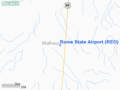
Rome Airport (IATA: REO, ICAO: KREO), is a public airport located 20 miles (32 km) southwest of Rome in Malheur County, Oregon, USA.
History
The airport was built by the United States Army Air Force about 1942, and was known as Rome Flight Strip. It was an emergency landing airfield for military aircraft on training flights. It was closed after World War II, and was turned over for local government use by the War Assets Administration (WAA).
The above content comes from Wikipedia and is published under free licenses – click here to read more.
Location & QuickFacts
| FAA Information Effective: | 2008-09-25 |
| Airport Identifier: | REO |
| Airport Status: | Operational |
| Longitude/Latitude: | 117-53-07.5480W/42-34-39.5760N
-117.885430/42.577660 (Estimated) |
| Elevation: | 4053 ft / 1235.35 m (Surveyed) |
| Land: | 147 acres |
| From nearest city: | 20 nautical miles SW of Rome, OR |
| Location: | Malheur County, OR |
| Magnetic Variation: | 17E (1985) |
Owner & Manager
| Ownership: | Publicly owned |
| Owner: | Oregon Department Of Aviation |
| Address: | 3040 25th St Se
Salem, OR 97302-1125 |
| Phone number: | 503-378-4880 |
| Manager: | State Airports Manager |
| Address: | 3040 25th St Se
Salem, OR 97302-1125 |
| Phone number: | 503-378-4880 |
Airport Operations and Facilities
| Airport Use: | Open to public |
| Wind indicator: | Yes |
| Segmented Circle: | No |
| Control Tower: | No |
| Landing fee charge: | No |
| Sectional chart: | Klamath Falls |
| Region: | ANM - Northwest Mountain |
| Traffic Pattern Alt: | 1000 ft |
| Boundary ARTCC: | ZLC - Salt Lake City |
| Tie-in FSS: | MMV - Mc Minnville |
| FSS on Airport: | No |
| FSS Toll Free: | 1-800-WX-BRIEF |
| NOTAMs Facility: | REO (NOTAM-d service avaliable) |
Airport Communications
Airport Services
| Airframe Repair: | NONE |
| Power Plant Repair: | NONE |
| Bottled Oxygen: | NONE |
| Bulk Oxygen: | NONE |
Runway Information
Runway 03/21
| Dimension: | 6000 x 150 ft / 1828.8 x 45.7 m |
| Surface: | GRAVEL, Poor Condition
SAGEBRUSH ON WEST PORTION OF RWY. |
| |
Runway 03 |
Runway 21 |
| Traffic Pattern: | Left | Left |
| Runway End Identifier: | No | No |
|
Radio Navigation Aids
| ID |
Type |
Name |
Ch |
Freq |
Var |
Dist |
| RMD | NDB | Mc Dermitt State | | 204.00 | 17E | 34.8 nm |
| REO | VORTAC | Rome | 072X | 112.50 | 19E | 1.1 nm |
Remarks
- SAGE GROWING IN PRIMARY SFC.
- ESTABD PRIOR TO 1959.
Images and information placed above are from
http://www.airport-data.com/airport/REO/
We thank them for the data!
| General Info
|
| Country |
United States
|
| State |
OREGON
|
| FAA ID |
REO
|
| Latitude |
42-34-39.576N
|
| Longitude |
117-53-07.548W
|
| Elevation |
4053 feet
|
| Near City |
ROME
|
We don't guarantee the information is fresh and accurate. The data may
be wrong or outdated.
For more up-to-date information please refer to other sources.
|
|


