 |
|
| Prospect State Airport |
| IATA: none – ICAO: none – FAA LID: 64S |
| Summary |
| Airport type |
Public |
| Operator |
Oregon Department of Aviation |
| Location |
Prospect, Oregon |
| Elevation AMSL |
2578 ft / 786 m |
| Coordinates |
42°44′35.4590″N 122°29′17.1250″W / 42.74318306°N 122.48809028°W / 42.74318306; -122.48809028Coordinates: 42°44′35.4590″N 122°29′17.1250″W / 42.74318306°N 122.48809028°W / 42.74318306; -122.48809028 |
| Runways |
| Direction |
Length |
Surface |
| ft |
m |
| 2/20 |
4000 |
1219 |
Asphalt |
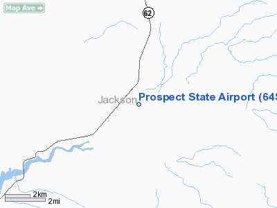
Prospect State Airport (FAA LID: 64S), is a public airport located one mile (1.6 km) south of Prospect in Jackson County, Oregon, USA.
The above content comes from Wikipedia and is published under free licenses – click here to read more.
Location & QuickFacts
| FAA Information Effective: | 2008-09-25 |
| Airport Identifier: | 64S |
| Airport Status: | Operational |
| Longitude/Latitude: | 122-29-17.1250W/42-44-35.4590N
-122.488090/42.743183 (Estimated) |
| Elevation: | 2578 ft / 785.77 m (Estimated) |
| Land: | 24 acres |
| From nearest city: | 1 nautical miles S of Prospect, OR |
| Location: | Jackson County, OR |
| Magnetic Variation: | 18E (1985) |
Owner & Manager
| Ownership: | Publicly owned |
| Owner: | Oregon Dept. Of Aviation |
| Address: | 3040 25th St, Se
Salem, OR 97302-1125 |
| Phone number: | 503-378-4880 |
| Manager: | State Airports Manager |
| Address: | 3040 25th St, Se
Salem, OR 97302-1125 |
| Phone number: | 503-378-4880 |
Airport Operations and Facilities
| Airport Use: | Open to public |
| Wind indicator: | Yes |
| Segmented Circle: | Yes
NON-STD; TIRES PAINTED WHITE. |
| Control Tower: | No |
| Lighting Schedule: | DUSK-DAWN |
| Beacon Color: | Clear-Green (lighted land airport) |
| Landing fee charge: | No |
| Sectional chart: | Klamath Falls |
| Region: | ANM - Northwest Mountain |
| Traffic Pattern Alt: | 1000 ft |
| Boundary ARTCC: | ZSE - Seattle |
| Tie-in FSS: | MMV - Mc Minnville |
| FSS on Airport: | No |
| FSS Toll Free: | 1-800-WX-BRIEF |
| NOTAMs Facility: | MMV (NOTAM-d service avaliable) |
Airport Communications
| CTAF: | 122.800 |
| Unicom: | 122.800 |
Airport Services
| Airframe Repair: | NONE |
| Power Plant Repair: | NONE |
| Bottled Oxygen: | NONE |
| Bulk Oxygen: | NONE |
Runway Information
Runway 02/20
| Dimension: | 4000 x 50 ft / 1219.2 x 15.2 m |
| Surface: | ASPH, Fair Condition |
| Edge Lights: | Low |
| |
Runway 02 |
Runway 20 |
| Traffic Pattern: | Left | Left |
| Markings: | Basic, Fair Condition | Basic, Good Condition |
| Obstruction: | 92 ft trees, 285.0 ft from runway, 100 ft right of centerline | 114 ft trees, 990.0 ft from runway, 30 ft right of centerline, 6:1 slope to clear
+1 FT FENCE AT 40 FT FROM RY END, 0B. |
|
Radio Navigation Aids
| ID |
Type |
Name |
Ch |
Freq |
Var |
Dist |
| MEF | NDB | Medford | | 356.00 | 19E | 27.3 nm |
| RBG | NDB | Roseburg | | 400.00 | 20E | 48.4 nm |
| RBG | VOR/DME | Roseburg | 019X | 108.20 | 20E | 46.3 nm |
| OED | VORTAC | Rogue Valley | 083X | 113.60 | 19E | 24.6 nm |
| LMT | VORTAC | Klamath Falls | 106X | 115.90 | 17E | 48.9 nm |
| MFR | VOT | Medford-jackson County | | 117.20 | | 28.6 nm |
Remarks
- TRAFFIC PATTERN ALT 1000'.
- 80 FT - 100 FT TREES WITH IN 200 FT OF RY CNTRLN BOTH SIDES OF RY.
- TURF TIE DOWN AREA ROUGH.
- IRREGULAR WINTER MAINTENANCE; ARPT MAY BE CLOSED BY SNOW.
Images and information placed above are from
http://www.airport-data.com/airport/64S/
We thank them for the data!
| General Info
|
| Country |
United States
|
| State |
OREGON
|
| FAA ID |
64S
|
| Latitude |
42-44-35.459N
|
| Longitude |
122-29-17.125W
|
| Elevation |
2578 feet
|
| Near City |
PROSPECT
|
We don't guarantee the information is fresh and accurate. The data may
be wrong or outdated.
For more up-to-date information please refer to other sources.
|
|


