 |
|
Pacific City State Airport |
| Pacific City State Airport |
| IATA: PFC – ICAO: KPFC |
| Summary |
| Airport type |
Public |
| Operator |
Oregon Department of Aviation |
| Location |
Pacific City, Oregon |
| Elevation AMSL |
5 ft / 2 m |
| Coordinates |
45°11′59.3740″N 123°57′44.4190″W / 45.19982611°N 123.96233861°W / 45.19982611; -123.96233861Coordinates: 45°11′59.3740″N 123°57′44.4190″W / 45.19982611°N 123.96233861°W / 45.19982611; -123.96233861 |
| Runways |
| Direction |
Length |
Surface |
| ft |
m |
| 14/32 |
1875 |
572 |
Asphalt |
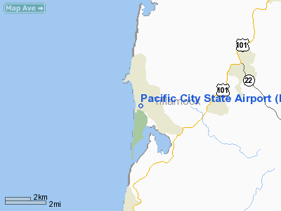
Pacific City State Airport (IATA: PFC, ICAO: KPFC), is a public airport located one mile (1.6 km) south of the city of Pacific City in Tillamook County, Oregon, USA.
The above content comes from Wikipedia and is published under free licenses – click here to read more.
Location & QuickFacts
| FAA Information Effective: | 2008-09-25 |
| Airport Identifier: | PFC |
| Airport Status: | Operational |
| Longitude/Latitude: | 123-57-44.4190W/45-11-59.3740N
-123.962339/45.199826 (Estimated) |
| Elevation: | 5 ft / 1.52 m (Estimated) |
| Land: | 15 acres |
| From nearest city: | 1 nautical miles S of Pacific City, OR |
| Location: | Tillamook County, OR |
| Magnetic Variation: | 19E (1985) |
Owner & Manager
| Ownership: | Publicly owned |
| Owner: | Oregon Dept Of Aviation |
| Address: | 3040 25th St Se
Salem, OR 97302-1125 |
| Phone number: | 503-378-4880 |
| Manager: | State Airport Manager |
| Address: | 3040 25th St Se
Salem, OR 97302-1125 |
| Phone number: | 503-378-4880 |
Airport Operations and Facilities
| Airport Use: | Open to public |
| Wind indicator: | Yes |
| Segmented Circle: | No |
| Control Tower: | No |
| Landing fee charge: | No |
| Sectional chart: | Seattle |
| Region: | ANM - Northwest Mountain |
| Traffic Pattern Alt: | 1000 ft |
| Boundary ARTCC: | ZSE - Seattle |
| Tie-in FSS: | MMV - Mc Minnville |
| FSS on Airport: | No |
| FSS Toll Free: | 1-800-WX-BRIEF |
| NOTAMs Facility: | MMV (NOTAM-d service avaliable) |
Airport Communications
Airport Services
| Bottled Oxygen: | NONE |
| Bulk Oxygen: | NONE |
Runway Information
Runway 14/32
| Dimension: | 1875 x 30 ft / 571.5 x 9.1 m |
| Surface: | ASPH, Good Condition |
| Weight Limit: | Single wheel: 7000 lbs. |
| |
Runway 14 |
Runway 32 |
| Traffic Pattern: | Left | Left |
| Markings: | Nonstandard, Good Condition
RWY 14/32 NSTD BSC MARKINGS, MARKINGS NSTD SIZE/PLACEMENT AND RWY EDGE MARKINGS | Nonstandard, Good Condition |
| Displaced threshold: | 300.00 ft | 0.00 ft |
| Obstruction: | 40 ft pline, 500.0 ft from runway, 7:1 slope to clear
APCH RATIO 20:1 TO DSPLCD THR.
CABLED FNC & HWY 2' FM RY END; BLDGS, ANT, LUMBER PILES, POLES & MISC EQUIP TO +30' FM 50' TO +200' FM RY END. | 30 ft trees, 1100.0 ft from runway, 30:1 slope to clear |
|
Radio Navigation Aids
| ID |
Type |
Name |
Ch |
Freq |
Var |
Dist |
| LWG | NDB | Lewisburg | | 225.00 | 18E | 45.9 nm |
| PND | NDB | Banks | | 356.00 | 21E | 46.5 nm |
| UBG | VOR/DME | Newberg | 121X | 117.40 | 21E | 42.6 nm |
| ONP | VORTAC | Newport | 118X | 117.10 | 19E | 37.8 nm |
| HIO | VOT | Portland-hillsboro | | 115.20 | | 47.5 nm |
Remarks
- RY MAY BE UNDER WATER DURING WINTER HIGH TIDES.
- OWNER ADZS CTC WITH DEPT OF AVIATION 503-378-4880 PRIOR TO USE.
- SOFT & MARSHY OFF PAVED AREAS.
- RAMP IN POOR CONDITION
- OCCASIONAL DRIFTWOOD ON RWY DUE TO FLOODING
- ESTABD PRIOR TO 1959.
Images and information placed above are from
http://www.airport-data.com/airport/PFC/
We thank them for the data!
| General Info
|
| Country |
United States
|
| State |
OREGON
|
| FAA ID |
PFC
|
| Latitude |
45-11-59.374N
|
| Longitude |
123-57-44.419W
|
| Elevation |
5 feet
|
| Near City |
PACIFIC CITY
|
We don't guarantee the information is fresh and accurate. The data may
be wrong or outdated.
For more up-to-date information please refer to other sources.
|
|


