|
|
Owyhee Reservoir State Airport |
| Owyhee Reservoir State Airport |
| IATA: none – ICAO: none – FAA LID: 28U |
| Summary |
| Airport type |
Public |
| Operator |
Oregon Department of Aviation |
| Location |
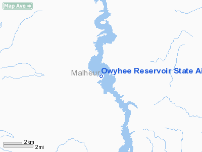
Owyhee, Oregon |
| Elevation AMSL |
2680 ft / 817 m |
| Coordinates |
43°25′29.5730″N 117°20′43.5840″W / 43.42488139°N 117.34544°W / 43.42488139; -117.34544Coordinates: 43°25′29.5730″N 117°20′43.5840″W / 43.42488139°N 117.34544°W / 43.42488139; -117.34544 |
| Runways |
| Direction |
Length |
Surface |
| ft |
m |
| 13/31 |
1840 |
561 |
Dirt |
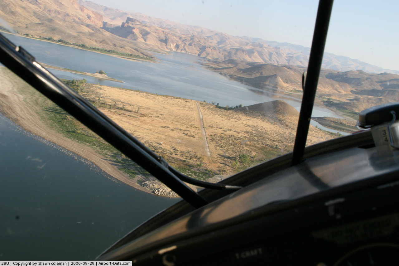
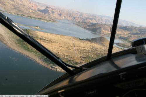
Owyhee Reservoir State Airport (FAA LID: 28U) is a public airport located 25 miles (40 km) southwest of Owyhee, in Malheur County, Oregon, United States.
The above content comes from Wikipedia and is published under free licenses – click here to read more.
 |
(Click on the photo to enlarge) |
Location & QuickFacts
| FAA Information Effective: | 2008-09-25 |
| Airport Identifier: | 28U |
| Airport Status: | Operational |
| Longitude/Latitude: | 117-20-43.5840W/43-25-29.5730N
-117.345440/43.424881 (Estimated) |
| Elevation: | 2680 ft / 816.86 m (Estimated) |
| Land: | 10 acres |
| From nearest city: | 25 nautical miles SW of Owyhee, OR |
| Location: | Malheur County, OR |
| Magnetic Variation: | 17E (1985) |
Owner & Manager
| Ownership: | Publicly owned |
| Owner: | Oregon Dept. Of Aviation |
| Address: | 3040 25th St, Se
Salem, OR 97302-1125 |
| Phone number: | 503-378-4880 |
| Manager: | State Airports Manager |
| Address: | 3040 25th St, Se
Salem, OR 97302-1125 |
| Phone number: | 503-378-4880 |
Airport Operations and Facilities
| Airport Use: | Open to public |
| Wind indicator: | Yes |
| Segmented Circle: | No |
| Control Tower: | No |
| Landing fee charge: | No |
| Sectional chart: | Klamath Falls |
| Region: | ANM - Northwest Mountain |
| Traffic Pattern Alt: | 1000 ft |
| Boundary ARTCC: | ZLC - Salt Lake City |
| Tie-in FSS: | MMV - Mc Minnville |
| FSS on Airport: | No |
| FSS Toll Free: | 1-800-WX-BRIEF |
| NOTAMs Facility: | MMV (NOTAM-d service avaliable) |
Airport Communications
Airport Services
| Airframe Repair: | NONE |
| Power Plant Repair: | NONE |
| Bottled Oxygen: | NONE |
| Bulk Oxygen: | NONE |
Runway Information
Runway 13/31
| Dimension: | 1840 x 30 ft / 560.8 x 9.1 m |
| Surface: | DIRT, Poor Condition
RY 13/31 SFC ROUGH, LOOSE ROCKS, SOFT WHEN WET, SUBJECT TO WASHOUTS. |
| |
Runway 13 |
Runway 31 |
| Traffic Pattern: | Left | Left |
|
Radio Navigation Aids
| ID |
Type |
Name |
Ch |
Freq |
Var |
Dist |
| MPA | NDB | Meridian | | 238.00 | 16E | 36.8 nm |
| ONO | NDB | Ontario | | 305.00 | 17E | 38.6 nm |
| BO | NDB | Ustik | | 359.00 | 17E | 46.1 nm |
| BOI | VOT | Boise | | 116.70 | | 49.4 nm |
Remarks
- OWNER ADVISES CONTACT WITH STATE DEPT OF AVIATION 503-378-4880 PRIOR TO USE.
- REMOTE AIRPORT; NO GROUND ACCESS.
- AIRPORT IN CANYON; SURROUNDED BY HIGH TERRAIN.
- ESTABD PRIOR TO 1959.
Images and information placed above are from
http://www.airport-data.com/airport/28U/
We thank them for the data!
| General Info
|
| Country |
United States
|
| State |
OREGON
|
| FAA ID |
28U
|
| Latitude |
43-25-29.573N
|
| Longitude |
117-20-43.584W
|
| Elevation |
2680 feet
|
| Near City |
OWYHEE
|
We don't guarantee the information is fresh and accurate. The data may
be wrong or outdated.
For more up-to-date information please refer to other sources.
|
|