 |
|
| Newport Municipal Airport |
| IATA: ONP – ICAO: KONP |
| Summary |
| Airport type |
Public |
| Operator |
City of Newport |
| Location |
Newport, Oregon |
| Elevation AMSL |
160 ft / 48.8 m |
| Coordinates |
44°34′49.3000″N 124°03′28.5000″W / 44.580361°N 124.057917°W / 44.580361; -124.057917Coordinates: 44°34′49.3000″N 124°03′28.5000″W / 44.580361°N 124.057917°W / 44.580361; -124.057917 |
| Website |
Newport Municipal Airport |
| Runways |
| Direction |
Length |
Surface |
| ft |
m |
| 16/34 |
5398 |
1645 |
Asphalt |
| 2/20 |
3001 |
915 |
Asphalt |
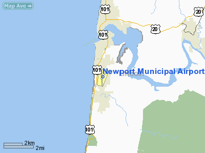
Newport Municipal Airport (IATA: ONP, ICAO: KONP), is a public airport located three miles (4.8 km) south of the city of Newport in Lincoln County, Oregon, USA.
Newport has supported occasional commercial passenger service in the past, mostly with connections to Portland International Airport (PDX).
Airlines and destinations
| Airlines |
Destinations |
| SeaPort Airlines |
Portland International Airport |
The above content comes from Wikipedia and is published under free licenses – click here to read more.
Location & QuickFacts
| FAA Information Effective: | 2008-09-25 |
| Airport Identifier: | ONP |
| Airport Status: | Operational |
| Longitude/Latitude: | 124-03-28.5000W/44-34-49.3000N
-124.057917/44.580361 (Estimated) |
| Elevation: | 160 ft / 48.77 m (Surveyed) |
| Land: | 700 acres |
| From nearest city: | 3 nautical miles S of Newport, OR |
| Location: | Lincoln County, OR |
| Magnetic Variation: | 19E (1990) |
Owner & Manager
| Ownership: | Publicly owned |
| Owner: | City Of Newport |
| Address: | 169 Sw Coast Hwy
Newport, OR 97365 |
| Phone number: | 541-574-0604 |
| Manager: | Dennis Reno |
| Address: | 169 Sw Coast Hwy
Newport, OR 97365 |
| Phone number: | 541-867-7422 |
Airport Operations and Facilities
| Airport Use: | Open to public |
| Wind indicator: | Yes |
| Segmented Circle: | Yes |
| Control Tower: | No |
| Lighting Schedule: | RDO-CTL
ACTVT MALSR, MIRL RYS 02/20 & HIRL 16/34 AND REIL RY 34 - CTAF. |
| Beacon Color: | Clear-Green (lighted land airport) |
| Landing fee charge: | No |
| Sectional chart: | Seattle |
| Region: | ANM - Northwest Mountain |
| Boundary ARTCC: | ZSE - Seattle |
| Tie-in FSS: | MMV - Mc Minnville |
| FSS on Airport: | No |
| FSS Toll Free: | 1-800-WX-BRIEF |
| NOTAMs Facility: | ONP (NOTAM-d service avaliable) |
| Certification type/date: | I L U 11/1975
PPR FOR ACR OPNS WITH MORE THAN 30 PSGR SEATS CALL AMGR 541-867-7422. |
| Federal Agreements: | NGRY3 |
Airport Communications
| CTAF: | 122.800 |
| Unicom: | 122.800 |
Airport Services
| Fuel available: | 100LLA
FOR FUEL AFT HRS CALL 541-867-3655 OR 541-270-3532.. |
| Airframe Repair: | MAJOR |
| Power Plant Repair: | MAJOR |
| Bottled Oxygen: | NONE |
| Bulk Oxygen: | NONE |
Runway Information
Runway 02/20
| Dimension: | 3001 x 75 ft / 914.7 x 22.9 m |
| Surface: | ASPH, Good Condition |
| Weight Limit: | Single wheel: 33000 lbs.
Dual wheel: 50000 lbs.
Dual tandem wheel: 84000 lbs. |
| Edge Lights: | Medium |
| |
Runway 02 |
Runway 20 |
| Longitude: | 124-03-34.7274W | 124-03-09.5898W |
| Latitude: | 44-34-43.4488N | 44-35-07.0082N |
| Elevation: | 130.00 ft | 160.00 ft |
| Alignment: | 37 | 127 |
| Traffic Pattern: | Left | Right |
| Markings: | Basic, Good Condition | Basic, Good Condition |
| Obstruction: | 17 ft gnd, 875.0 ft from runway, 300 ft right of centerline, 39:1 slope to clear | |
|
Runway 16/34
| Dimension: | 5398 x 150 ft / 1645.3 x 45.7 m |
| Surface: | ASPH, Good Condition |
| Weight Limit: | Single wheel: 75000 lbs.
Dual wheel: 120000 lbs.
Dual tandem wheel: 170000 lbs. |
| Edge Lights: | High |
| |
Runway 16 |
Runway 34 |
| Longitude: | 124-03-33.7380W | 124-03-30.2567W |
| Latitude: | 44-35-12.6347N | 44-34-19.3899N |
| Elevation: | 151.00 ft | 159.00 ft |
| Alignment: | 127 | 127 |
| ILS Type: | ILS
| |
| Traffic Pattern: | Right | Left |
| Markings: | Precision instrument, Good Condition | Precision instrument, Good Condition |
| Crossing Height: | 50.00 ft | 50.00 ft |
| Displaced threshold: | 0.00 ft | 300.00 ft |
| VASI: | 4-box on right side | 4-light PAPI on left side |
| Visual Glide Angle: | 3.00° | 3.00° |
| Approach lights: | MALSR | |
| Runway End Identifier: | No | Yes |
|
Radio Navigation Aids
| ID |
Type |
Name |
Ch |
Freq |
Var |
Dist |
| LWG | NDB | Lewisburg | | 225.00 | 18E | 33.8 nm |
| EU | NDB | Frakk | | 260.00 | 19E | 42.2 nm |
| CVO | VOR/DME | Corvallis | 101X | 115.40 | 18E | 33.1 nm |
| ONP | VORTAC | Newport | 118X | 117.10 | 19E | 0.3 nm |
| EUG | VORTAC | Eugene | 076X | 112.90 | 20E | 45.3 nm |
Remarks
- BIRDS INVOF ARPT DURG APRIL AND OCT.
- ESTABD PRIOR TO 1959.
Images and information placed above are from
http://www.airport-data.com/airport/ONP/
We thank them for the data!
| General Info
|
| Country |
United States
|
| State |
OREGON
|
| FAA ID |
ONP
|
| Latitude |
44-34-49.300N
|
| Longitude |
124-03-28.500W
|
| Elevation |
160 feet
|
| Near City |
NEWPORT
|
We don't guarantee the information is fresh and accurate. The data may
be wrong or outdated.
For more up-to-date information please refer to other sources.
|
|


