 |
|
Nehalem Bay State Airport |
| Nehalem Bay State Airport |
| IATA: none – ICAO: none – FAA LID: 3S7 |
| Summary |
| Airport type |
Public |
| Operator |
Oregon Department of Aviation |
| Location |
Manzanita, Oregon |
| Elevation AMSL |
22 ft / 6.7 m |
| Coordinates |
45°41′53.3820″N 123°55′47.4840″W / 45.69816167°N 123.92985667°W / 45.69816167; -123.92985667Coordinates: 45°41′53.3820″N 123°55′47.4840″W / 45.69816167°N 123.92985667°W / 45.69816167; -123.92985667 |
| Runways |
| Direction |
Length |
Surface |
| ft |
m |
| 15/33 |
2350 |
716 |
Asphalt |
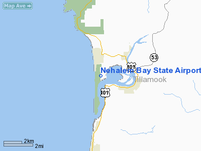
The Nehalem Bay State Airport on a still morning. Nehalem Bay State Airport (FAA LID: 3S7), is a public airport located two miles (3.2 km) southeast of Manzanita in Tillamook County, Oregon, USA. The airport is located within the boundaries of Nehalem Bay State Park. The airport also offers several campsites for fly-in camping, just a few steps away from the tiedown area. About a ten minute walk to the north is the town of Manzanita, offering dining and lodging.
The above content comes from Wikipedia and is published under free licenses – click here to read more.
Location & QuickFacts
| FAA Information Effective: | 2008-09-25 |
| Airport Identifier: | 3S7 |
| Airport Status: | Operational |
| Longitude/Latitude: | 123-55-47.4840W/45-41-53.3820N
-123.929857/45.698162 (Estimated) |
| Elevation: | 22 ft / 6.71 m (Surveyed) |
| Land: | 18 acres |
| From nearest city: | 2 nautical miles S of Manzanita, OR |
| Location: | Tillamook County, OR |
| Magnetic Variation: | 20E (1985) |
Owner & Manager
| Ownership: | Publicly owned |
| Owner: | Oregon Dept Of Aviation |
| Address: | 3040 25th St Se
Salem, OR 97302-1125 |
| Phone number: | 503-378-4880 |
| Manager: | State Airport Manager |
| Address: | 3040 25th St Se
Salem, OR 97302-1125 |
| Phone number: | 503-378-4880 |
Airport Operations and Facilities
| Airport Use: | Open to public |
| Wind indicator: | Yes |
| Segmented Circle: | Yes
NON-STD SEGMENTED CIRCLE; LAID OUT WITH TIRES. |
| Control Tower: | No |
| Landing fee charge: | No |
| Sectional chart: | Seattle |
| Region: | ANM - Northwest Mountain |
| Traffic Pattern Alt: | 1000 ft |
| Boundary ARTCC: | ZSE - Seattle |
| Tie-in FSS: | MMV - Mc Minnville |
| FSS on Airport: | No |
| FSS Toll Free: | 1-800-WX-BRIEF |
| NOTAMs Facility: | MMV (NOTAM-d service avaliable) |
Airport Communications
Airport Services
| Airframe Repair: | NONE |
| Power Plant Repair: | NONE |
Runway Information
Runway 15/33
| Dimension: | 2350 x 50 ft / 716.3 x 15.2 m |
| Surface: | ASPH, Good Condition |
| |
Runway 15 |
Runway 33 |
| Traffic Pattern: | Left | Left |
| Markings: | Basic, Good Condition | Basic, Good Condition |
| Obstruction: | 30 ft trees, 300.0 ft from runway, 50 ft right of centerline, 3:1 slope to clear | , 50:1 slope to clear
RWY 33 +3 FT CABLE FENCE AT 140 FT ON CNTRLN. |
|
Radio Navigation Aids
| ID |
Type |
Name |
Ch |
Freq |
Var |
Dist |
| AST | FAN MARKER | Fort Stevens | | | 22E | 30.7 nm |
| PEN | NDB | Karpen | | 201.00 | 20E | 30.1 nm |
| PND | NDB | Banks | | 356.00 | 21E | 37.4 nm |
| AST | VOR/DME | Astoria | 087X | 114.00 | 19E | 27.9 nm |
| UBG | VOR/DME | Newberg | 121X | 117.40 | 21E | 45.1 nm |
| HIO | VOT | Portland-hillsboro | | 115.20 | | 42.3 nm |
Remarks
- 20' GRVL TWY TO TIEDOWN AREA.
- -2' DITCH 90' FM CNTRLN WEST OF RWY MRKED W/SIGNS.
- DEER AND WATER FOWL INVOF ARPT.
- UN-PAVED TAXIWAY AND RAMP
- ESTABD PRIOR TO 1959.
Images and information placed above are from
http://www.airport-data.com/airport/3S7/
We thank them for the data!
| General Info
|
| Country |
United States
|
| State |
OREGON
|
| FAA ID |
3S7
|
| Latitude |
45-41-53.382N
|
| Longitude |
123-55-47.484W
|
| Elevation |
22 feet
|
| Near City |
MANZANITA
|
We don't guarantee the information is fresh and accurate. The data may
be wrong or outdated.
For more up-to-date information please refer to other sources.
|
|


