 |
|
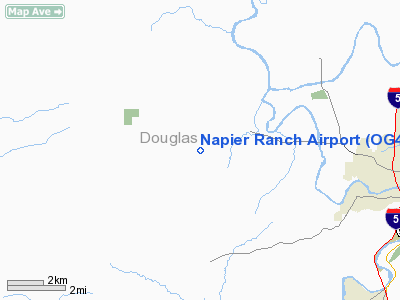
Location & QuickFacts
| FAA Information Effective: | 2008-09-25 |
| Airport Identifier: | OG40 |
| Airport Status: | Operational |
| Longitude/Latitude: | 123-29-34.9800W/43-14-14.4100N
-123.493050/43.237336 (Estimated) |
| Elevation: | 485 ft / 147.83 m (Estimated) |
| Land: | 195 acres |
| From nearest city: | 6 nautical miles W of Roseburg, OR |
| Location: | Douglas County, OR |
| Magnetic Variation: | () |
Owner & Manager
| Ownership: | Privately owned |
| Owner: | Chuck Napier |
| Address: | 599 Flournoy Valley Rd
Roseburg, OR 97470 |
| Phone number: | 541-672-8214 |
| Manager: | Chuck Napier |
| Address: | 599 Flournoy Valley Rd
Roseburg, OR 97470 |
| Phone number: | 541-672-8214 |
Airport Operations and Facilities
| Airport Use: | Private |
| Wind indicator: | Yes |
| Segmented Circle: | No |
| Control Tower: | No |
| Sectional chart: | Klamath Falls |
| Region: | ANM - Northwest Mountain |
| Boundary ARTCC: | ZSE - Seattle |
| Tie-in FSS: | MMV - Mc Minnville |
| FSS Toll Free: | 1-800-WX-BRIEF |
Airport Communications
Runway Information
Runway 16/34
| Dimension: | 2600 x 50 ft / 792.5 x 15.2 m |
| Surface: | TURF, |
| |
Runway 16 |
Runway 34 |
| Traffic Pattern: | Left | Left |
|
Radio Navigation Aids
| ID |
Type |
Name |
Ch |
Freq |
Var |
Dist |
| RBG | NDB | Roseburg | | 400.00 | 20E | 5.9 nm |
| RBG | VOR/DME | Roseburg | 019X | 108.20 | 20E | 7.0 nm |
| OTH | VORTAC | North Bend | 058X | 112.10 | 18E | 31.4 nm |
Images and information placed above are from
http://www.airport-data.com/airport/OG40/
We thank them for the data!
|
|


